
Severe Weather Risk Later Today
Heat Humidity Tuesday Through At Least Thursday
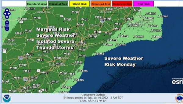
The new week begins with a warm front going by to our north and a cold front coming in from the west. This puts of square in between the two fronts in the “warm sector” which means there could be some downpours and thunderstorms. The first round is from Northern New Jersey to Southern New England north and east while the second round late today will be in the form of a line of showers and thunderstorms from north to south.
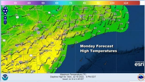
In between all this will be clouds with developing sunshine and high humidity. Daytime heating will be key to thunderstorm activity this evening. Highs will reach the low and middle 80s in most places inland and 70s to near 80 degrees along the immediate coast. The Storm Prediction Center overnight has Eastern Pennsylvania to Southern NY and Southern New England in a marginal risk for severe weather which favors isolated severe thunderstorm risk. They may update this to add a small area of slight risk later today if it appears that daytime heating will be ample.
SATELLITE

WEATHER RADAR

Once this weather system plays through it is on to heat and humidity for the next 3 days. This “cold front” is not exactly a cold front since the air behind it is actually warmer than the air ahead of it. We will likely see dew points a little lower Tuesday but it will still be sticky. Then the dew points rise to the mid 60s to near 70 for Wednesday and Thursday.
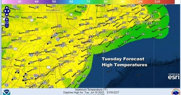
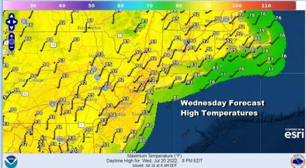
This will be our longest stretch of 90 degree plus highs of the summer so far. Highs for Tuesday through Thursday will be in the low to mid 90s. We should see a good deal of sunshine Tuesday and Wednesday and just the small chance for an isolated shower or thunderstorm. 99 percent of you won’t see anything.
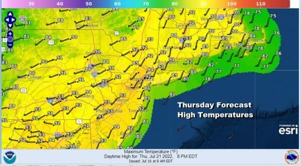
Thursday brings the next “cold front” which once again isn’t much of a cold front from the standpoint of temperature but there might be a little humidity releif behind it for Friday and into Saturday. Thursday’s highs will reach the low and middle 90s and there is a chance for thunderstorms late in the day when the front passes.
Right now Friday through Sunday look mostly dry with sunshine. Highs will be in the upper 80s and lower 90s each day. Another weak front comes through Saturday night with another round of slight dew point releif Sunday into Monday. Other than today and perhaps late Thursday, not much in the way of rain is forecast for the next week.
BE SURE TO DOWNLOAD THE FREE METEOROLOGIST JOE CIOFFI WEATHER APP &
ANGRY BEN’S FREE WEATHER APP “THE ANGRY WEATHERMAN!
MANY THANKS TO TROPICAL TIDBITS & F5 WEATHER FOR THE USE OF MAPS
Please note that with regards to any severe weather, tropical storms, or hurricanes, should a storm be threatening, please consult your local National Weather Service office or your local government officials about what action you should be taking to protect life and property.


