
Severe Weather Risk Heat Humidity Scattered Thunderstorms
Cooler Onshore Flow Thursday & Friday

Severe Weather Risk Heat Humidity Scattered Thunderstorms
Cooler Onshore Flow Thursday & Friday
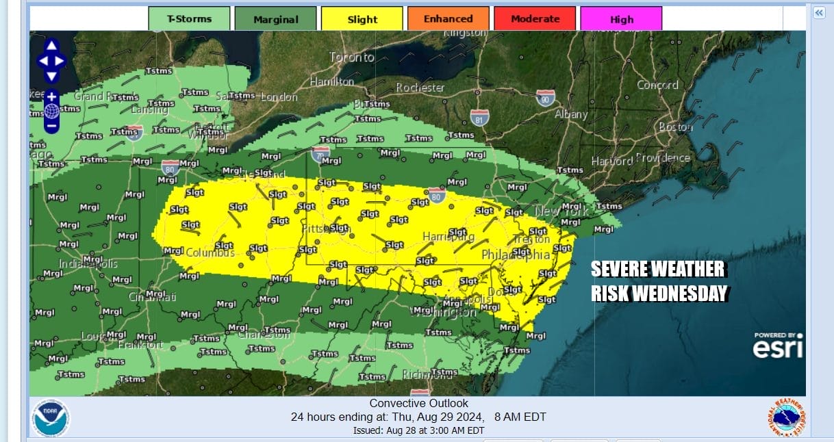
The Storm Prediction Center has indicated that areas from the Lower Hudson Valley in NY south to Delaware, Maryland and Northern Virginia have a marginal to slight risk for severe thunderstorms late this afternoon into tonight. This is thanks to a cold front that is dropping southeast from Eastern Canada, Upstate NY and the Great Lakes. The risk area extends west into the Ohio Valley.
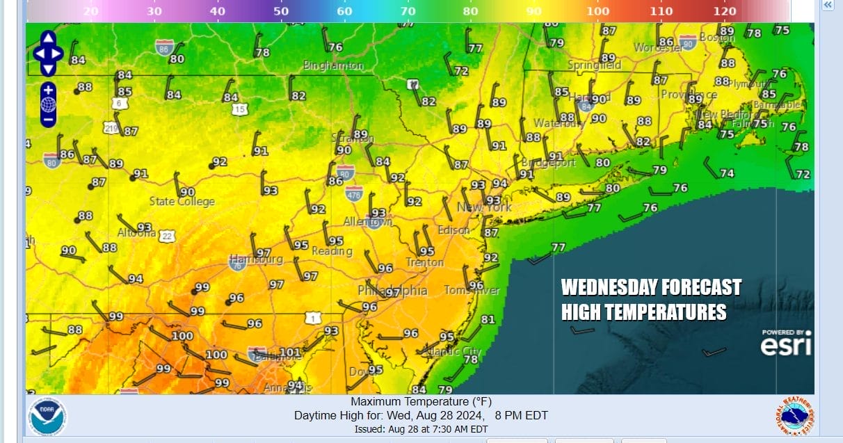
Ahead of this front today will be the hottest temperatures of the week and in some places the hottest temperatures of the month. Most highs in Eastern Pennsylvania to Southern New England will reach the low to middle 90s. Areas to the south in Southern Pennsylvania into Maryland will see highs in the upper 90s to near 100. Meanwhile cooler air in Upstate NY is not that far away. Sunshine will occur for much of the day and then thunderstorms will develop in the late afternoon and evening. Not everyone is going to see thunderstorm activity.
SATELLITE WITH LIGHTNING STRIKES

WEATHER RADAR

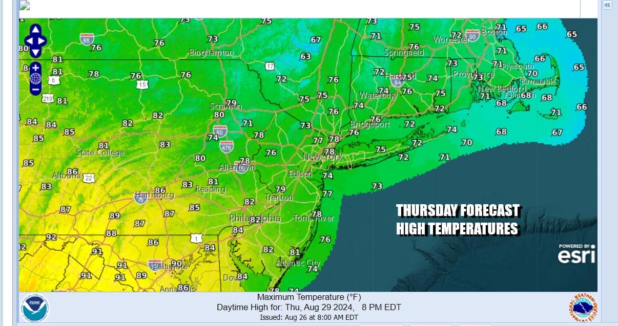
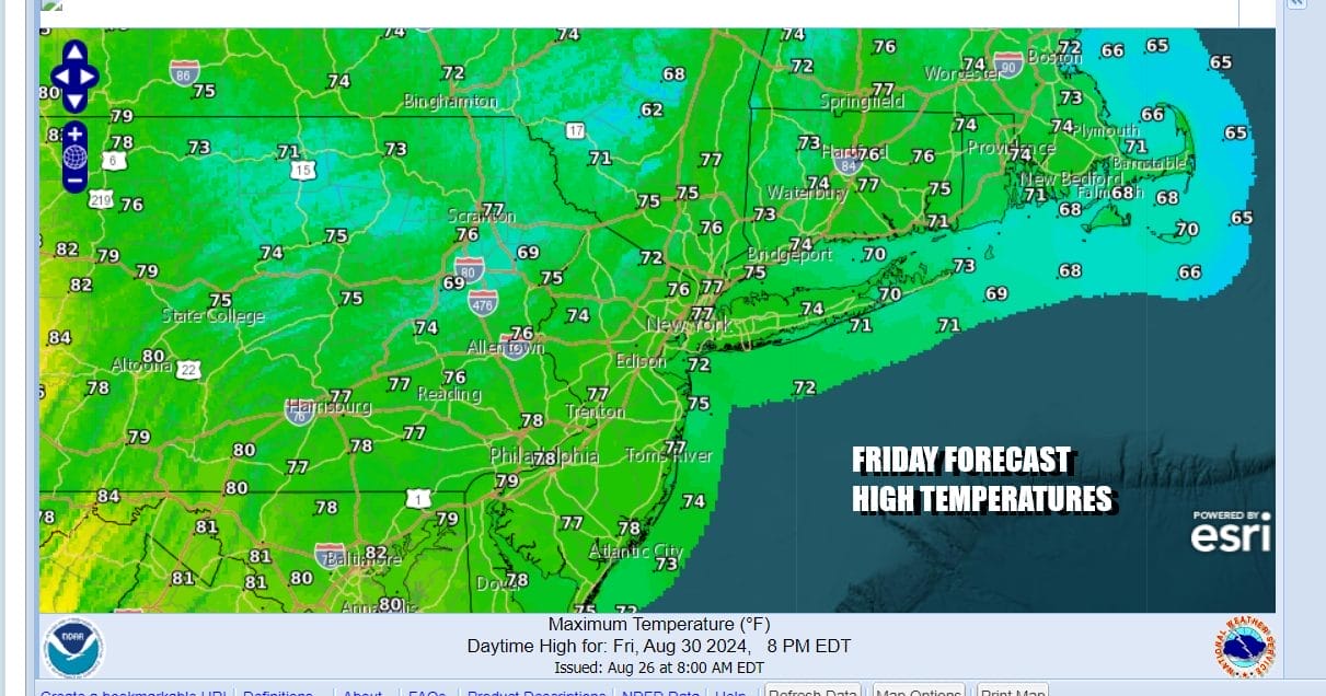
Thunderstorms overnight will shift southward as high pressure builds strongly into New England. An onshore northeast flow develops and that will put an end to the heat. The front is going to drop southward and stall across the Delmarva Peninsula and back westward into Virginia. The onshore flow will remain in place through Friday and then turn southerly Saturday ahead of another cold front that will be moving through over the weekend.

This set up will probably means clouds around for both Thursday and Friday. Humidity levels will come down as will temperatures. If you are north of NYC in the Hudson Valley and in interior Southern New England you might see some sunshine breaking through. If you south, probably more clouds. There also could be the chance for a passing shower on either day given the flow off the ocean and the proximity of the stalled front. Highs both Thursday and Friday will be mostly in the 70s.
The Labor Day weekend won’t be picture perfect but won’t be a washout by any means. Saturday dayside will be warmer and more humid with clouds, some sun and highs reaching back into the upper 70s and lower 80s. A cold front will bring showers and a few thunderstorms Saturday night but should be offshore by Sunday morning. Sunday we will see decreasing clouds as we go through the day with highs in the low to middle 80s. Then much cooler dry air will sweep in Sunday night thanks to a large high building in from Canada and the Great Lakes. Monday looks to be a mostly sunny nice day with highs in the upper 70s to near 80.
BE SURE TO DOWNLOAD THE FREE METEOROLOGIST JOE CIOFFI WEATHER APP &
ANGRY BEN’S FREE WEATHER APP “THE ANGRY WEATHERMAN!
MANY THANKS TO TROPICAL TIDBITS FOR THE USE OF MAPS
Please note that with regards to any severe weather, tropical storms, or hurricanes, should a storm be threatening, please consult your local National Weather Service office or your local government officials about what action you should be taking to protect life and property.
(Amazon is an affilate of Meteorologist Joe Cioffi & earns commissions on sales.)


