Severe Weather Risk Expanded River Flooding Risk Continues.
Severe Weather Risk Expanded River Flooding Risk Continues.
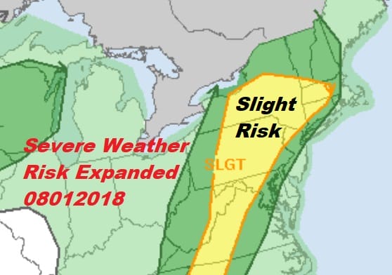
The Storm Prediction Center has expanded the area of severe weather risk today to include most of Connecticut and Southwestern New England, across the Hudson Valley, Northwest New Jersey and most of Pennsylvania and New York State. The slight risk area extends down into Maryland and Western Virginia southward down the Appalachians into Northeast Georgia.

A warm front is going by this morning as showers move northeastward into Upstate NY & New England. Daytime heating will be key to how thunderstorms fire up later today and tonight. Not much will be happening into at least mid afternoon.

Areas from Northwest New Jersey and especially Pennsylvania need to keep a close eye on rivers streams and creeks as they are all at this point filled to capacity. It would not take much rain in a heavy thunderstorm to produce flooding issues very quickly. The ground in many areas remains saturated from 10 days of a foot or more of rain so the sponge is filled to capacity.

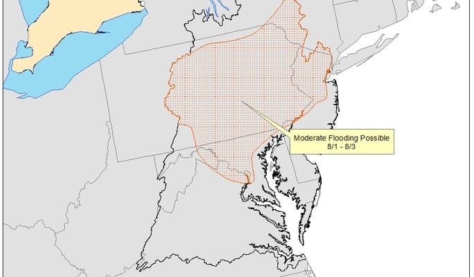
The map above shows where the Middle Atlantic River Forecast Center sees the greatest risk of river flooding. THIS DOES NOT INCLUDE FLASH FLOOD RISK so bear that in mind. Much of Pennsylvania and the Northern half of New Jersey is under the area likely to see significant river flooding.


Thunderstorms today have the potential to produce at least a couple of inches of rain rather quickly. We saw late last week how some thunderstorms clustered over specific areas in Northeast New Jersey and parts of Eastern Pennsylvania to produce a fast 3 to 5 inches of rain. The atmosphere is saturated with tropical moisture so any thunderstorm today has the potential to produce a flooding deluge.
FiOS1 News Weather Forecast For Long Island
FiOS1 News Weather Forecast For New Jersey
FiOS1 News Weather Forecast For Hudson Valley
NATIONAL WEATHER SERVICE SNOW FORECASTS
LATEST JOESTRADAMUS ON THE LONG RANGE