Severe Weather Risk Evening Thunderstorms Warmer More Humid Weekend

Weather in 5/Joe & Joe Weather Show Latest Podcast
Severe Weather Risk Evening Thunderstorms Warmer More Humid Weekend
Today it is about the warm front that is moving northeastward and how far north it gets, followed by a cold front tonight and developing thunderstorms ahead of it. Rising dew points in the 60s and some daytime heating will result in strong to possible severe thunderstorms when the front arrives.
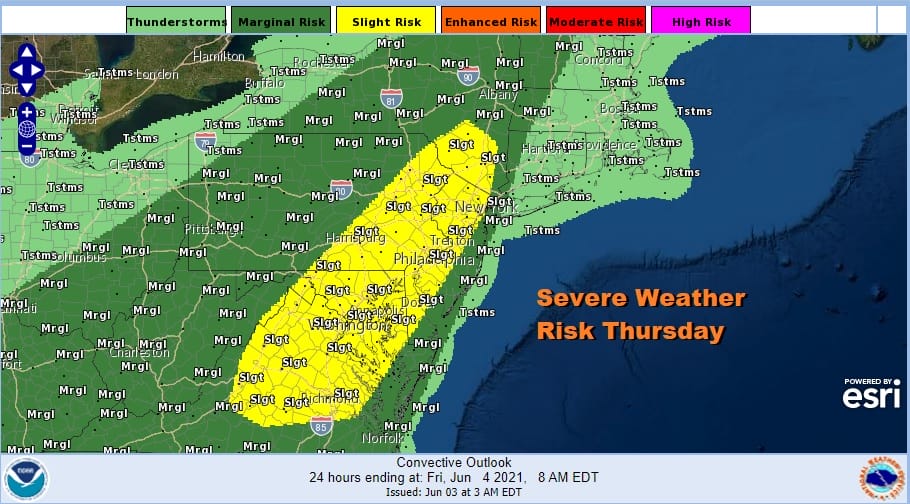
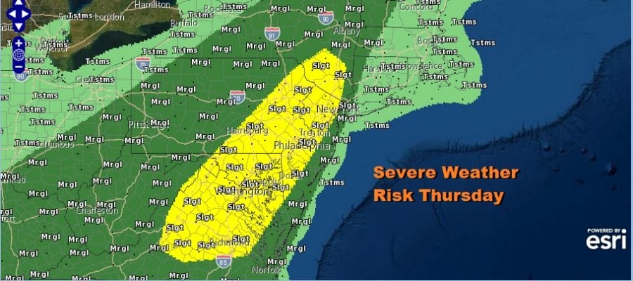
The Storm Prediction Center is showing a slight risk of severe in the yello from Virginia to the Hudson Valley. The marginal risk cuts off in Western Connecticut to about NYC and this is due to the proximity of the warm front and south winds off the ocean which may weaken storms once they reach the coast. It will be important to watch the developments today regarding these factors. There is also tornado risk of 2% in the slight risk zone.
SATELLITE

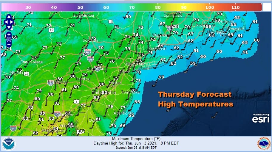
Clusters of downpours and thunderstorms ahead of the warm front will move away to the east and then temperatures will rise south and west of the warm front into the upper 70s to lower 80s. The warm front probably gets stuck somewhere in Southern New England to Eastern Long Island. 60s will be the rule for highs here thanks to lots of clouds and south southwest wind off the ocean.
Weather models generally agree that there will be thunderstorms but there are timing issues among them by a few hours either side of 8pm so we decided to split the difference with development beginning to the west in Pennsylvania later this afternoon and reaching the coast between 7 and 8pm

Once these storms move out the front will pass but slow down. In addition we will have to wait for the upper trough to move through on Friday. That could trigger some scattered thunderstorms in the afternoon and evening. There is severe weather risk for Friday from Southern New Jersey southward and we will look at the closer later today. There will be clouds and some sun in the mix Friday with highs in the 70s to near 80.
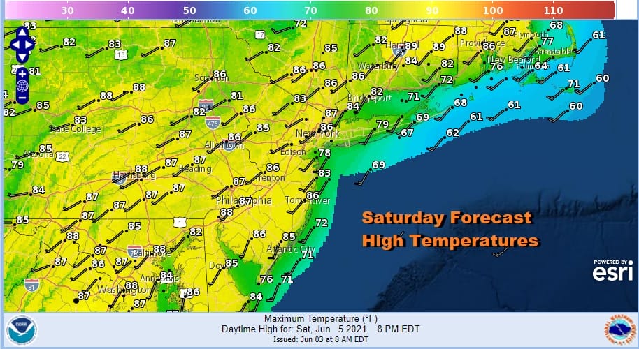
The very warm to hot pattern begins on Saturday with high pressure off the South Atlantic coast and an upper ridge that begins to build across the Northeast and Mid Atlantic states. Saturday will be very warm but it won’t be too humid as dew points will be in the lower 60s. Highs Saturday will reach the middle to upper 80s with sunshine.
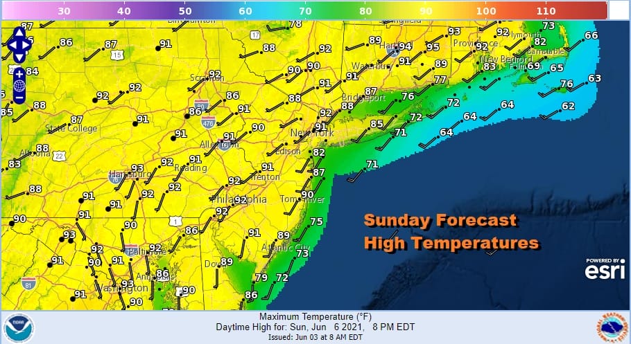
Sunday will be hot as we will have sunshine and a southwest wind. Dew points will be in the low to mid 60s and highs will reach the upper 80s and lower 90s just about everywhere. We will have sunshine and no rain is forecast this weekend. Once nice thing about an upper ridge is that it creates a stable atmosphere and thunderstorms can’t for or if they do they are very isolated and don’t last long. Hot and humid weather continues into at least Wednesday of next week before any cold front can even get close.

BE SURE TO DOWNLOAD THE FREE METEOROLOGIST JOE CIOFFI WEATHER APP &
ANGRY BEN’S FREE WEATHER APP “THE ANGRY WEATHERMAN!
MANY THANKS TO TROPICAL TIDBITS FOR THE USE OF MAPS
Please note that with regards to any severe weather, tropical storms, or hurricanes, should a storm be threatening, please consult your local National Weather Service office or your local government officials about what action you should be taking to protect life and property.


