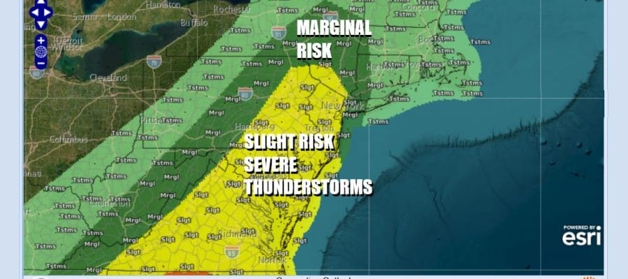

Severe Thunderstorm Risks Rise Today Hudson Valley Eastern Pennsylvania to New Jersey Western Long Island & Western Connecticut

Severe Weather Risks loom large today from the Hudson Valley & the Catskills in New York State south to New York City & Western Long Island. A slight risk (15 percent chance) also covers all of New Jersey, the Eastern half of Pennsylvania, Delaware, south to Maryland & Virginia. This area of risk is very large and extends as far south as Northern Florida and as far west as Alabama. This area also comes with a 2 percent tornado risk. The biggest risk is for straight line wind damage from strong gusty winds that could exceed 50 to 60 mph. Tornado spin ups are possible but should be isolated in nature and not widespread.
SATELLITE WITH LIGHTNING STRIKES

WEATHER RADAR

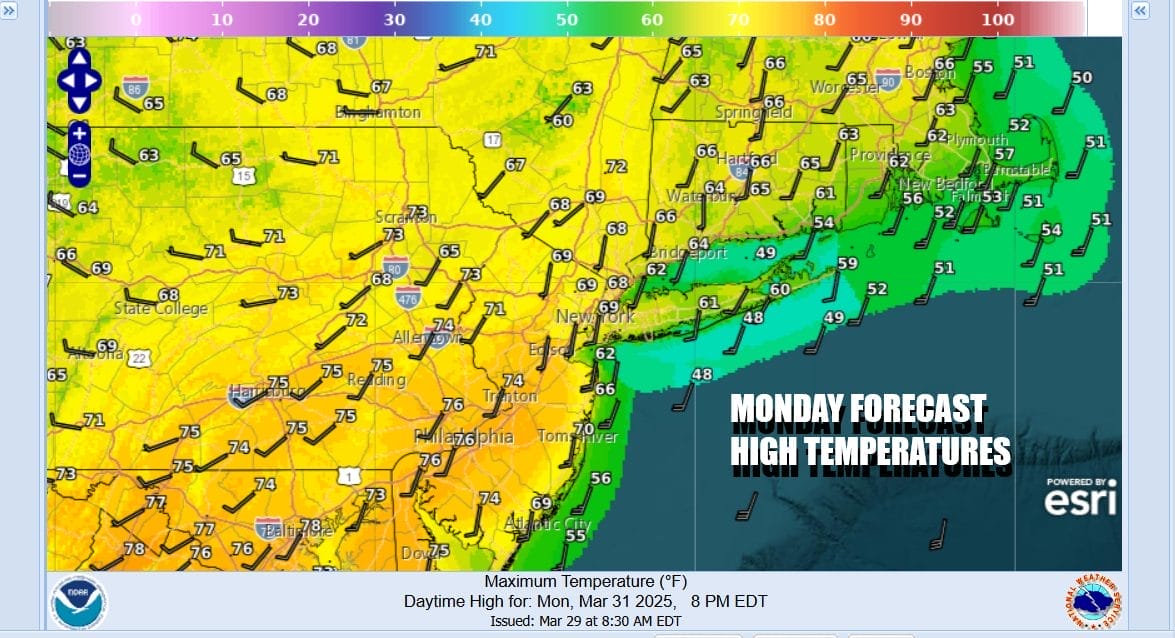
The set up for this begins later this afternoon and evening. The weekend back door cold front is moving northward and should push its way into the Hudson Valley and Western Connecticut. Temperatures which in many areas had a hard time getting out of the 40s & 50s will be respond to the warm front going north by rising into the 60s and 70s this afternoon. Weather models are indicating that some areas could break out into some sunshine and that will destabilize the atmosphere even more as the front approaches.
While we are seeing some renegade showers that have moved out ahead of the cold front, the main line of thunderstorms and severe weather will develop later this afternoon to the west and southwest in Pennsylvania & Virginia. Gradually the line of thunderstorms will organize as it moves eastward during the evening hours as the HRRR model shows below. The yellow & red echoes are indicating convection and potentially severe weather. Along coastal areas of Long Island and Southern New England thunderstorms are likely to weaken some as the move into an environment of cooler more stable marine air.

The front will move offshore late tonight taking showers and thunderstorms out to the east and offshore. Tuesday we will see colder air moving in on northwest winds. We should also see sunshine developing. Temperatures are going to be 20 degrees colder with afternoon highs barely back into the 50s.
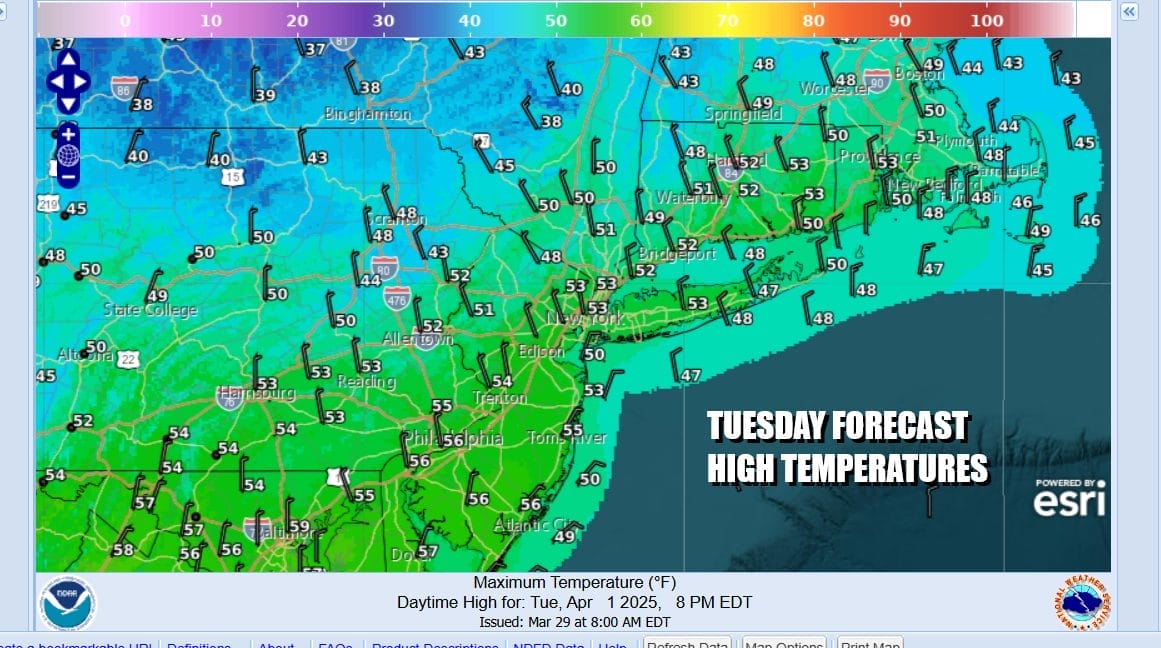
Wednesday will be a chilly day indeed with some sunshine but highs only in the upper 40s to lower 50s in most places. Another weather front will approach Thursday and this will likely bring another chance for showers an perhaps a heavier thunderstorm . A cold front will be approaching from the northwest and slowing down as it passes through. It should push south Thursday night and Friday ending the rain for a short period before we head into the weekend.
BE SURE TO DOWNLOAD THE FREE METEOROLOGIST JOE CIOFFI WEATHER APP &
ANGRY BEN’S FREE WEATHER APP “THE ANGRY WEATHERMAN!
MANY THANKS TO TROPICAL TIDBITS FOR THE USE OF MAPS
Please note that with regards to any severe weather, tropical storms, or hurricanes, should a storm be threatening, please consult your local National Weather Service office or your local government officials about what action you should be taking to protect life and property.


