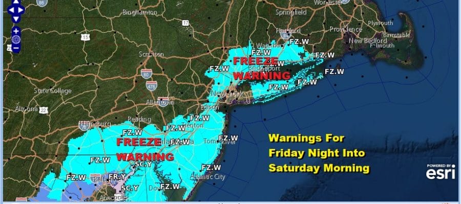
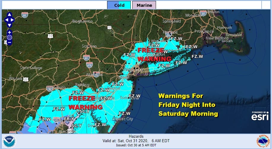
Second Storm Pulls Down Colder Air Cold Rain Wet Snow Freeze Tonight Saturday Morning

Weather in 5/Joe & Joe Weather Show Latest Podcast
Second Storm Pulls Down Colder Air Cold Rain Wet Snow Freeze Tonight Saturday Morning
Another mostly miserable day lies ahead with Post Tropical Cyclone Zeta long gone and now we move on to storm number 2 that is developing in response to an upper trough to the west. Rain is back and in colder air well to the north of the coast (north of Route 84) we are seeing wet snow coming into play. Nothing we saw model wise overnight suggests any upside here. We might see some wet snowflakes mix in down to the coast providing a cheap thrill for snow lovers.
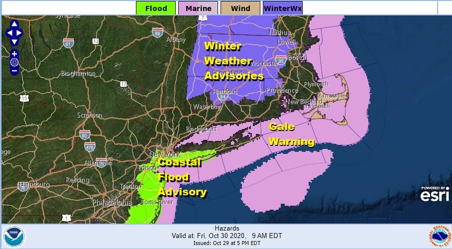
Winter Weather Advisories continue for the Northern half of Connecticut but no where else. Snow amounts here won’t amount to much. Coastal Flood Advisory for some tidal flooding at high tide is up for parts of the Long Island south shore and the New Jersey coast.
SATELLITE

REGIONAL RADAR

Radars are rather busy both regionally and locally today. Colder air is working its way into the areas north and west of the coast and that will continue into this afternoon as temperatures eventually settle in the upper 30s and lower 40s near the coast and mostly 30s inland.
LOCAL RADAR NEW YORK CITY

LOCAL RADAR PHILADELPHIA


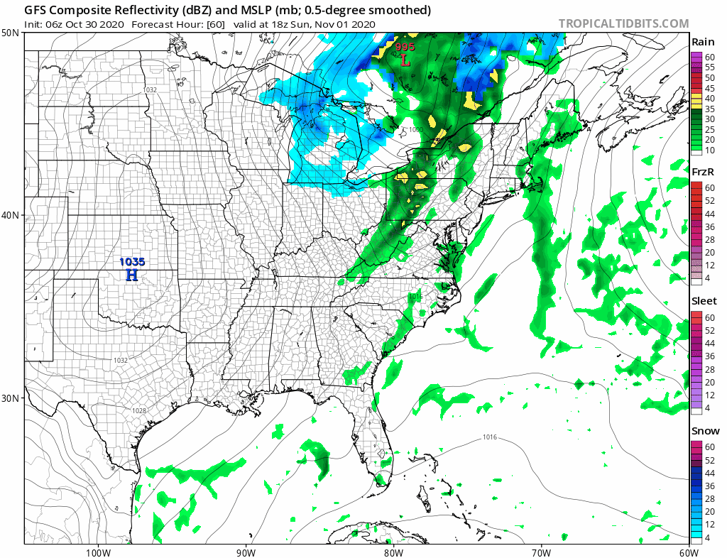
This second low pulls out this afternoon and precipitation ends from west to east. Skies will clear tonight and it will be very cold by morning. lows will be in the mid 20s to lower 30s. Except for the warmest of urban settings just about everyone will be under the freezing mark Saturday morning and that will drive a stake through the heart of the growing season everywhere.
Saturday should a be a nice sunny day but highs will only be in the 40s. The weekend is looking okay but we do have another front arriving late Sunday and that brings clouds back and the chance for showers. The wind will pick up. Highs will be in the 50s. The best chance for showers will be later in the day into Sunday evening.
This next front ushers in a shot of cold air for Monday and Tuesday of the new week and it also will come with wind. Gusts to 30 mph or higher will be common place on Monday with some sunshine through instability clouds. Highs will just be in the 40s. Some lake effect snow will develop Monday in upstate Western NY & Western Pennsylvania. A weak disturbance will bring clouds and perhaps a shower of rain (or snow inland) Monday night. This probably will help hold temperatures up somewhat thanks to some cloud cover. Tuesday Election Day looks cold with sun sunshine and still on the breezy side. Highs again will be in the 40s. Longer range we should warm up nicely starting Wednesday with highs in the 50s and we should be back into the 60s Thursday and Friday. It should be rain free and we will see some sunshine each day. This time around the marine layer will stay where it belongs..offshore!
BE SURE TO DOWNLOAD THE FREE METEOROLOGIST JOE CIOFFI WEATHER APP &
ANGRY BEN’S FREE WEATHER APP “THE ANGRY WEATHERMAN!
MANY THANKS TO TROPICAL TIDBITS FOR THE USE OF MAPS
Please note that with regards to any severe weather, tropical storms, or hurricanes, should a storm be threatening, please consult your local National Weather Service office or your local government officials about what action you should be taking to protect life and property.


