Saturday Sunshine Gives Way to Clouds & Some Rain Sunday
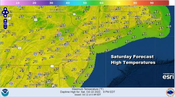
Of the two weekend days, today is the best of the two. We have satellite loops showing not much if any clouds over the Northeast and Mid Atlantic states today. On the lower part of the loop you can see the beginning of clouds moving northward but they won’t get here today. The radars are quiet as well and that leaves us with a mostly sunny Saturday. Temperatures this afternoon will top out in the mid to upper 60s with some warm spots approaching 70 degrees.
SATELLITE

WEATHER RADAR

Low pressure developing off the Southeast US coast will be moving northward up the coast tonight and Sunday and with it, an area of rain will spread northward. Clouds will arrive tonight and increase and thicken up into early Sunday morning with lows in the upper 40s to middle 50s. Sunday as the low pushes northward we will see rain coming in from the southeast to the northwest.
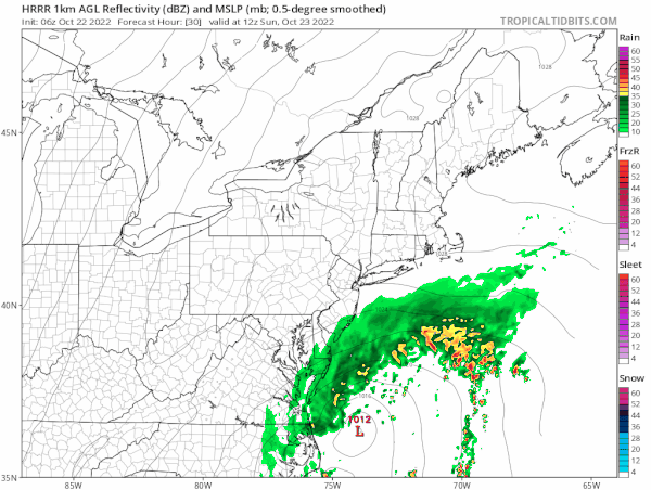
The lead band of rain is mostly in the light side and that moves through first with a steadier rain developing and moving northwestwrd late in the day Sunday. The loop above covers the daytime from 8am Sunday to 8pm Sunday. The low will continue northward and we will see bands of rain Sunday night into early Monday morning and other than some lingering showers, it should be mostly done by daybreak Monday. Temperatures Sunday will be just into the lower 60s in most places.
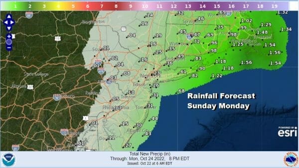
Rainfall amounts tail off considerably as you head west into Western NJ and Eastern Pennsylvania with amounts under a tenth of an inch on the western flank. However the opposite is true to the east where amounts go up across Long Island and Southern New England with 1 inch plus amounts in Southeastern New England likely. Meanwhile we have 1/4 inch amounts form NYC south along the New Jersey shore counties.
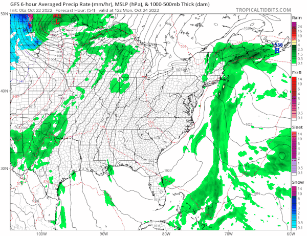
Next week will be a bit of a challenge forecast wise. We have an inverted trough off the East Coast and that keeps us in a mostly onshore flow most of the week. Monday will probably have clouds and some lingering scattered showers with highs in the 60s. We will also likely see clouds and some showers around Tuesday with a flow off the ocean and Wednesday could produce more of the same. It is not a situation where it rains all the time and there will be long dry stretches in betweem. Also we have a low forming offshore later this week and a possible tropical or subtropical low coming in from the east that could complicate things some. We will be addressing these and other issues over the weekend and into next week.
BE SURE TO DOWNLOAD THE FREE METEOROLOGIST JOE CIOFFI WEATHER APP &
ANGRY BEN’S FREE WEATHER APP “THE ANGRY WEATHERMAN!
MANY THANKS TO TROPICAL TIDBITS & F5 WEATHER FOR THE USE OF MAPS
Please note that with regards to any severe weather, tropical storms, or hurricanes, should a storm be threatening, please consult your local National Weather Service office or your local government officials about what action you should be taking to protect life and property.


