
The road to record high temperatures continues for the weekend. Mild air will be moving in once we get into the southwest flow which should begin on Thursday. The only issue will be clouds which we are dealing with tonight. This is going to impact temperatures. If skies partially clear many cold spots could easily temperatures in the upper 20s to lower 30s however should clouds remain stubborn this may keep everyone in the 30s to around 40 so we will be watching for whether skies clear out tonight or not. Satellite loop shows some drying from the north however it also shows another disturbance to the west in the Great Lakes which will keep us fighting clouds on and off through Wednesday. However there should be enough breaks in the cloud cover to give us some sunshine and temperatures back into the 50s.


Radars are now quiet for the most part and should be here into Thursday. It will be milder Thursday with some showers possible at night into Friday morning. They probably will be spotty in nature. Then in comes a strengthening southwest flow both at the surface and aloft. We should see 60 on Friday and be into the 60s over the weekend with a good shot at either record high temperatures or approaching record high temperatures in various locations.
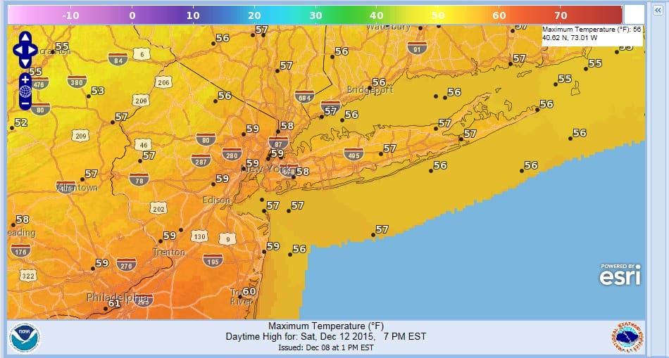
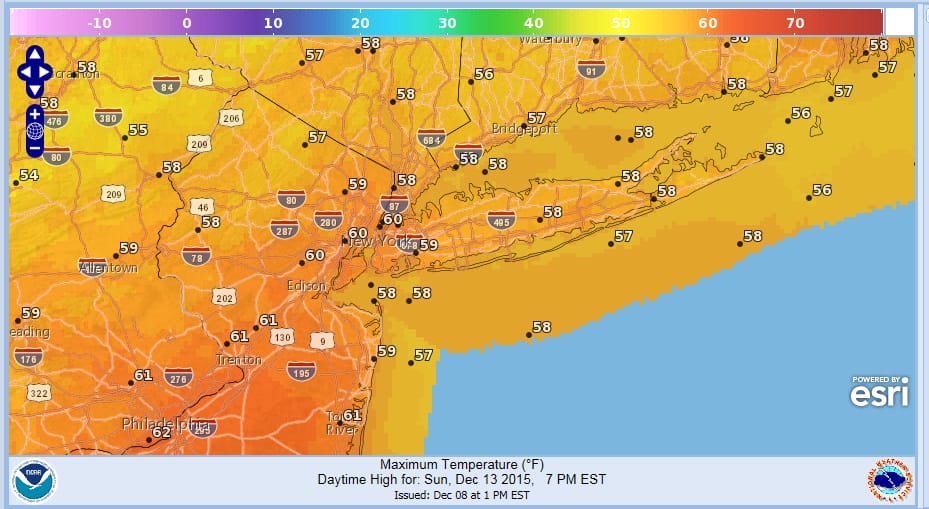
I actually believe the forecast highs on this map for Saturday and Sunday could easily be 5 degrees too low. Longer range is still in flux on models and we will address that later this evening. In the meantime check out my morning long range post including my video analysis of the long range gfs model from overnight.
JOESTRADAMUS LONG RANGE VIDEO ANALYSIS
WARM DECEMBER A BELL WEATHER FOR LESS SNOW?
NEW YORK CITY WEATHER FORECAST


