
Gfs Weather Model In Blocking Mode
In both runs the GFS weather model today had one common theme and that was it develops blocking. The blocking comes across the northern latitudes and begins the process of displacing cold air southward. Now we should point out that the other member models did not support this idea completely. Both runs were cold in the long range which we will ignore for now.It does appear that we will have some sort of transient cold air to deal with later next week. There are just way too many variables at play here and too many of them are flipping one way ot the other. This calls for continued patience among cold weather lovers.
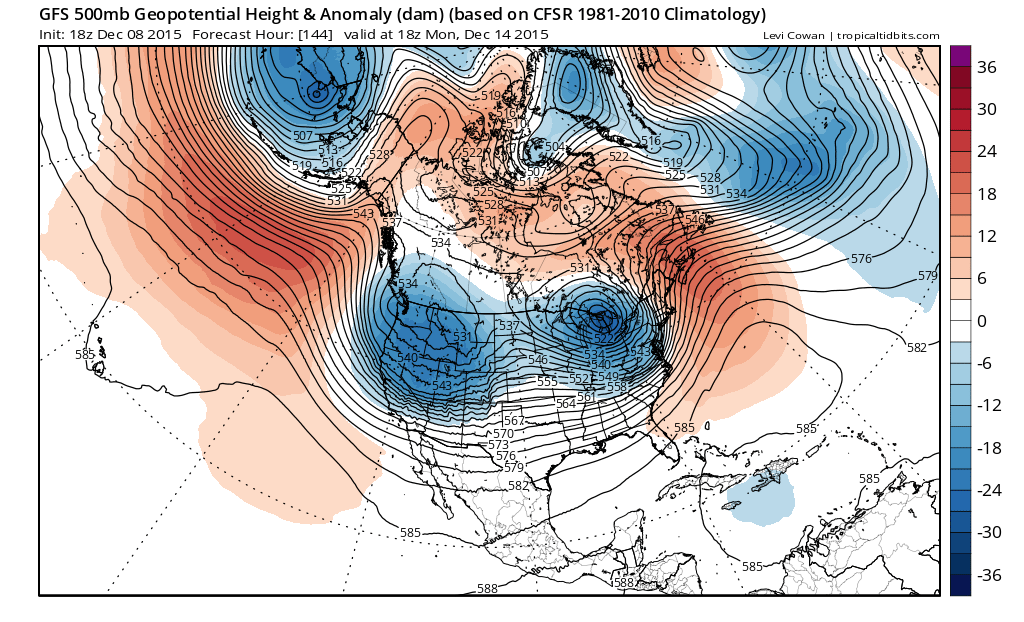
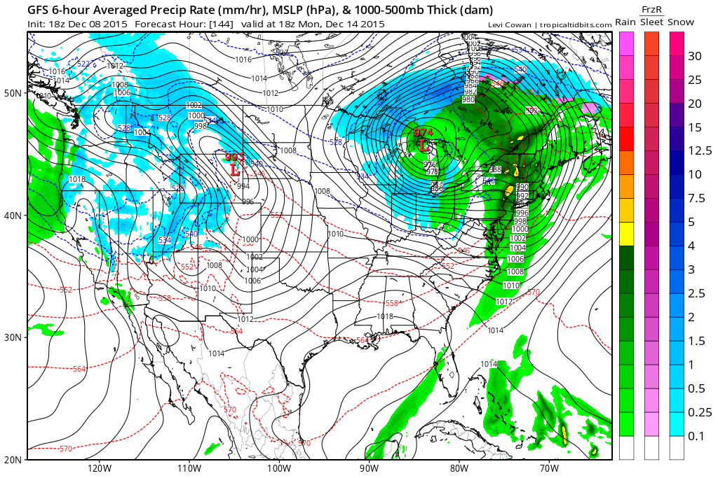
That said let us look at just exactly what is happening. The gfs model shows a rather deep system heading into the Great Lakes early next week with a strong cold front approaching the coast. The European today which has been showing a deep system like this for days has backed away from that idea today to some degree. A deep lead cyclone is important as each one can at least chip away at the overall pattern across North America. The model shows rising pressures in Northern Canada as there is some indication of blocking developing over time.
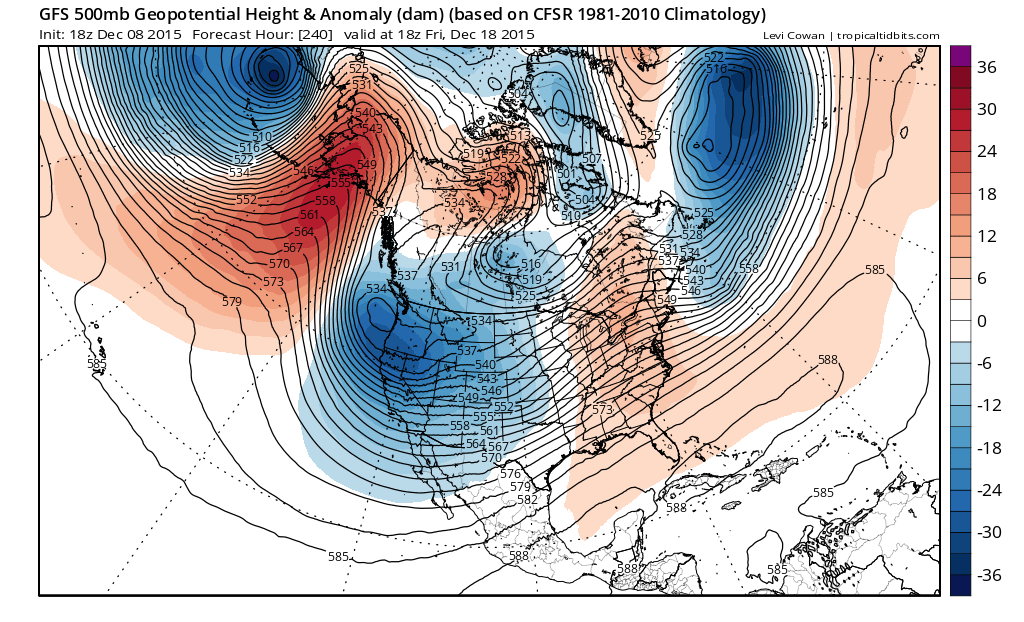
Jumping now to day 10 we see that trend continuing with displacement of the Aleutian vortex westward as a ridge replaces it in the Gulf of Alaska. While the ridge reappears in the east it is a little flatter on this sequence thanks to the deep low south of Greenland which is holding the ridge back to some degree. These features are all important in the scheme of things.

Jumping to day 13 we see a definite colder look here as we have a highway open for cold air to come into the United States as a vortex takes hold in Canada. A split flow with a strong subtropical jet is indicated here as well.

The gfs weather model continues to depend heavily on a negative NAO index as well as a negative Arctic Oscillation as pressures in the Arctic region continue to build. The problem here is that while the NAO looks to go negative the Arctic Oscillation in the longer term could go either way as some models show a negative value (cold air displaced south) while others do not (more of the same we have now).
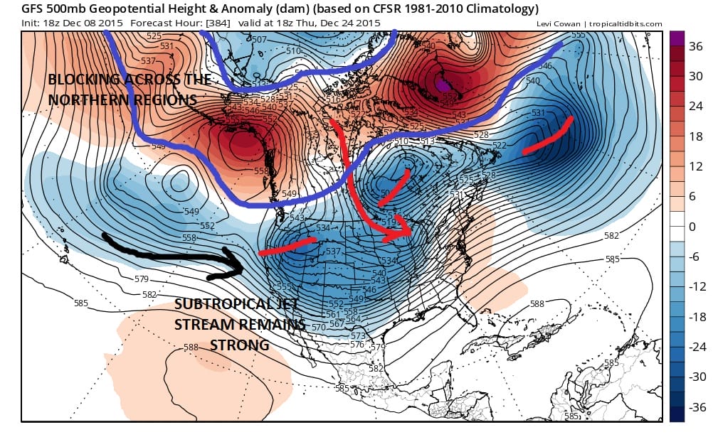
Looking out at day 16 we have a rather cold look across much of the United States with strong blocking across the top. The two runs today were very close with this idea so at least they didn’t flip from run to run. Again this look while enticing is not one that we can place much confidence on. We now have to start seeing whether the models are correct in the developing blocking. This is the strongest indication yet of some sort of slow change happening but confidence remains low. We now have to see this continue for the rest of this week. We also need to see the GFS model and all the models shy away from the ridge off the southeast coast. It needs to be correct on the crashing North Atlantic Oscillation, and it needs to be correct on the negative Arctic Oscillation. Given the strength of all the longer term factors at play including El Nino it remains a very tall order. However I continue to believe that even in the strongest dominant patterns there is usually a break of some sort. Even if this is close to being correct we have to also wonder how long it would last in the longer term. Should this change, is it temporary for a week or so before it reverts right back to the primary el nino dominant pattern? Many questions lie ahead which we will of course tackle on the next GFS weather model run. We also need to remember that IF this is close to being a reality, the entire process will take time. Pattern changes are processes. They are not events that happen over a few days. They can take weeks to evolve. Uncertainty continues going forward.
JOESTRADAMUS LONG RANGE VIDEO ANALYSIS
WARM DECEMBER A BELL WEATHER FOR LESS SNOW?
NEW YORK CITY WEATHER FORECAST