
Record Arctic Cold Saturday Sunday

Record Arctic Cold Saturday Sunday
Snow is forecast for Thursday and this will create some issues but the bigger issue may wind up being the cold air that follows on the back side of this coastal storm. We are setting up to see the lowest temperatures across the area this weekend in decades!
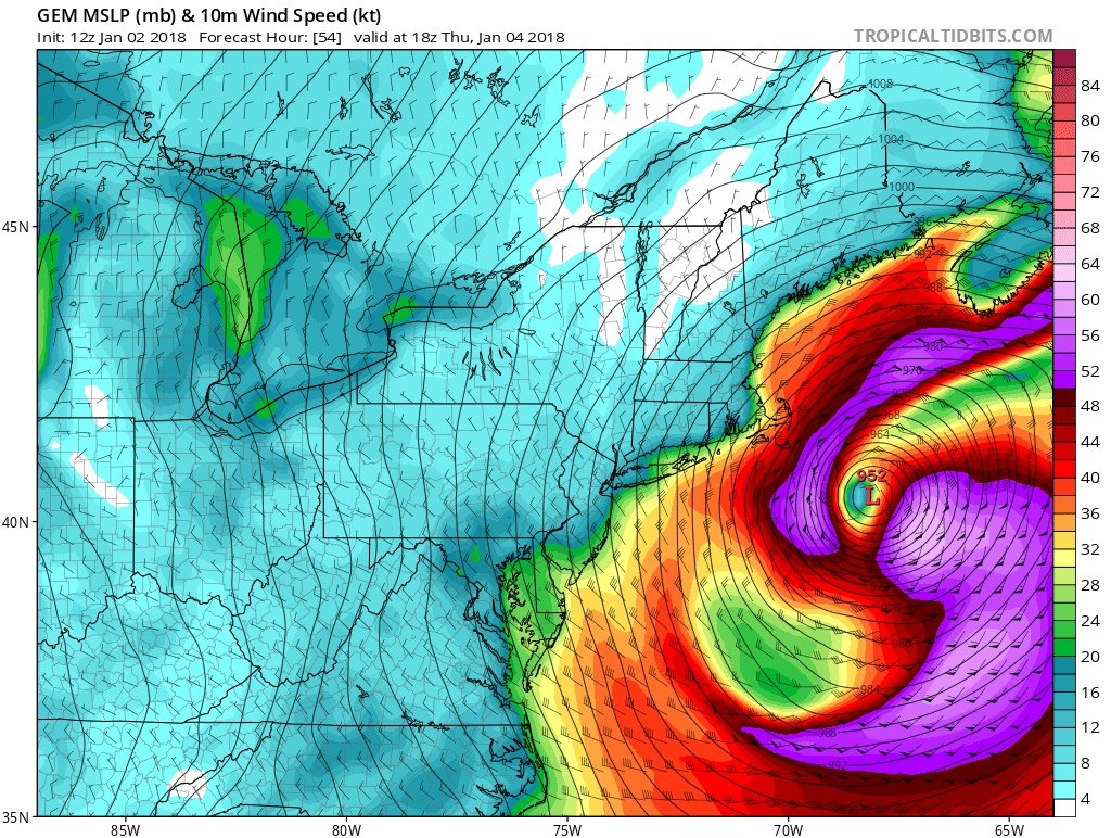
First off is the intense storm to the east will start the winds cranking on Thursday which will be blowing the snow around and pulling down cold air straight from the north. This time around the Arctic air mass coming down will have no time or opportunity to modify. Winds will be howling later Thursday into Saturday with gusts to 30 to 40 mph or more. Friday morning temperatures will fall to 5 to 10 above and then no higher than the low to mid teens on Friday. Some places won’t even get above 10. Then it is down we go Friday night into Saturday morning with lows below zero in many areas. The daytime Saturday will be absolutely brutal with highs just 10 to 15 and then Sunday morning with the winds dropping off, temperatures in some places will drop off the wall.
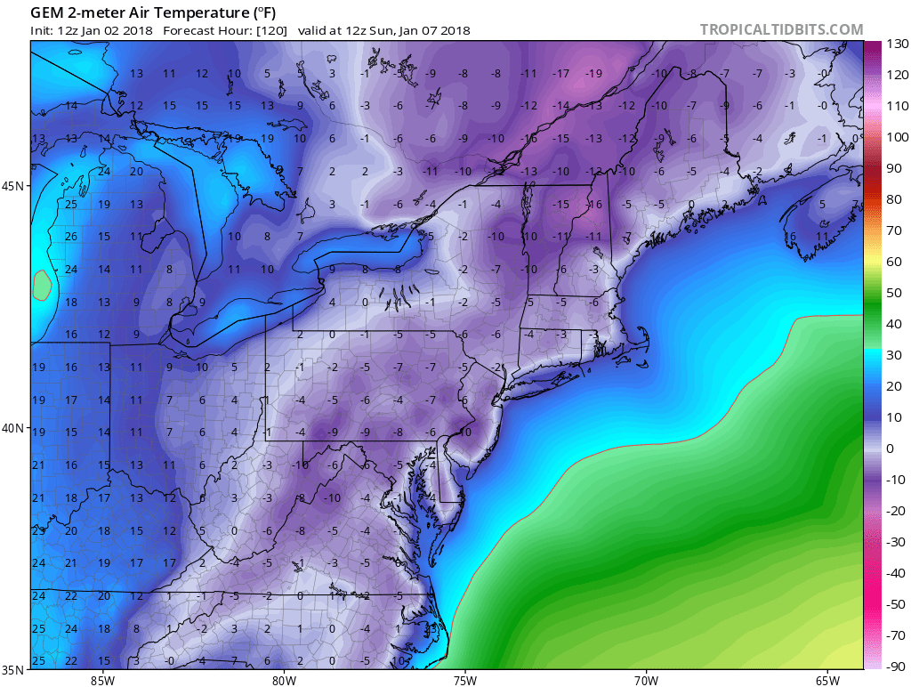
The map above is for Sunday morning shows below zero readings clear down into North Carolina. It is quite likely that Washington, Baltimore, Philadelphia, New York City, and Boston will see below zero temperatures over the weekend. The good news is that the arctic is will finally pull out on Monday but there might be some snow ice and rain to deal with when it does. Isn’t this winter turning out to be just lovely?
MANY THANKS TO TROPICAL TIDBITS FOR THE WONDERFUL USE OF THE MAPS

GET JOE A CIGAR IF YOU LIKE!
FiOS1 News Weather Forecast For Long Island
FiOS1 News Weather Forecast For New Jersey
FiOS1 News Weather Forecast For Hudson Valley
NATIONAL WEATHER SERVICE SNOW FORECASTS
LATEST JOESTRADAMUS ON THE LONG RANGE
Weather App

Don’t be without Meteorologist Joe Cioffi’s weather app. It is really a meteorologist app because you get my forecasts and my analysis and not some automated computer generated forecast based on the GFS model. This is why your app forecast changes every 6 hours. It is model driven with no human input at all. It gives you an icon, a temperature and no insight whatsoever.
It is a complete weather app to suit your forecast needs. All the weather information you need is right on your phone. Android or I-phone, use it to keep track of all the latest weather information and forecasts. This weather app is also free of advertising so you don’t have to worry about security issues with your device. An accurate forecast and no worries that your device is being compromised.
Use it in conjunction with my website and my facebook and twitter and you have complete weather coverage of all the latest weather and the long range outlook. The website has been redone and upgraded. Its easy to use and everything is archived so you can see how well Joe does or doesn’t do when it comes to forecasts and outlooks.
Just click on the google play button or the apple store button on the sidebar for my app which is on My Weather Concierge. Download the app for free. Subscribe to my forecasts on an ad free environment for just 99 cents a month.
Get my forecasts in the palm of your hand for less than the cost of a cup of Joe!


