Rain Will Taper Off Later Today But More Rain Coming
Wednesday into Thursday & Again Saturday

Rain Will Taper Off Later Today But More Rain Coming
Wednesday into Thursday & Again Saturday

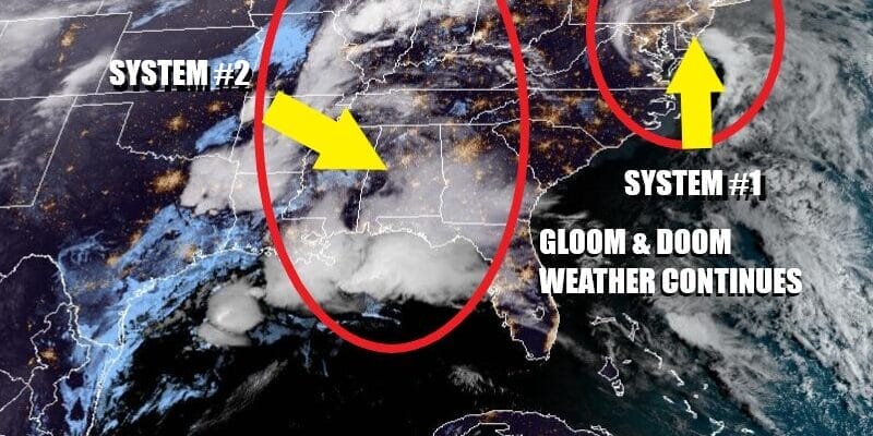
The parade of storm systems has begun and we have one moving up the coast today. It is a small system with a comma shape signature on the satellite. While the low center is not going to strengthen much if at all, it has a concentrated area of rain that is moving northward. We can see that signature very well on the radar and there are some bands of moderate to heavy rain showing up.

Basically it is a gloom and doom kind of day with a wind off the ocean, The raw northeast to east wind will keep temperatures in a range from the upper 40s to lower 50s for much of Eastern Pennsylvania to Southern New England. It is hard for temperatures to go anywhere with the combination of overcast skies, an wind off a cold ocean, and the rain itself. It is quintessential gloom & doom weather.
SATELLITE WITH LIGHTNING STRIKES

WEATHER RADAR

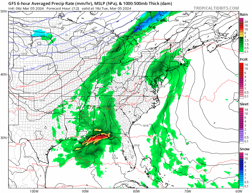
There will be a brief break in the rain tonight into Wednesday morning but as the gfs model loop above clearly shows, the parade of storms is far from over. The next storm system is already setting up today across the Ohio Valley where a cold front is moving eastward, and across the Deep South and Gulf States where we see an expanding area of rain and heavy downpours. Rain spreads up the coast during the day Wednesday and lasts into Thursday morning.
Thanks to a short break in the rain, we will see temperatures reach the 50s for highs Wednesday but once the rain gets underway and the ocean wind picks up, temperatures will settle into the 40s again. Rain will end well before daybreak Thursday morning. We should see some slow improvement later in the day Thursday and Friday looks like the one decent day with some sunshine and highs in the 50s. However the weekend brings yet another storm system with rain developing later in the day Saturday and lasting into early Sunday morning as a storm heads for the Great Lakes and Saint Lawrence Valley and a cold front swings east to the coast. The good news is that this is the last storm of this series and a drier pattern will start to set up beginning Sunday and lasting through much of next week.
BE SURE TO DOWNLOAD THE FREE METEOROLOGIST JOE CIOFFI WEATHER APP &
ANGRY BEN’S FREE WEATHER APP “THE ANGRY WEATHERMAN!
MANY THANKS TO TROPICAL TIDBITS FOR THE USE OF MAPS
Please note that with regards to any severe weather, tropical storms, or hurricanes, should a storm be threatening, please consult your local National Weather Service office or your local government officials about what action you should be taking to protect life and property.
(Amazon is an affilate of Meteorologist Joe Cioffi & earns commissions on sales.)


