
USE THE COUPON CODE “SPRING2026” AND GET 10 PERCENT OFF ON ANY PURCHASE

Rain Thunderstorms & Severe Weather Risk
Nice Sunny Mother’s Day
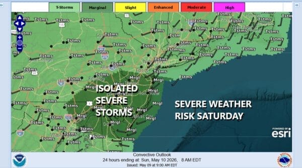
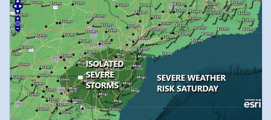
Rain will be moving across Eastern Pennsylvania to Southern New England this afternoon into this evening. We have an upper trough that is moving west to east and areas in Southern New Jersey and Southeastern Pennsylvania are at risk for isolated severe thunderstorms per the Storm Prediction Center. To the north of this zone there could be an isolated thunderstorm or two in the mix as everything moves from west to east.
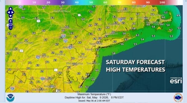
There will be some variability in rainfall amounts with this weather system. Most places could see a quarter to a half inch but there could be some locally higher amounts in any convection that develops. As far as temperatures go, most highs today will be in the 60s though in Southern New Jersey and Southeastern Pennsylvania where there is severe weather risk, highs could reach the upper 60s to near 70 degrees.
SATELLITE WITH LIGHTNING STRIKES

WEATHER RADAR

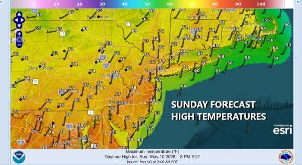
The upper trough will move offshore this afternoon and evening putting an end to the rain from west to east. Skies will partially clear tonight and by morning, most lows will be in the low to mid 50s. Some patchy fog could develop. This sets up for some sunshine Sunday which is Mother’s Day. It will be on the warm side with most highs reaching the middle to upper 70s, except along the immediate coast where local sea breezes are likely to develop.
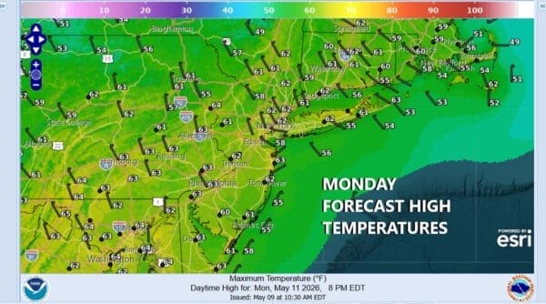
There is another weather front heading our way and that could set off a shower or thunderstorm late Sunday afternoon or evening in some places. The highest chance for this is likely from New York City north and northeast. The front stalls to the south and a weak wave brings some rain late Sunday night or Monday morning. Leftover clouds are likely in the afternoon. Highs Monday will be in the lower 60s.
Some sunshine will return Tuesday with temperatures mostly in the 60s. Winds will turn south Wednesday. Highs will again be mostly in the 60s. Another cold front is going to approach with the risk for showers Wednesday morning, and the chance for showers and thunderstorms late Wednesday into Wednesday night as the cold front passes. Drier and cool air returns for Thursday and Friday with highs in the 60s.
DOWNLOAD THE UPSIDE APP & EARN CASH AT GAS STATIONS, RESTAURANTS, & SUPERMARKETS

BE SURE TO DOWNLOAD THE FREE METEOROLOGIST JOE CIOFFI WEATHER APP &
ANGRY BEN’S FREE WEATHER APP “THE ANGRY WEATHERMAN!
MANY THANKS TO TROPICAL TIDBITS FOR THE USE OF MAPS
Please note that with regards to any severe weather, tropical storms, or hurricanes, should a storm be threatening, please consult your local National Weather Service office or your local government officials about what action you should be taking to protect life and property.


