
USE THE COUPON CODE “SPRING2026” AND GET 10 PERCENT OFF ON ANY PURCHASE

Nickel & Dime Events For the Week Ahead

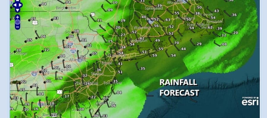
Mother’s Day is coming to a close and we do have a cold front that is approaching from the west. You can see it on satellite and radars as the front nears. Showers are breaking out ahead of the front and there might even be a scattered thunderstorm or two in the mix. The front is going to slow down and stall overnight, bringing another surge of rain overnight into Monday morning. Temperatures will settle to the upper 40s to near 50 degrees by morning. This is another one of those nickel and dime events that will be moving through leaving a quarter to a half inch of rain in some places.
SATELLITE WITH LIGHTNING STRIKES

WEATHER RADAR

Most of the rain should be done by daybreak and that will leave us with leftover clouds along with some developing breaks of sunshine. Winds will shift to the northwest bringing down cooler and drier air. Temperatures Monday will generally be in the 60s in most places. Skies will clear Monday night with Tuesday morning lows in the upper 30s in colder inland spots and mostly low and middle 40s elsewhere.

Tuesday should be a sunny but cool day with high temperatures mostly in the 60s. Wednesday looks to be dry for much of the day but we will see sunshine give away to some arriving clouds with another cold front approaching. Highs Wednesday will be in the 60s except 50s along the coast thanks to a wind off the ocean. The front likely will produce showers and perhaps a thunderstorm or two Wednesday night through part of Thursday until the front moves offshore and improving weather conditions follow.
DOWNLOAD THE UPSIDE APP & EARN CASH AT GAS STATIONS, RESTAURANTS, & SUPERMARKETS

BE SURE TO DOWNLOAD THE FREE METEOROLOGIST JOE CIOFFI WEATHER APP &
ANGRY BEN’S FREE WEATHER APP “THE ANGRY WEATHERMAN!
MANY THANKS TO TROPICAL TIDBITS FOR THE USE OF MAPS
Please note that with regards to any severe weather, tropical storms, or hurricanes, should a storm be threatening, please consult your local National Weather Service office or your local government officials about what action you should be taking to protect life and property.


