Rain & Snow Showers Wednesday Night Into Thursday Morning
Very Cold Air Follows

Rain & Snow Showers Wednesday Night Into Thursday Morning
Very Cold Air Follows
The cold weather continues today on west to northwest winds. We have the core of the cold air mass that has been with us since last Friday sitting overhead and moving out to the east. We will see partly to mostly sunny skies today and high temperatures will reach the upper 30s to around or just over 40 degrees. Radars and satellite loops are showing areas of snow showers across the snow belts of Northeast Ohio, Northwest Pennsylvania, Southwestern & North Central NY. Another round of heavy lake effect snow is about to get underway. Tonight skies will be cold and clear with most lows in the low to middle 20s with upper teens in cold spots.
SATELLITE WITH LIGHTNING STRIKES

WEATHER RADAR

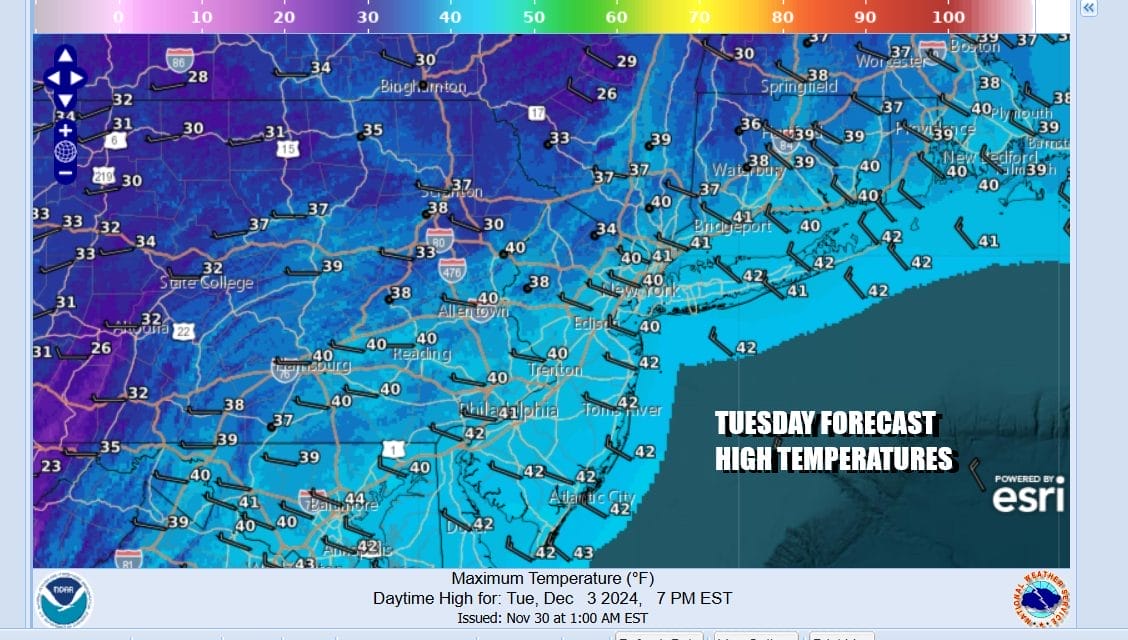
Wednesday we are going to see sunshine giving way to arriving clouds. Low pressure will be moving across the Great Lakes and then into Southeastern Canada Wednesday night and Thursday. We will be seeing a cold front and an upper trough approach and move through tonight and Thursday morning. Wednesday high temperatures will be in the upper 30s and lower 40s.

Temperatures overnight into Thursday morning should be near freezing inland and north of the coast and precipitation could come in as snow or a mix Wednesday night and lasting into Thursday morning. Along the immediate coast around NYC, Long Island and Coastal New Jersey it will a mix to mostly rain. We are not talking about a lot of precipitation here, mostly under a quarter of an inch of liquid.
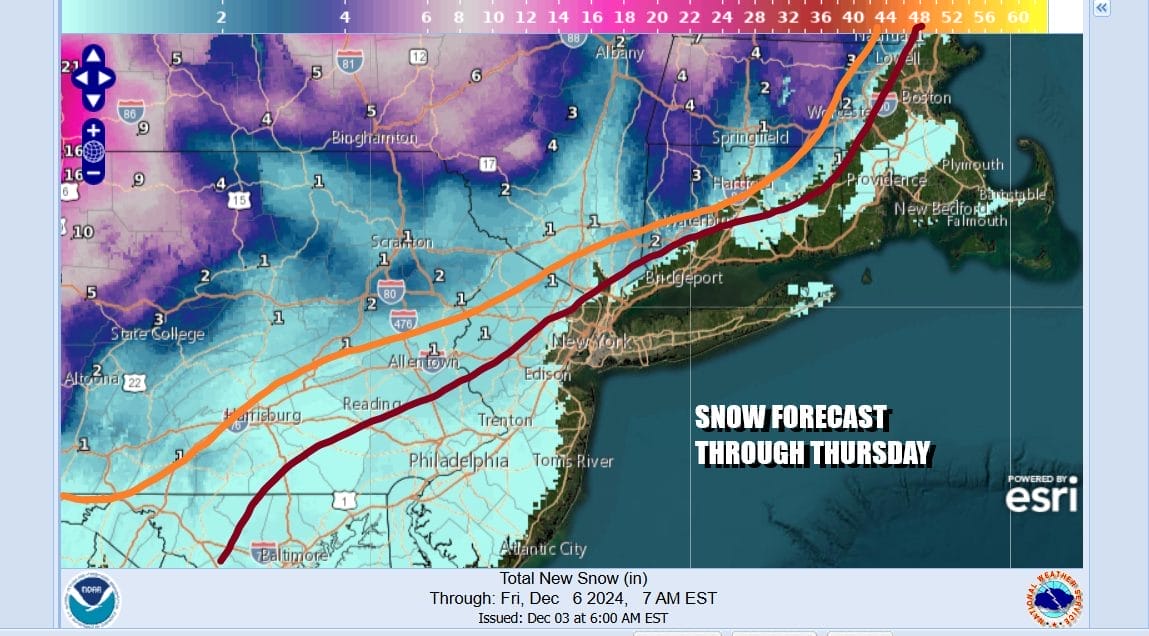
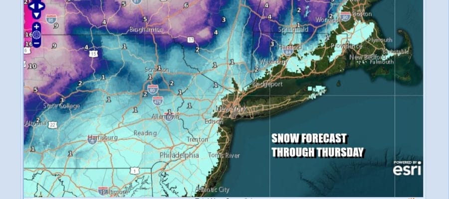
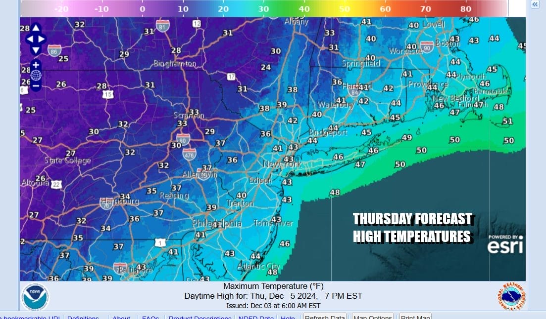
As far as snow accumulations are concerned we are talking about a coating to an inch just north and west of Philadelphia and New York City and coastal Connecticut. A inch or so is possible north of Route 78 in New Jersey and west of Route 287. The same holds for areas north of 287 in the Hudson Valley. North of Route 84 is where we start to see 1 to 2 inch amounts and in Connecticut we are talking 2 to 3 inches possible north of Route 84. Behind the front is the coldest air of this stretch and temperatures Thursday will top in the upper 30s and lower 40s.
Thursday night into Friday morning skies will clear and it will be windy with lows mostly in the low to middle 20s. Friday is setting up to be a windy and very cold day with sunshine and clouds. Temperatures Friday will be in the low to middle 30s with gusty northwest winds of 20 to 30 mph making it feel like it is in the 20s all day long. By Saturday morning we will see lows in the upper teens and lower 20s. The weekend will be cold but we will see the coldest air pulling out to the east. That should allow temperatures to inch higher under dry conditions Saturday and Sunday.
BE SURE TO DOWNLOAD THE FREE METEOROLOGIST JOE CIOFFI WEATHER APP &
ANGRY BEN’S FREE WEATHER APP “THE ANGRY WEATHERMAN!
MANY THANKS TO TROPICAL TIDBITS FOR THE USE OF MAPS
Please note that with regards to any severe weather, tropical storms, or hurricanes, should a storm be threatening, please consult your local National Weather Service office or your local government officials about what action you should be taking to protect life and property.


