Rain Moving Northward Models Disagree
Rain Moving Northward Models Disagree
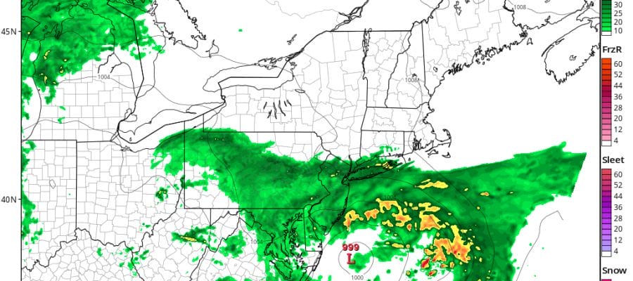
Weather models are in complete disagreement this afternoon on the rain moving northward from the Middle Atlantic States. We can say there are no issues for the rest of the day with just clouds increasing. Then for later tonight the big question is how far north and west does the rain get? The HRRR model would argue for rain everywhere from Eastern Pennslylvania to Southern New England arriving tonight and lasting into the first part of Wednesday morning.
RAIN MOVING NORTHWARD HRRR 4AM WEDNESDAY
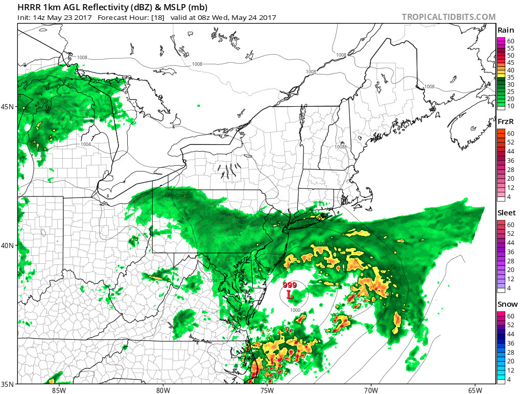
The HRRR model has a wall of rain at 4am. It would suggest everyone gets hit with heavier rain along the coast. The NAM model on the other hand has a complete miss!
RAIN MOVING NORTH BUT NAM KEEPS RAIN OFFSHORE 4AM WEDNESDAY
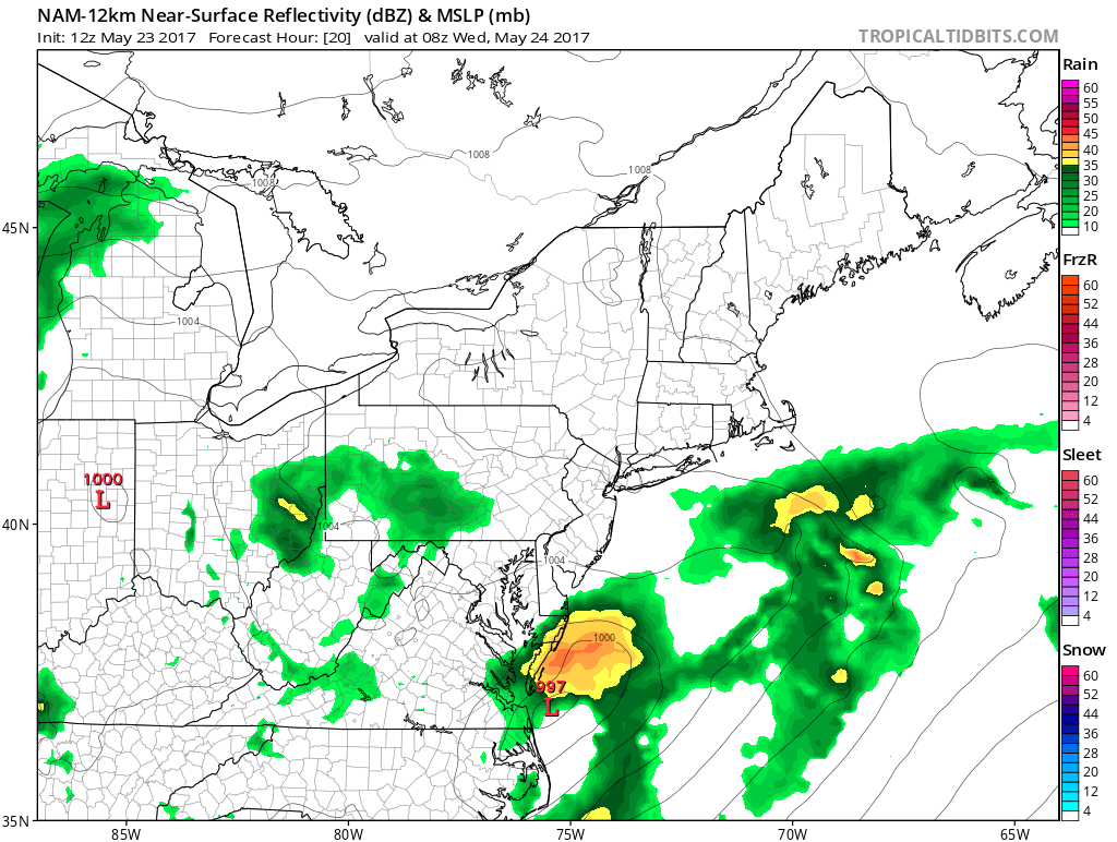
Naturally the GFS model splits the difference between the two and has rain along the coast of New Jersey & Long Island but not much north and west and north of the immediate coast. Right now that is the compromise view of things with this weather system We will just have to watch the radars below and see how well they match up.
SATELLITE LOOP

REGIONAL RADAR

LOCAL RADAR NEW YORK CITY

LOCAL RADAR PHILADELPHIA


At least for now the rest of the forecast remains unchanged. Once this system moves out more rain is forecast for Thursday as the next wave moves through. That rain could last through Thursday night with leftover showers on Friday. The weekend remains in doubt though Saturday still looks like the best of the three day holiday weekend. Temperatures are going no where today as they hold generally in the 60s with some warmer areas in Central and South Jersey possibly nearing 70. Tonight it will be in the 50s especially with the northeast wind as the low goes by to the east. If clouds break tomorrow afternoon we could see temperatures reach the upper 60s and lower 70s.
 GET JOE A CIGAR IF YOU LIKE

LANDSCAPE COMPANIES FOR YOUR NEEDS
LONG ISLAND ROCKLAND COUNTY Connecticut

![]()

ROCKLAND COUNTY TRI STATE SNOW REMOVAL JOHNSTOWN PA


FiOS1 News Weather Forecast For Long Island
FiOS1 News Weather Forecast For New Jersey
FiOS1 News Weather Forecast For Hudson Valley
NATIONAL WEATHER SERVICE SNOW FORECASTS
LATEST JOESTRADAMUS ON THE LONG RANGE
Weather App

Don’t be without Meteorologist Joe Cioffi’s weather app. It is really a meteorologist app because you get my forecasts and my analysis and not some automated computer generated forecast based on the GFS model. This is why your app forecast changes every 6 hours. It is model driven with no human input at all. It gives you an icon, a temperature and no insight whatsoever.
It is a complete weather app to suit your forecast needs. All the weather information you need is right on your phone. Android or I-phone, use it to keep track of all the latest weather information and forecasts. This weather app is also free of advertising so you don’t have to worry about security issues with your device. An accurate forecast and no worries that your device is being compromised.
Use it in conjunction with my website and my facebook and twitter and you have complete weather coverage of all the latest weather and the long range outlook. The website has been redone and upgraded. Its easy to use and everything is archived so you can see how well Joe does or doesn’t do when it comes to forecasts and outlooks.
Just click on the google play button or the apple store button on the sidebar for my app which is on My Weather Concierge. Download the app for free. Subscribe to my forecasts on an ad free environment for just 99 cents a month.
Get my forecasts in the palm of your hand for less than the cost of a cup of Joe!


