

Rain Into Saturday Morning Followed By Afternoon Improvement
& A Sunny Mothers Day
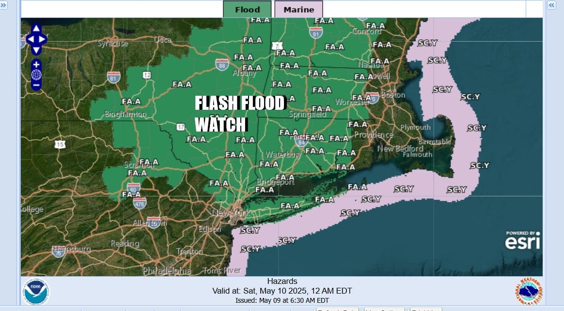
A soaking rain is underway and given that the ground is saturated in many areas from the rains of the last 10 days, the risk for flash flooding exists and the National Weather Service is indicating the highest risk for Long Island as well as parts of Northern New Jersey, Northeast Pennsylvania, the Catskills and entire Hudson Valley as well as much of Western, Central and Southern New England.

Rainfall is forecast to be in the inch and a half to 2 inch range which could be enough to set off some local flash flooding. There could be some areas that wind up with more than two inches if some convection gets going and it is entirely possible that there could be some isolated thunderstorms in the mix. Rainfall amounts will be far less across Central and Southern New Jersey as the heaviest rains line up more to the west and northwest into Pennsylvania and Upstate NY.
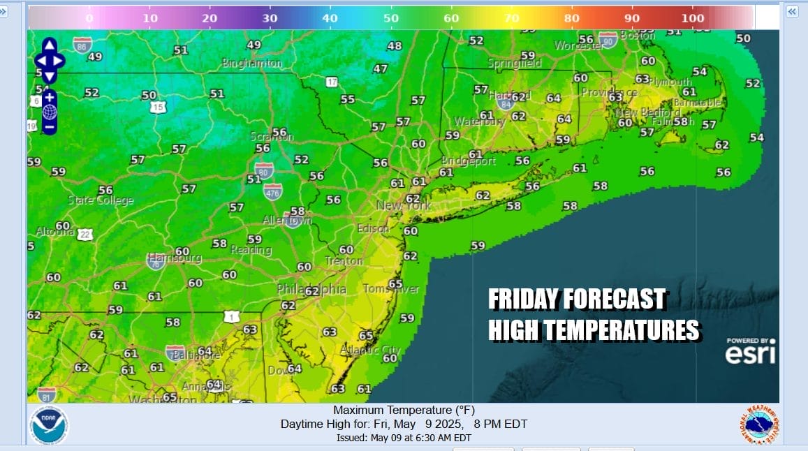
As far as temperatures are concerned, today is a day of raw, gloom & doom weather. Rain is spreading northward up the coast as low pressure develops in the Carolinas and a moist flow up the East Coast is firmly established. Winds off the ocean plus the rain will keep temperatures mostly ni the 50s to around 60 degrees at best. Rain will taper off from south to north this evening and overnight.
SATELLITE WITH LIGHTNING STRIKES

WEATHER RADAR

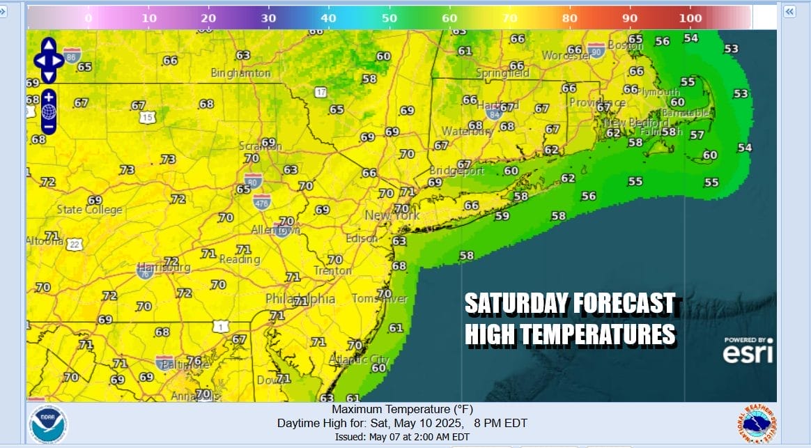
The good news is that the upper air pattern is not stuck in a blocking mode so weather systems will be moving along. Most if not all of the rain should be long gone by daybreak except for Southeastern New England. Leftover clouds will slowly give way to some afternoon sunshine Saturday from west to east. Winds will freshen from the northwest and north and temperatures will top in the upper 60s to some lower 70s
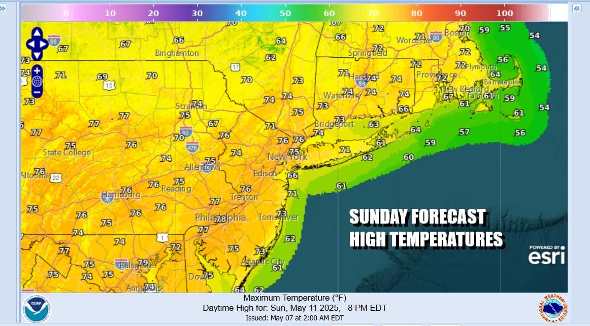
High pressure builds in to Upstate New York and New England Sunday and that means we will have a lovely Mothers Day of sunshine from start to finish. There will be a northwest breeze into the afternoon that could give way to local sea breezes at the shore. Temperatures Sunday will be mostly in the low to middle 70s and there is absolutely no rain in the forecast.
Moving into next week it seems it will be dry and warm for Monday and for Tuesday as well with sunshine Monday, and sunshine giving way to some arriving clouds Tuesday. Monday highs will be in the mid to upper 70s. Tuesday highs will reach the upper 70s and lower 80s. Low pressure this weekend in the Gulf of Mexico will bring heavy rain to parts of the Deep South and Southeast. Some of that moisture could head up the coast by Wednesday of next week.
BE SURE TO DOWNLOAD THE FREE METEOROLOGIST JOE CIOFFI WEATHER APP &
ANGRY BEN’S FREE WEATHER APP “THE ANGRY WEATHERMAN!
MANY THANKS TO TROPICAL TIDBITS FOR THE USE OF MAPS
Please note that with regards to any severe weather, tropical storms, or hurricanes, should a storm be threatening, please consult your local National Weather Service office or your local government officials about what action you should be taking to protect life and property.


