Quiet Week With Temperatures Trending Higher Late Week,
Next Chance For Rain Sunday

Quiet Week With Temperatures Trending Higher Late Week,
Next Chance For Rain Sunday
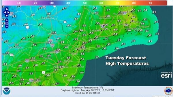
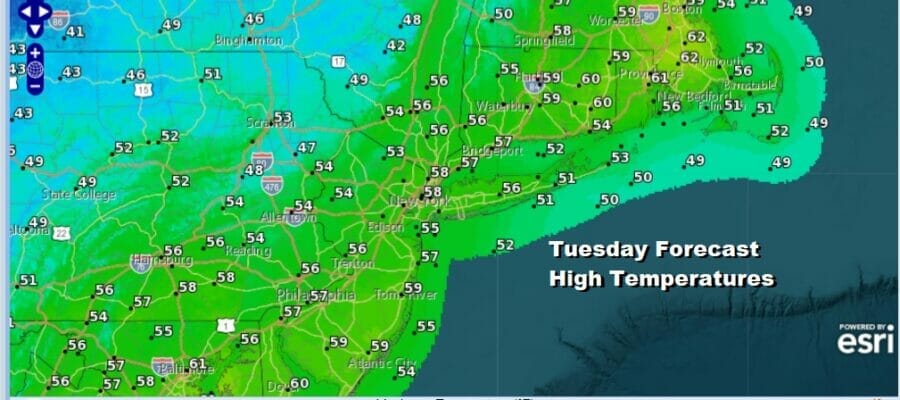
We have a chilly day ahead thanks to low pressure in Southeastern Canada and it stands out so well on the satellite loop. The counterclockwise rotation around the low will bring some clouds into the mix today along with breaks of sunshine. It will also be a little breezy and temperatures today will not be going anywhere far. High will generally be in the 50s with perhaps one or two spots getting close to the 60 degree mark. There are some instability showers on the radar inland as the radar loop shows and I suppose there could be the odd inland sprinkle or brief shower. Otherwise for most of you the day will be dry.
SATELLITE

WEATHER RADAR

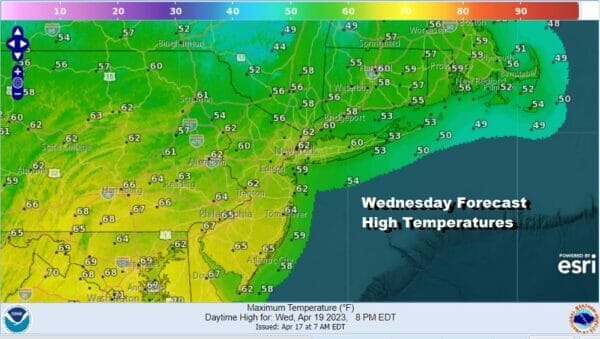
There will be a warming trend that gets underway Wednesday. A chilly night under clear skies lies ahead and lowswill be in the 30s inland to low 40s coast. Wednesday should be a sunny day and with a prevailing northwest or west wind for much of the day, highs will reach the low and middle 60s which is about where we should be for this time of year.
There are no changes in the outlook for the late week as we have been discussing in past days. High pressure will be offshore and while this sets us up for a warm up, the high being to the southeast means that the warm up will be nothing like what happened last week. Instead we will be subject to day to day temperature fluctuations depending on sky conditions and wind direction.
Also the strong ridge off the East Coast will at least initially slow the progress of weather systems to our west. The first cold front approaches Friday night from the west but never gets here. The second front will approach Saturday night and with the high offshore, this front will take its time moving through. Getting there it will be dry Thursday and Friday with sunshine both days. Temperatures will be in the 70s Thursday. and in the mid 70s to lower 80s Friday.
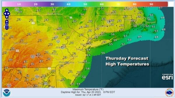
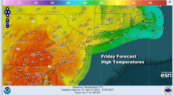
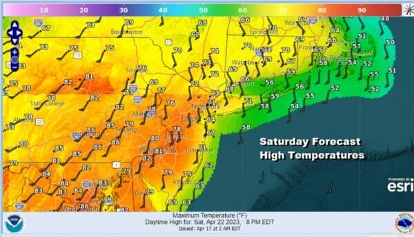
Do note that on both days we have a wide range in temperatures from coast to inland areas where wind direction and local sea breezes will be playing a big role in temperatures. South and east facing shorelines will be at least 10 degrees cooler both Thursday and Friday. Saturday should be dry with a southwest to south wind. Temperatures will be in the 70s to lower 80s with clouds and some breaks of sun.
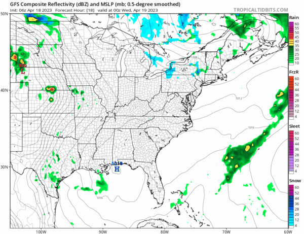
The second cold front mentioned earlier will approach Saturday night and Sunday and as the GFS model shows above, it could be very slow moving and put us in line for rain and thunderstorms throughout the day. Temperatures will be in the 60s and 70s ahead of it. The front may not move offshore until early Monday. We will have to see how this slowdown/stall could impact rainfall amounts.
BE SURE TO DOWNLOAD THE FREE METEOROLOGIST JOE CIOFFI WEATHER APP &
ANGRY BEN’S FREE WEATHER APP “THE ANGRY WEATHERMAN!
MANY THANKS TO TROPICAL TIDBITS & F5 WEATHER FOR THE USE OF MAPS
Please note that with regards to any severe weather, tropical storms, or hurricanes, should a storm be threatening, please consult your local National Weather Service office or your local government officials about what action you should be taking to protect life and property.


