Quiet Dry Conditions Continue Mostly Dry Weekend
Chance For Rain Monday

We are enjoying a mostly nice day of weather today and sunshine will take highs to the middle and even a few upper 80s. The exception to this today will be Southern New England and points east where highs till be in the lower 80s and upper 70s near the coast. We are seeing some scttered showers well north into Upstate NY and New England. We are going to keep a shower mention out of the forecast for today. Tonight under mainly clear skies will see lows in the warmer urban areas close to 70 while inland lows will be in the 60s with 50s in cool spots.

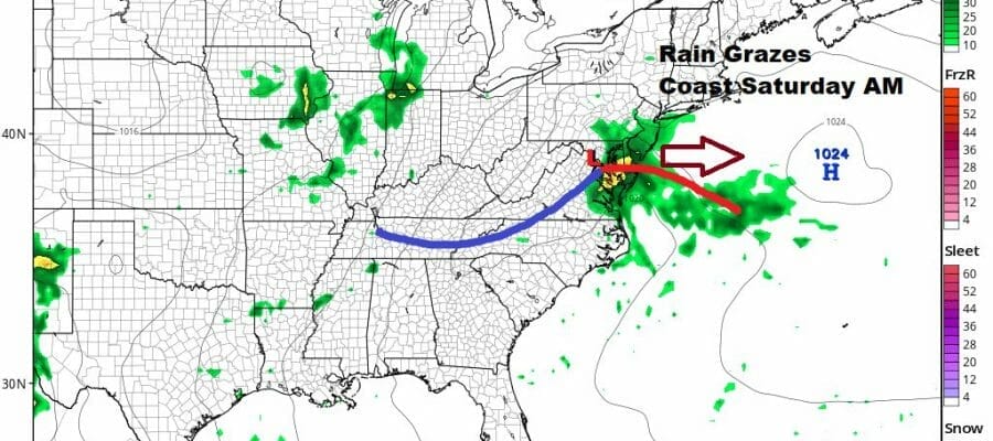
Friday caps off what has been a nice weather week with no worse than partly sunny skies. Highs will be in the mid to upper 80s with little or no chance for an isolated shower or thunderstorm. We then head into the weekend with a weather system that will graze the coast Saturday morning with clouds and maybe some showers (i do mean maybe).
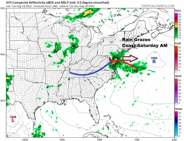
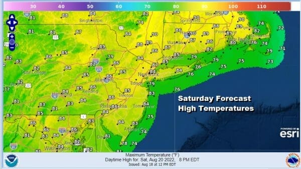
This system is rather weak and might push rain up the coast to New Jersey and possibly Long Island Saturday mornng but it will be long gone to the east by afternoon and weather conditions will improve afterwards. Inland areas will see some clouds but we should see sunshine develop everywhere by afternoon and highs will be in the low to mid 80s.
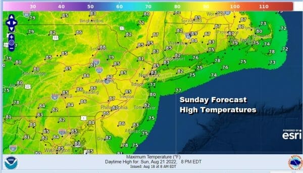
Sunday will be a decent day of sunshine and a few clouds. Highs will be in the middle 80s for the most part. Temperatures will be a little cooler at the shore. Humdity levels this weekend will be coming up making it a little more uncomfortable Saturday and more so on Sunday.
Late Sunday night into Monday morning a warm front will be moving through with some showers or a thundertorm ahead of it and then a cold front follows with the chance for more showers later in the day Monday. Highs will be in the 80s.
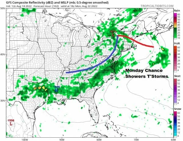
This system has the potential to bring half inch rainfalls for some places but this is likely to be the only chance for rain next week. Once this system goes by the rest of the week looks quiet from a rain standpoint. Next week leaves us in typical late August weather with moderate to high humidity levels, nights of low clouds and sunshine during the day. Highs most days will be in the 80s.
BE SURE TO DOWNLOAD THE FREE METEOROLOGIST JOE CIOFFI WEATHER APP &
ANGRY BEN’S FREE WEATHER APP “THE ANGRY WEATHERMAN!
MANY THANKS TO TROPICAL TIDBITS & F5 WEATHER FOR THE USE OF MAPS
Please note that with regards to any severe weather, tropical storms, or hurricanes, should a storm be threatening, please consult your local National Weather Service office or your local government officials about what action you should be taking to protect life and property.


