Potential Tropical Cyclone Off North Carolina Coast
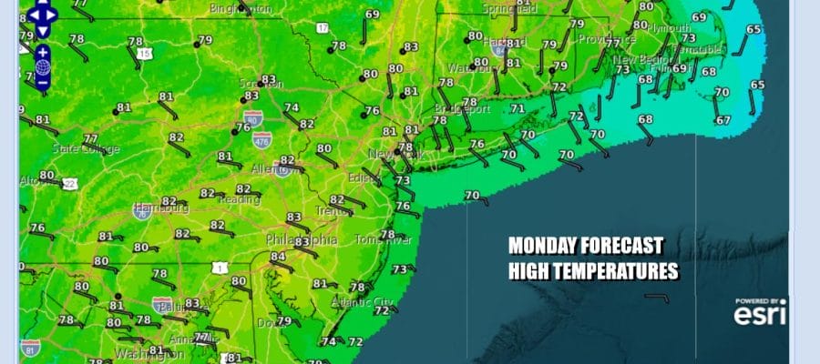
One More Nice Day Eastern PA to Southern New England

Potential Tropical Cyclone Off North Carolina Coast
One More Nice Day Eastern PA to Southern New England

The new week begins like the weekend finished. We have satellite pictures and loops showing not much in the way of clouds. We can also Potential Tropical Cyclone 8 which is sitting off the South Carolina coast. It doesn’t exactly look tropical as it is elongated in an east west fashion. At least for today we will see sunshine and just some wispy high clouds. The flow is on shore but the air is still mostly dry especially aloft so there will be no issues today. Highs will be mostly in the upper 70s to perhaps near 80 inland with quiet radars.
SATELLITE WITH LIGHTNING STRIKES

WEATHER RADAR

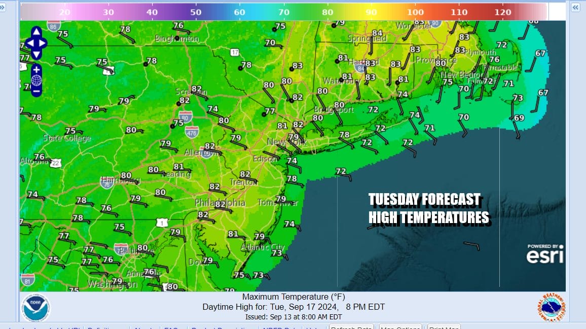
Potential Tropical Cyclone 8 could become a tropical storm later today but even if it does, it probably doesn’t have much time to strengthen before it moves inland into South Carolina or Southeast North Carolina. The high offshore will strengthen the onshore flow tonight and Tuesday so clouds will be rolling in. There could be some patchy fog overnight as well with most lows in the upper 50s to mid 60s.

If everything goes according to plan, the low moves inland and then heads north northwest into Western Virginia where it likely dissipates. However the rain shield might sneak up the coast and bring rain northward. The dayside Tuesday should be mainly cloudy with most highs in the 70s. Some rain or showers will move in from south to north Tuesday night and then exit from south to north during the day Wednesday.
Rainfall amounts don’t appear to be anything too problematic. In general it looks to be a half to three quarters of an inch. Lots of clouds will linger once any rain ends. Most highs Wednesday will be in the 70s. There is some disagreement as to what happens beyond Wednesday. Another strong high is forecast to build southward from Labrador and that could bring improving weather conditions at the end of the week and into the upcoming weekend but that is not a guarantee at this point. The onshore flow will remain in place all week long so it will depend on the strength of that high and how far south it builds. For now we will call it cloudy for Thursday and Friday with highs in the 70s. If we see the high being a stronger feature we may go more optimistic for the end of the week as far as sky conditions are concerned.
BE SURE TO DOWNLOAD THE FREE METEOROLOGIST JOE CIOFFI WEATHER APP &
ANGRY BEN’S FREE WEATHER APP “THE ANGRY WEATHERMAN!
MANY THANKS TO TROPICAL TIDBITS FOR THE USE OF MAPS
Please note that with regards to any severe weather, tropical storms, or hurricanes, should a storm be threatening, please consult your local National Weather Service office or your local government officials about what action you should be taking to protect life and property.
(Amazon is an affilate of Meteorologist Joe Cioffi & earns commissions on sales.)


