Parade of Cold Fronts Northwest Flow Keep Heat Humidity Away

Weather in 5/Joe & Joe Weather Show Latest Podcast
Parade of Cold Fronts Northwest Flow Keep Heat Humidity Away
An upper trough moved off the New England coast which kept us in cloud cover. Showers in Southern New England moved southeast offshore and are no longer an issue for eastern areas. Now we are seeing clouds slowly breaking apart this afternoon and most of the area should go partly sunny with temperatures in the 70s. The humidity is low and will remain low until further notice. No rain is in the forecast for the rest of today and tonight.
SATELLITE

We should have partially clear skies tonight with most lows in the mid 50s to lower 60s. Sunday should be a partly sunny day with cloud amounts varying from place to place. No showers are forecast even though a cold front will be approaching Sunday night. With that there could be a few showers overnight into early Monday morning. Sunday highs will be in the 70s to near 80 with 60s along the coast. Again there are no issues with humidity as it remains contained.
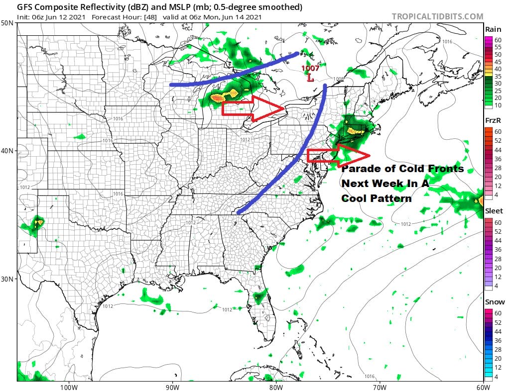
This week it is all about cold fronts as the upper air pattern is the complete opposite of last weekend and last week. We have a deep trough forming in the Eastern US and a strong ridge out to the west. The west ridge is in the Southern Rockies and Southwest where they will burn with heat while the trough is right along the East Coast which keeps it cool and mostly dry. In fact temperatures will be below average all the way to North Florida!

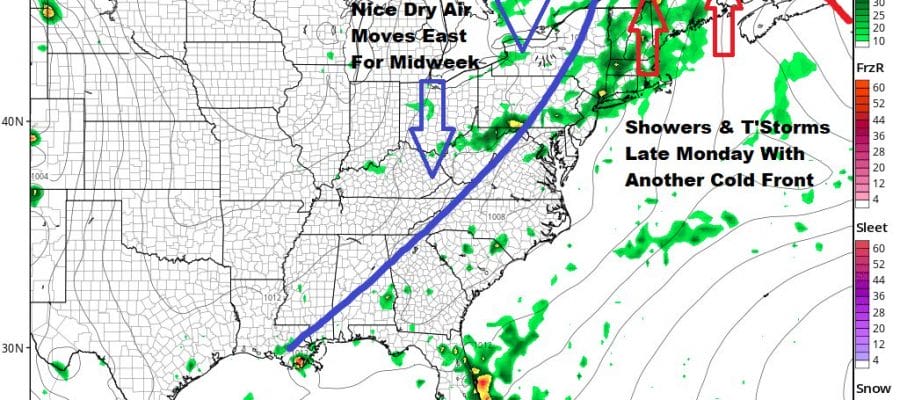
Another front arrives late Monday and we could see showers and thunderstorms in the afternoon and evening. Highs Monday will be in the upper 70s to lower 80s. For now it doesn’t look to be severe since the dew points are not all the high to begin with and there isn’t time for a solid southwest flow to set up.
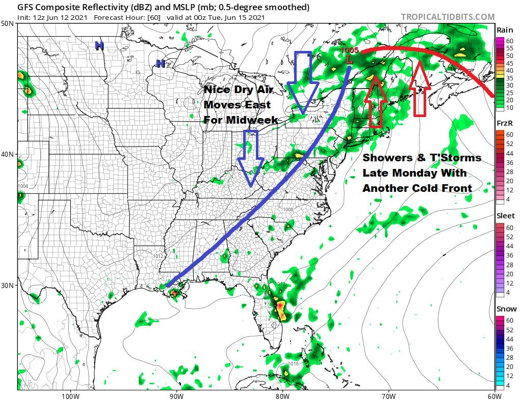
With the position of the trough along the coast the front will stall offshore. However it should be far enough out to the east to prevent issues here. This will leave us dry with a cool high building in for the middle of next week. Tuesday’s highs will be in the upper 70s and lower 80s and Wednesday and Thursday will be in the 70s. All three days will have very low humidity levels. The pattern looks to hold through Father’s Day weekend and perhaps even into the week that follows at least for the start.

BE SURE TO DOWNLOAD THE FREE METEOROLOGIST JOE CIOFFI WEATHER APP &
ANGRY BEN’S FREE WEATHER APP “THE ANGRY WEATHERMAN!
MANY THANKS TO TROPICAL TIDBITS FOR THE USE OF MAPS
Please note that with regards to any severe weather, tropical storms, or hurricanes, should a storm be threatening, please consult your local National Weather Service office or your local government officials about what action you should be taking to protect life and property.


