One More Nice Day Then Unsettled Weather Monday Through Wednesday

We have another nice day to look forward to with low humidity and we should start off with plenty of sunshine. However the next round of weather systems are lining up to impact our weather through the first half of this week. This will likely lead to some arriving clouds coming in from the west during the afternoon though it may take a while for those clouds to move from Eastern Pennsylvania. Temperatures Sunday will reach up into the lower 80s.

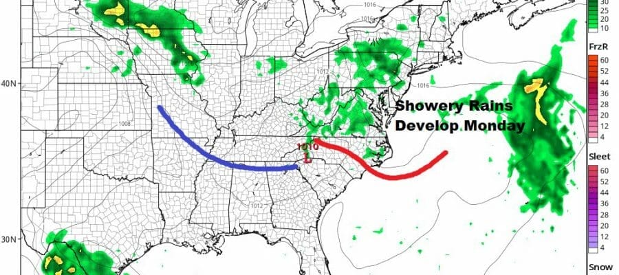
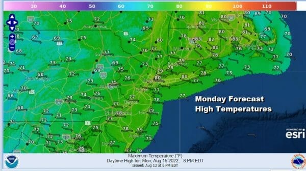
Monday begins the process of low pressure dropping from the Great Lakes into the Mid Atlantic states. The upper air storm responsible for all this is broad and that is making for a difficult forecast for the first half of the week. Energy will eventually be focused on a coastal low of some sort but there is still a large degree of uncertainty regarding development. For now we will forecast showery rains for Monday that will produce higher amounts west and south of the coast. Temperatures Monday will likely be in the 70s.
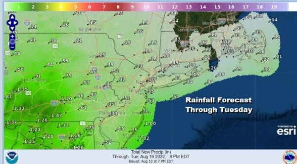
The risk for showery rains will continue into Tuesday and probably Wednesday as well though how much and where will depend on coastal low development. There remains a lot of uncertainty here and hopefully we will get a better handle on this Sunday. Tuesday highs will be in the 70s again.

For now rainfall amounts through Tuesday will be nothing extraordinary and for some areas quite light. It seems the heavier rains will be from South Central Pennsulvania southward into Virginia while rainfall across Eastern Pennsylvania to Southern New England will be light to miniscule.
We will leave showery rain chances in the forecast through Wednesday as the upper air low remains somewhere over the Northeast. Then we could see some improvement late in the week as this system finally starts to pull out to the northeast.
BE SURE TO DOWNLOAD THE FREE METEOROLOGIST JOE CIOFFI WEATHER APP &
ANGRY BEN’S FREE WEATHER APP “THE ANGRY WEATHERMAN!
MANY THANKS TO TROPICAL TIDBITS & F5 WEATHER FOR THE USE OF MAPS
Please note that with regards to any severe weather, tropical storms, or hurricanes, should a storm be threatening, please consult your local National Weather Service office or your local government officials about what action you should be taking to protect life and property.


