No Major Threats Spring Sunshine Continues
No Major Threats Spring Sunshine Continues
We are starting off the morning with mainly clear skies. The amount of patchy fog that is around this morning is minimal and will be gone shortly as we have a mostly sunny day ahead of us. Temperatures bottomed this morning in the 40s to low 50s and we should be heading to the upper 60s and lower 70s this afternoon. We have a weak onshore flow that is enough to keep temperatures near seasonal and not strong enough to envelop us in low clouds all day long.
US SATELLITE

REGIONAL RADAR

The satellite shows just a minimal amount of cloud cover this morning with clear skies just about everywhere else. Radars will be quiet though a few scattered showers may form in the mountains of Central & NE Pennsylvania but they should be weak and not amount to very much. Wednesday we play wash rinse repeat with some morning low clouds and fog possible along coastal areas followed by sunshine with highs into the 70s away from the ocean. Thursday is going to see the next cold front approach with clouds and sun and a south southwest wind ahead of it. That will mean 70s inland and 60s for most coastal areas with south facing shorelines. Thursday night could bring a few passing showers and then Friday it is back to some sunshine with highs reaching into the 70s.
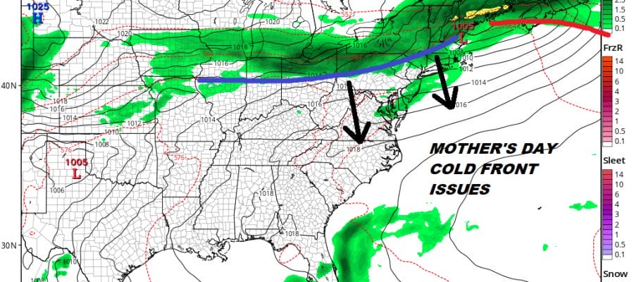
MOTHER’S DAY WEEKEND
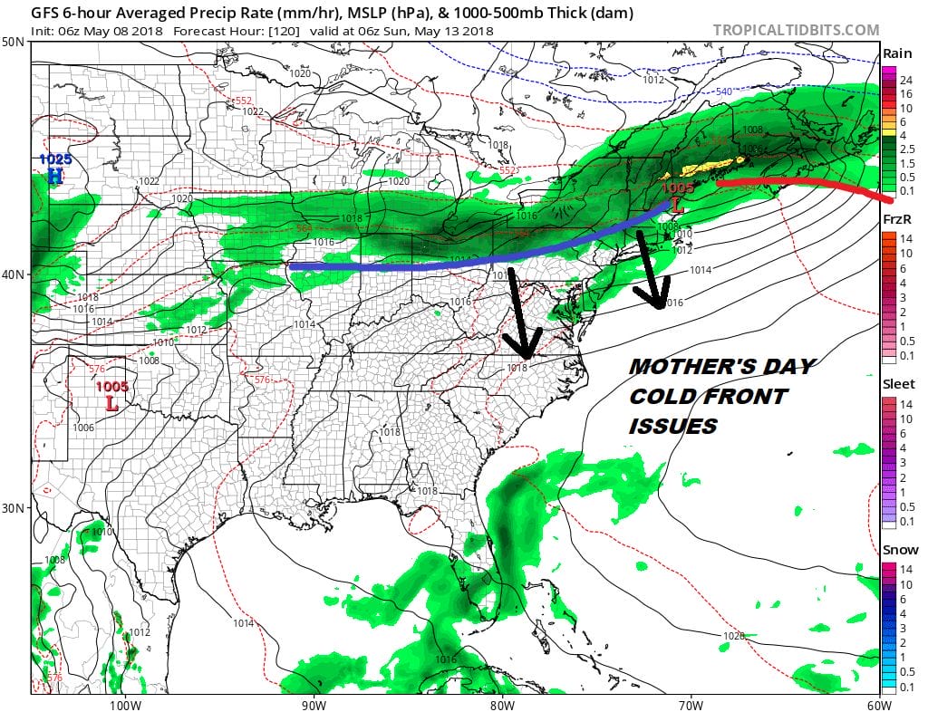
It is beginning to look like Saturday will be the better of the two weekend days and that a cold front will be coming through Sunday morning with showers just in time for Mother’s Day. Saturday could be rather warm with highs in the 70s to near 80 before the front passes. Sunday we may spend it clouds and in some morning showers at least before the front sags southward. If this is indeed the case Sunday could turn out much cooler than originally forecast and highs may only reach the 70s and in some areas not out of the 60s. How far south that front gets will be key and also whether it comes through and keeps on moving or does it stall for awhile with wave action and showers all day long? Those are key questions at this point.
 GET JOE A CIGAR IF YOU LIKE

FiOS1 News Weather Forecast For Long Island
FiOS1 News Weather Forecast For New Jersey
FiOS1 News Weather Forecast For Hudson Valley


