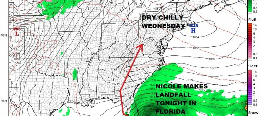
Nicole Nears South Florida Sunshine Chilly Wednesday
Rain Friday Into Saturday Morning
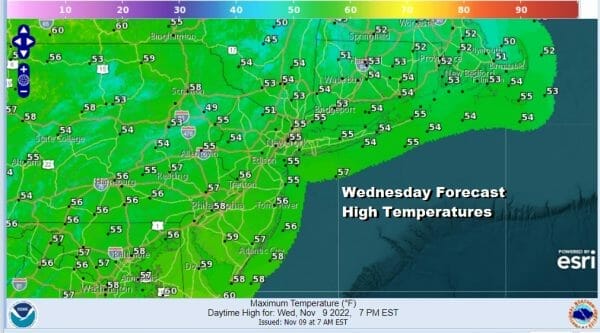
A strong high and a chilly air mass are sitting over the Eastern US today and that produces a day with lots of sunshine. We bottomed out in the 20s and 30s this morning but the core of the cool air mass is overhead so we should see temperatures bounce back this afternoon. Most highs will be in the low to mid 50s with some upper 50s in Southern Pennsylvania and Southern New Jersey. Coolest highs will be to the north and west of NYC and Philadelphia. Overall it is a nice autumn day. The radars are quiet and no rain is forecast until Friday.
SATELLITE

WEATHER RADAR

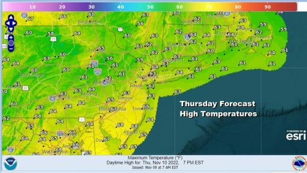
Tonight won’t be a chilly with inland lows in the 30s. Coastal and warmer urban locations will be in the 40s. Thursday we should be sunny for most of the day. Temperatures will be heading back into the 60s during the afternoon. Some high clouds could move in late in the day but it will not be an issue. No rain is forecast.
While our weather is calm, Tropical Storm Nicole could become a minimal hurricane today as it heads toward the Florida East Coast. First we have the storm moving through the Northwest Bahamas today and landfall in Florida will occur tonight probably around midnight or so. Nicole will not strengthen much before landfall and coming in as a category 1 hurricane is about as strong as this storm gets.
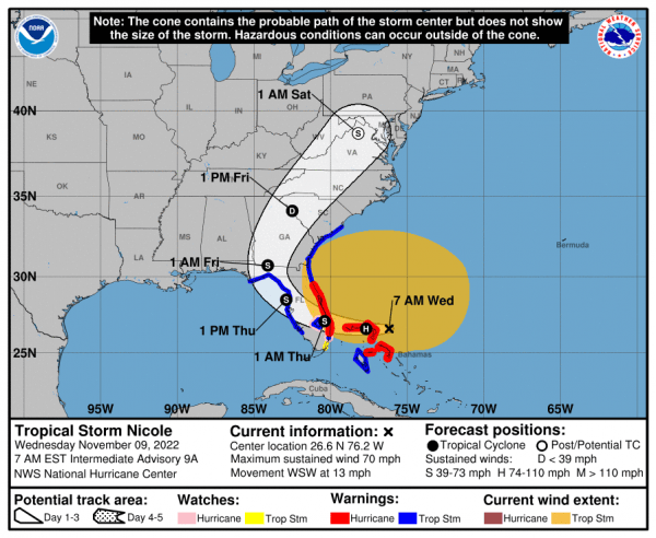
After landfall on the east coast of Florida, Nicole will move across the state and then emerge briefly off the west coast of Florida near Tampa and then back inland along the big bend of Florida. From there we will see a sharp turn to the north northeast and a track up along the Appalachians.
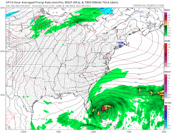
This track by the models and the National Hurricane Center forecast track would mean that the heaviest rains will be to the west and inland across Central Pennsylvania & western and northern NY. The good news is that it seems that Nicole will get absorbed by the cold front which lessens the possibility of many inches of rain. We still could wind up an inch or 2 of rain from this.
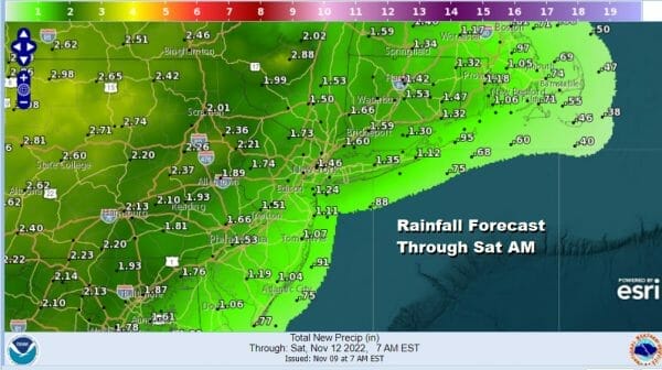
Friday will be a cloudy breezy day as south winds pick up. Rain will develop from south to north as the day wears on. Showery downpours and even a thunderstorm or two will continue into Friday night and then come to an end early Saturday morning. Friday highs will be in the mid 60 to near 70 degrees. Once the rain pulls out and the cold front passes we will see improving and colder weather conditions developing over the weekend and into next week. We will have leftover warm air around early on Saturday will be in the 60s. Then Sunday and Monday we will see some sunshine returning with highs both days just in the 40s.
BE SURE TO DOWNLOAD THE FREE METEOROLOGIST JOE CIOFFI WEATHER APP &
ANGRY BEN’S FREE WEATHER APP “THE ANGRY WEATHERMAN!
MANY THANKS TO TROPICAL TIDBITS & F5 WEATHER FOR THE USE OF MAPS
Please note that with regards to any severe weather, tropical storms, or hurricanes, should a storm be threatening, please consult your local National Weather Service office or your local government officials about what action you should be taking to protect life and property.


