
Nice Sunshine Friday Saturday Rain Late Sunday With Next Weather System

September is known for its spectacular sunny days with reasonable temperatuers and humidity and we have a Friday that fits the bill. Skies on the satellite don’t show much in the way of cloud cover. The radars are nice and quiet which is a good thing. Humidity levels are on the low side. Therefore it is a mostly sunny finish to the week with most highs today reaching around or just over the 80s degree mark, though a little cooler at the shore. Tonight should be nice and clear with lows in the mid 50s to lower 60s.
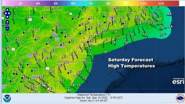
HIgh pressure will settle along the coast Saturday and that puts us in another day with lots of sunshine. Highs will be in the lower 80s with 70s at the beaches. Saturday night will be nice and clear to start but some clouds will arrive late and humidity levels with start to rise somewhat. Lows will be in the upper 50s to middle 60s.
Sunday leaves us in a bit of a tricky spot. While we enjoy nice weather here today and Saturday, moisture is shooting out of the Gulf of Mexico and into the Southeast US. At least initially, there will be some rain that will be riding northward along the Appalachians keeping it to our west through Saturday night. By Sunday the moisture stream will start to shift east but the question is how far east and when?
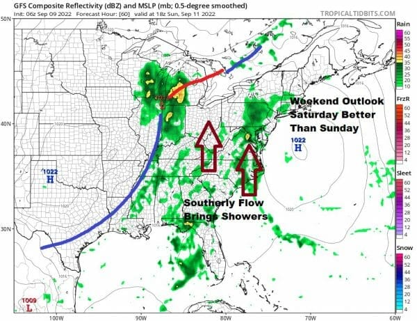
Saturday will be the better of the two weekend days. Sunday i think will start out partly sunny before clouds overwhelm. The GFS seems to want to rush some showers in by early afternoon. I’m going to hold back and go with the idea that showers will move into Eastern Pennsylvania and Western New Jersey in the early afternoon and reaching the coast by evening.
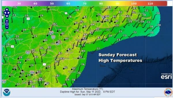
Temperatures Sunday will be in the upper 70s and lower 80s for highs. Showers will move through Sunday night and offshore. That leaves us Monday with clouds around, warm and humid conditions with the risk for a few showers or a downpour. Highs Monday will be in the upper 70s and lower 80s. The cold front will arrive with downpours and some thunderstorms Monday night into Tuesday.
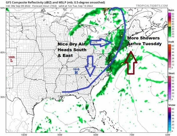
Once this front passes we will see the return of nice dry air with low humidity and a dry second half of next week. Rainfall amounts from the Sunday-Tuesday system could be on the order of 1/2 inch to 1 inch of rain spread over 3 days.
BE SURE TO DOWNLOAD THE FREE METEOROLOGIST JOE CIOFFI WEATHER APP &
ANGRY BEN’S FREE WEATHER APP “THE ANGRY WEATHERMAN!
MANY THANKS TO TROPICAL TIDBITS & F5 WEATHER FOR THE USE OF MAPS
Please note that with regards to any severe weather, tropical storms, or hurricanes, should a storm be threatening, please consult your local National Weather Service office or your local government officials about what action you should be taking to protect life and property.


