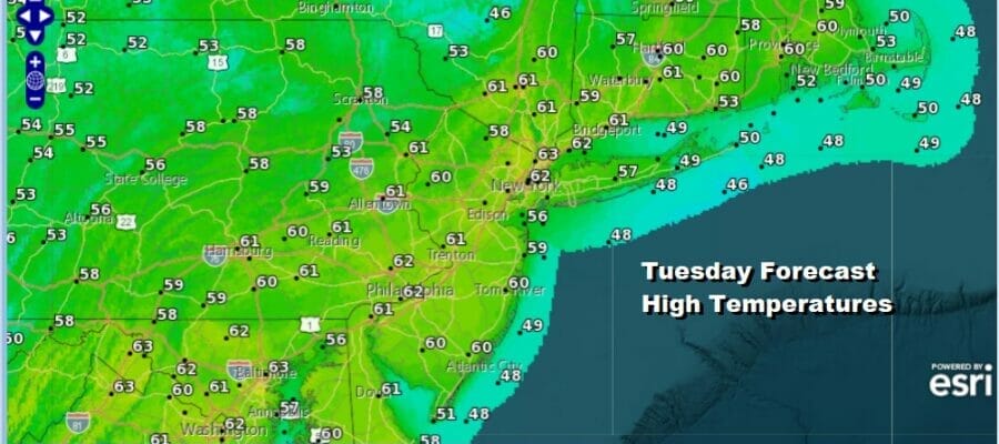
Nice First Full Day of Spring As Highs Reach the 60s Rain Late Week Into Saturday

It is the time of year where under the right conditions of a strengthening sun, and a west wind can come together to give you some temperature upsde and that is what we will likely see today. Most of the clouds on the satellite loop are passing well to the north in Upstate NY and Northern New England. Radars are not an issue in Eastern Pennsylvania to Southern New England and Long Island. Skies should be partly to mostly sunny and look for highs this afternoon to reach the low to mid 50s. The exception will be coastal areas and south facing shore lines where a sea breeze will likely develop and that will send temperatures back into the 50s or keep them in the low 50s at best.
SATELLITE

WEATHER RADAR

Temperatures tonight won’t be as cold as past nights with most lows in the mid 30s to lower 40s. Some passing clouds will mix with clear skies overnight. Wednesday should be an okay day though there will be a few clouds around along with some sunshine. Wind direction will be key to highs tomorrow as coastal areas will be in the 50s while the warm spots will reach lower 60s mostly inland.

Moving on to Thursday through Saturday, we have a cold front that will move through Thursday and that will produce clouds and the chance for a few showers. I don’t know if everyone see showers Thursday as some places could miss out. The front is going to pass and stall to the south across the Mid Atlantic and as low pressure comes out of the Lower Mississippit Valley, the front will buckle and start to move northward later Friday.
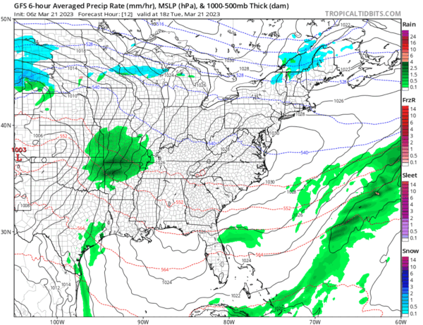
Thursday highs will be into the 60s. On and offshowers continue into Friday and then once the warm front starts to move northward we will likely see a cold raw rain overspread the area Friday night and last into a good chunk of Saturday. The warm front struggles and to the north of that boundary it will be an utterly miserable day with temperatures probably in the 40s and rain for most of Saturday. Weather conditions will improve Sunday which will be the better of the two weekend days for sure.
BE SURE TO DOWNLOAD THE FREE METEOROLOGIST JOE CIOFFI WEATHER APP &
ANGRY BEN’S FREE WEATHER APP “THE ANGRY WEATHERMAN!
MANY THANKS TO TROPICAL TIDBITS & F5 WEATHER FOR THE USE OF MAPS
Please note that with regards to any severe weather, tropical storms, or hurricanes, should a storm be threatening, please consult your local National Weather Service office or your local government officials about what action you should be taking to protect life and property.


