Much Cooler Air 60s Monday Heat Back Severe Weather Risk Wednesday

Weather in 5/Joe & Joe Weather Show Latest Podcast
Much Cooler Air 60s Monday Heat Back Severe Weather Risk Wednesday
The summer weather of the weekend (because that is what it was) with highs reaching into the 90s in some areas has come to an end. A cold front went through last night. Winds from the northwest are coming out of a cool high in Upstate NY.
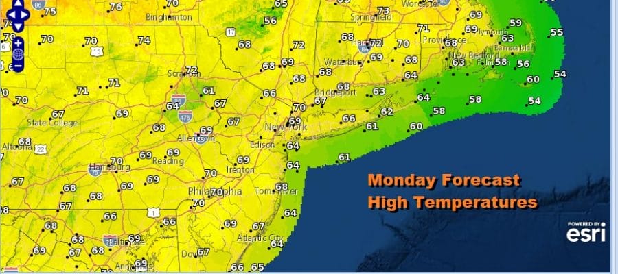
So here we are on a Monday with a forecast of partly sunny skies. The satellite picture this morning does show some patchy high clouds coming in from the west. This is because this cool shot goes in and out quick and the process of warming things back up actually starts later today. High pressure passes offshore and winds begin to turn to the west southwest. Temperatures today however will have a tough time making it back to 70 degrees which means we will be a noticeable 20 degrees cooler than yesterday! Areas across Southern Pennsylvania into Maryland and Northern Virginia are seeing clouds and some showers leftover from overnight and these showers will slowly diminish as the day wears on.
SATELLITE

The process continues on Tuesday and we will have to wait for a warm front to go by to our north. This puts us in a mix of clouds and some sunshine for Tuesday. Most highs will be in the 70s to near 80. Then we turn to Wednesday where it will be much like yesterday with a west wind and sunshine. This will take highs up to 90 and in some places as high as 94 or 95 degrees.
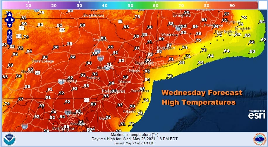
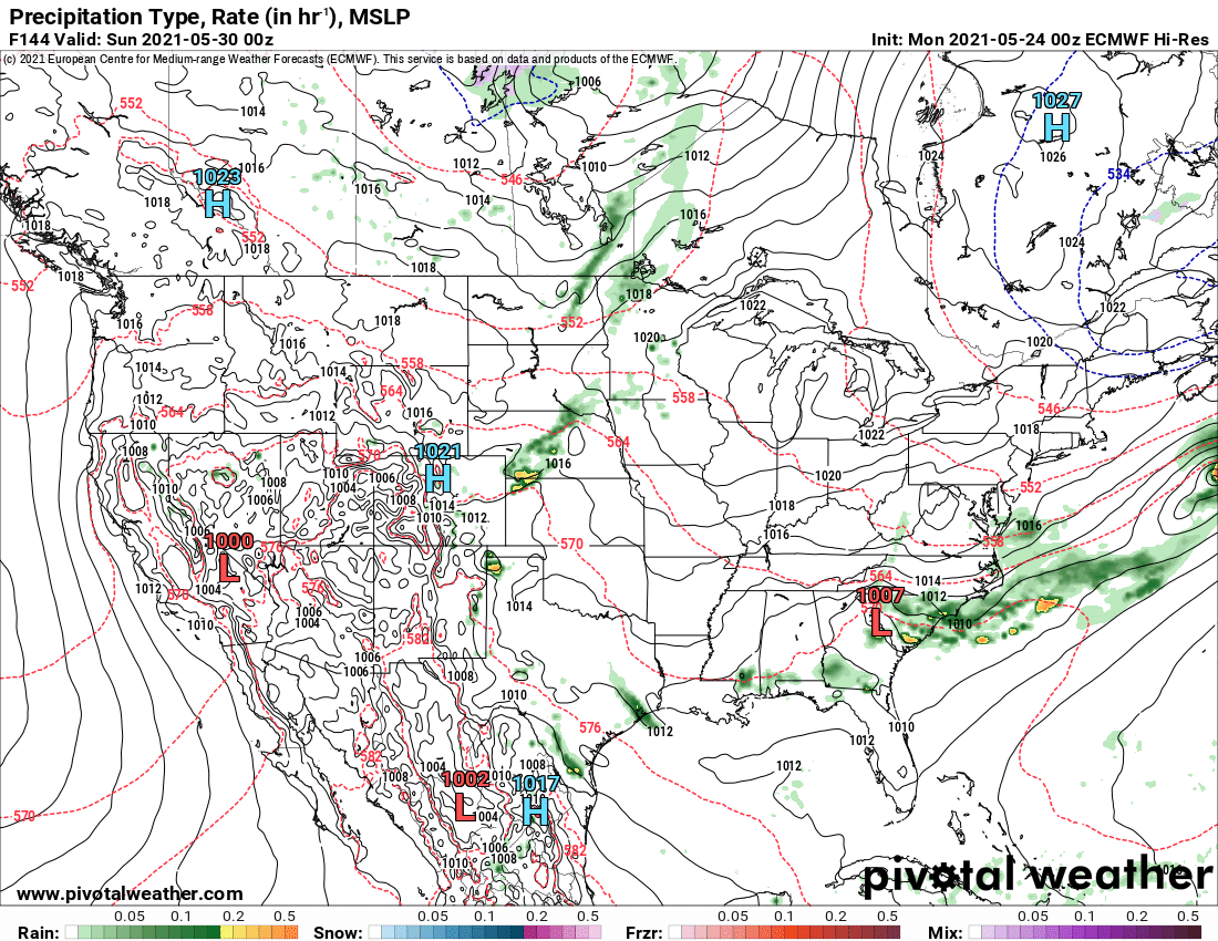
This will be another one day hit of heat as a cold front will be arriving Wednesday night and ahead of it late Wednesday into Wednesday evening we could see some scattered thunderstorms. This front is a little stronger than yesterday as it has a bit of upper level support and a trough moving southeast across the Northeast.
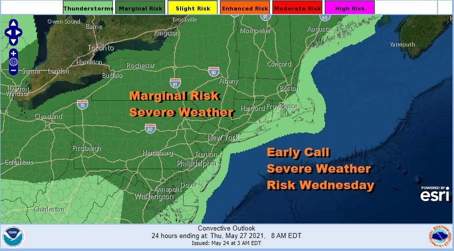
The Storm Prediction Center is showing a large area of marginal severe weather risk for Wednesday from Northern Virginia northeast to Northern New England. It still does not appear that we will see widespread activity but we should see more scattered thunderstorms Wednesday than what we saw Sunday.

Thursday sets up dry with some sunshine. Highs will be in the upper 70s and lower 80s. Slightly cooler air comes in behind the front but this is not a quick shot in and out. Low pressure is forecast to move across the Ohio Valley and then find its way off the Delaware coast. The problem going into this weekend is that everything in the atmosphere will be slowing down. We will see some rain develop from west to east Friday afternoon and it could last into Saturday morning. Temperatures Friday will settle into the 60s once the rain starts and then eventually into the 50s Friday night.
We are going to take the more optimistic view of the European model vs the GFS over the weekend. The GFS takes forever to get the trough in the east offshore and linger clouds and rain on and off into Sunday. The European seems to me to have the more logical solution of a trough swinging east and offshore Saturday suppressing the frontal boundary southward and getting rain out of the way. So at the moment we will be cautiously optimistic calling for leftover clouds giving way to some sun from north to south Saturday. Temperatures will be on the cool side with highs in the mid 60s to lower 70s (depending on how much sun). Sunday and Monday will see some sunshine. Highs will be in the mid 60s to low 70s Sunday and low to mid 70s on Monday. This again assumes that the pessimistic GFS model is wrong about lingering energy along the East Coast all weekend.

BE SURE TO DOWNLOAD THE FREE METEOROLOGIST JOE CIOFFI WEATHER APP &
ANGRY BEN’S FREE WEATHER APP “THE ANGRY WEATHERMAN!
MANY THANKS TO TROPICAL TIDBITS FOR THE USE OF MAPS
Please note that with regards to any severe weather, tropical storms, or hurricanes, should a storm be threatening, please consult your local National Weather Service office or your local government officials about what action you should be taking to protect life and property.


