Mostly Quiet Dry Week Ahead New Tropical Depression Forms Southeast of Bermuda
WEATHER IN 5 MONDAY OCTOBER 19, 2020
JOE & JOE WEATHER SHOW SUNDAY OCTOBER 18, 2020
A new week begins with sunshine and some clouds. In fact the forecast for every day this week is a mix of sun and clouds, or on some days, a mix of clouds and sun. We also have several cold fronts headed our way and each one is going to have a difficult time getting through. Showers are showing up well to the west in western NY and Western Pennsylvania. Those showers will probably stay west of the mountains in Pennsylvania and northwest of the Catskills. This leaves our area experiencing a decent day with highs reaching the middle to upper 60s.
SATELLITE

REGIONAL RADAR

Since we are not going to see a truly meaningful change in air masses this week, the nights will be on the mild side. Lows tonight will be in the 50s with clouds around. Some low clouds will likely develop along coastal areas during the early morning hours. Such will be the case every morning this week.
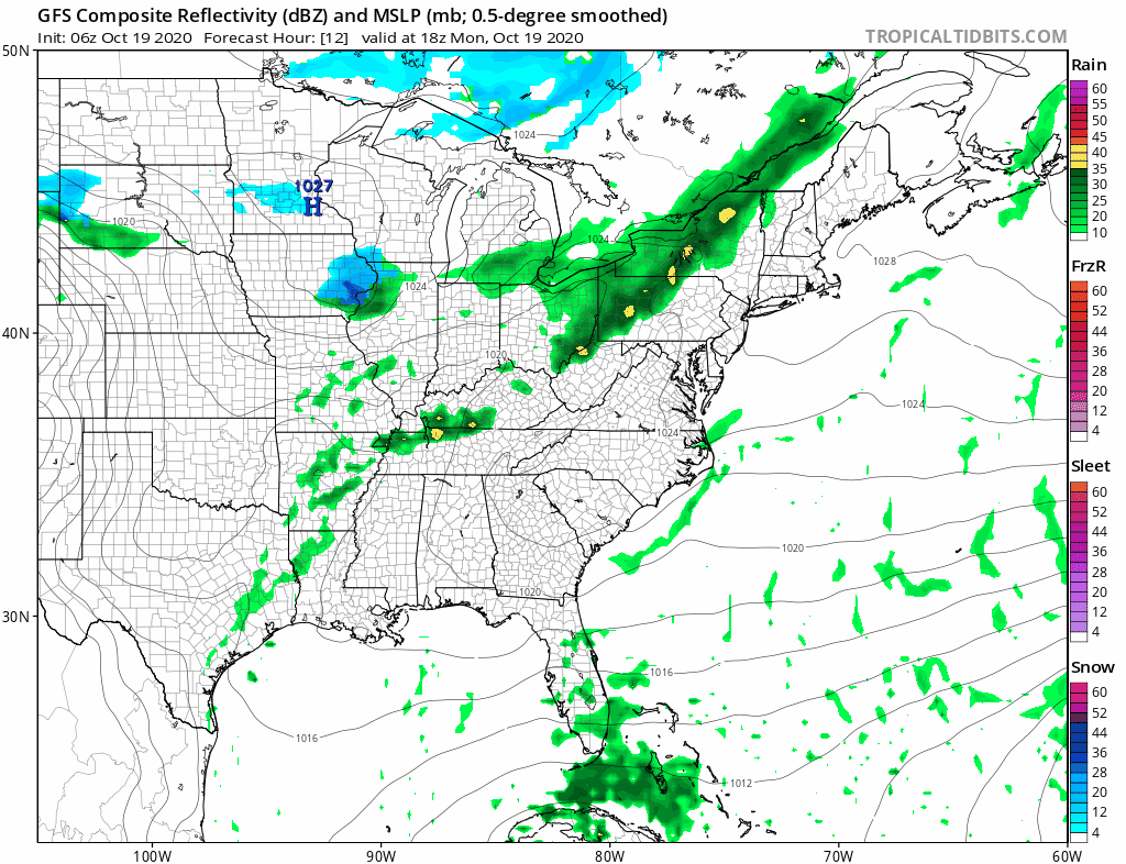
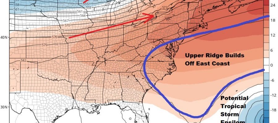
The frontal boundary to the northwest will essentially stay in position to the west all week long. Western Pennsylvania and Western NY to Northern New England will see rain from this in waves. Meanwhile well to the east is new Tropical Depression 27 which will become a tropical storm later today and likely a hurricane late this week. If you remember we saw weather models showing two systems with models developing the system in the Northwest Caribbean vs the one southeast of Bermuda. The outcome will be the reverse. In fact the development of the tropical system southeast of Bermuda has altered the upper air pattern along the East Coast.
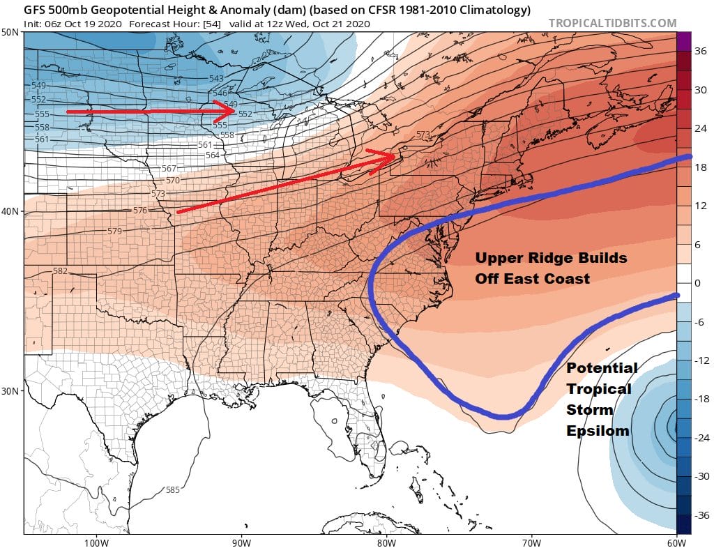
Last week we were seeing models showing deep troughs in the east but now with the ridge between potential Tropical Storm Epsilom and the upper air westerlies has kept the trough well to the northwest. Eventually the ridge will break down and this system probably heads for Bermuda late week and then turns north and northeastward. Meanwhile it is cruise control here probably through next weekend with some sun and some clouds each day. From Tuesday on highs will be mostly in the upper 60s to middle 70s. Nights will be in the 50s with low clouds and perhaps patchy fog develops in some areas. Im going to leave showers out of the forecast for the most part through next weekend.
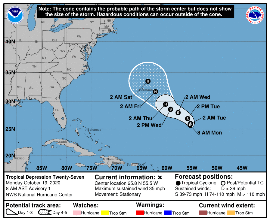
Tropical Depression 27 has formed from a non tropical low that has developed southeast of Bermuda. It continues to organize and we will likely have Tropical Storm Epsilon later today or tonight. This system is forecast to strengthen as it heads west northwest or northwest and it looks like Bermuda is in the crosshairs late this week.
We will be discussing this later today on my weather platform on Patreon as well as tonight on the Joe & Joe Weather Show. Also tonight at 9pm I will be hosting what will become a regular event on Zoom for Patreon members where we discuss any and all weather issues and address your questions. It should be fun so be sure to joing in the conversation tonight at 9pm
BE SURE TO DOWNLOAD THE FREE METEOROLOGIST JOE CIOFFI WEATHER APP &
ANGRY BEN’S FREE WEATHER APP “THE ANGRY WEATHERMAN!
MANY THANKS TO TROPICAL TIDBITS FOR THE USE OF MAPS
Please note that with regards to any severe weather, tropical storms, or hurricanes, should a storm be threatening, please consult your local National Weather Service office or your local government officials about what action you should be taking to protect life and property.


