
Mostly Calm Weather Settling Into the Eastern US Through Christmas

Mostly Calm Weather Settling Into the Eastern US Through Christmas
We are now behind one of the strongest storms to move up the East Coast in many years. The widespread nature of that storm, causing big issues from Florida to Maine is what stands out as well as the fact that no where was snow an issue. This is was all rain for everyone, and it was tons of rain for sure. The good news is that the atmosphere is usually spent after a major storm and we tend to go into a stretch of calm uneventful weather and that is exactly what is going to be happening between now and lasting right through Christmas.
SATELLITE WITH LIGHTNING STRIKES

WEATHER RADAR

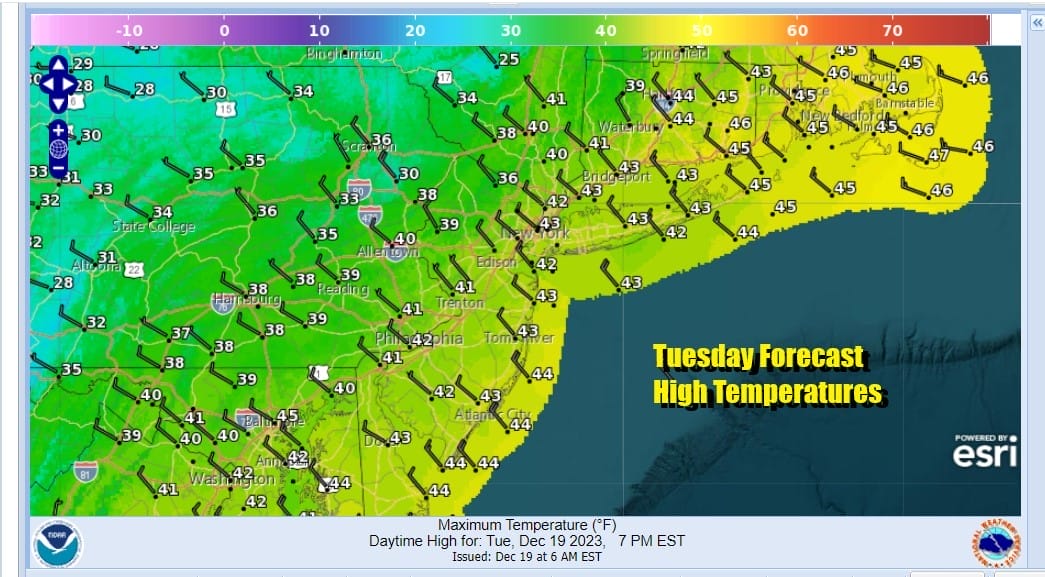
We do have chilly air covering much of the Eastern US today and there is an upper trough that is producing snow showers to the west and northwest in Pennsylvania and Upstate New York. Today will be a day of in and out sunshine with highs generally in the low to mid 40s. I’m going to throw in the chance for a rain or snow showers as this upper trough passes by.

Lows tonight will be mostly in the mid to upper 20s with skies generally going mostly clear. Not much is going to happen in the coming days with higher pressures along the coast and all the stormy action playing out in California as low pressure moves inland from the Pacific. Much of that moisture stays in the west all week so we will just move along with sunshine and temperatures that will either be close to or slightly above average.

Thursday and Friday we will see sunshine both days. Thursday highs will be in the low to mid 40s. Friday it will be a little colder as slightly colder air bleeds southward from Eastern Canada so highs will be in the upper 30s and lower 40s. High clouds from a warm front going by to our north will likely move in Friday night and Saturday holding temperatures down Saturday. Then Sunday Christmas Eve looks to be a partly sunny nice day with highs in the mid to upper 40s and the same holds I think for Christmas Day. There will be no major storms around at the end of the week which will help those of you travelling for the Christmas holiday.
BE SURE TO DOWNLOAD THE FREE METEOROLOGIST JOE CIOFFI WEATHER APP &
ANGRY BEN’S FREE WEATHER APP “THE ANGRY WEATHERMAN!
MANY THANKS TO TROPICAL TIDBITS FOR THE USE OF MAPS
Please note that with regards to any severe weather, tropical storms, or hurricanes, should a storm be threatening, please consult your local National Weather Service office or your local government officials about what action you should be taking to protect life and property.
(Amazon is an affilate of Meteorologist Joe Cioffi & earns commissions on sales.)


