
More Gloom & Doom Oover the Weekend
Chance For Snow Well Inland Sunday Night into Monday

More Gloom & Doom Oover the Weekend
Chance For Snow Well Inland Sunday Night into Monday
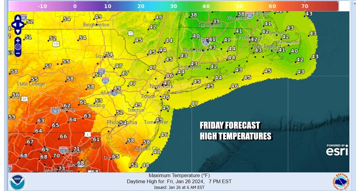
Overnight rain continues to shift northward into Central and Northern New England and today’s dilemma is a weather front that cuts New Jersey in half. To the south from Southern Pennsylvania and Southern New Jersey southward, we will see clouds with some breaks of sunshine with highs reaching the 60s. To the north from Northern New Jeresey to Southern New England on the other side of the frontal boundary, temperatures will be in the upper 40s to mid 50s with lots of clouds and even some patchy fog. It is a continuation of the gloom and doom pattern that will take us through the weekend with only a minor break Saturday. Tonight most areas will be cloudy with patchy fog. Lows will be in the 30s to near 40.
SATELLITE WITH LIGHTNING STRIKES

WEATHER RADAR

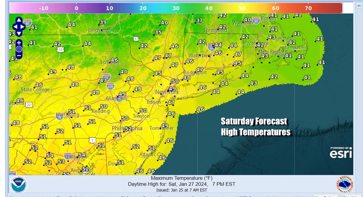
Saturday will be the better of the two weekend days and at least during the dayside, we will not see rain but rather we will have mostly cloudy skies. There will probably be some breaks of sunshine in the mix. Temperatures on Saturday will be in the upper 40s to lower 50s area wide. All of this is ahead of the next storm system for later Saturday night into Sunday night.
Across the south it has been a very wet week from East and South Texas to the Southeast US. Rainfall amounts in some places have exceeded 6 inches. One last low pressure system will be moving across the South Saturday intn Saturday night and that low will then turn northeast up the Appalachaians during the day Sunday. The will then redevelop off the coast of Delaware/New Jersey Sunday night into Monday morning.
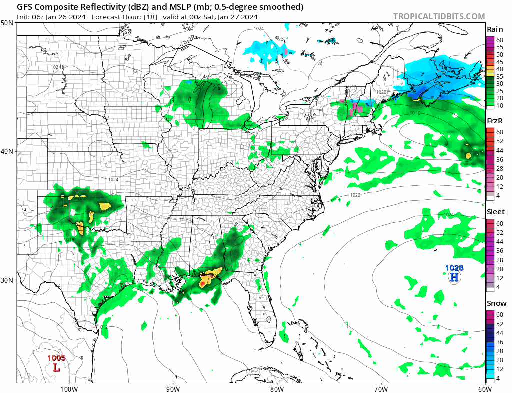
Rain will spread northward across the Mid Atlantic states and then spread over Eastern Pennsylvania to Southern New England during the early morning hours Sunday. We have walked down this path before with storms that have taken tracks like this and once again this will be a mostly rain event along the coast. There could be a change to snow before it ends early Monday morning but we expect no accumulation of consequence.

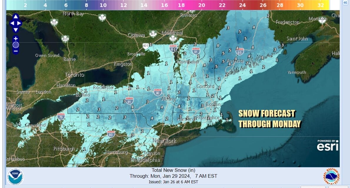
There will be snow with this sytem but it will fall mostly in elevated areas from Northeast Pennsylvania to the Middle Hudson Valley and then from Northern Connecticut northward. That is where the probability of at least 2 inches will be 50 percent or higher. We might see a coating to an inch, and mainly on colder surfaces perhaps extend as far south as Northwest New Jersey and in areas north of Route 287 and Route 15 in Connecticut.
The storm system will move away early Monday as low pressure exits to the east. We will finally see this wet gloomy pattern break next week with sunshine and temperatures close to where they should be for this time of year. We may go most of next week without much in the way of rain or snow.
BE SURE TO DOWNLOAD THE FREE METEOROLOGIST JOE CIOFFI WEATHER APP &
ANGRY BEN’S FREE WEATHER APP “THE ANGRY WEATHERMAN!
MANY THANKS TO TROPICAL TIDBITS FOR THE USE OF MAPS
Please note that with regards to any severe weather, tropical storms, or hurricanes, should a storm be threatening, please consult your local National Weather Service office or your local government officials about what action you should be taking to protect life and property.
(Amazon is an affilate of Meteorologist Joe Cioffi & earns commissions on sales.)


