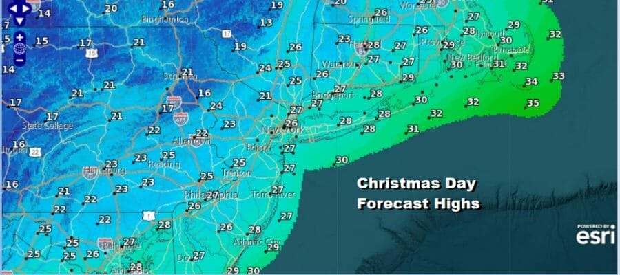
Merry Christmas On A Cold Christmas Day Moderation Begins Monday

A wonderful and joyus Merry Christmas to all. The cold air mass brought down by the major winter storm that impacted a large portion of the US is settling overhead today. After a very cold start this morning we will see sunshine. The wind will be lower than the last couple of days as it continues to slowly ease. As for temperatures which bottomed in the teens and single digits this morning will head into the 20s this afternoon just about everywhere. There are no weather issues to worry about as the radars are quiet locally though they still remain active around Lake Erie and Lake Ontario. The lake effect snow event continues today in Western and North Central NY.
SATELLITE

WEATHER RADAR

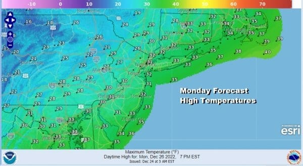
Another cold night lies ahead with clears skies and less wind. Lows by morning again will be in the teens and single digits. Monday we will see sunshine and temperatures may actually make a run for the freezing mark. Most highs will reach the lower 30s.
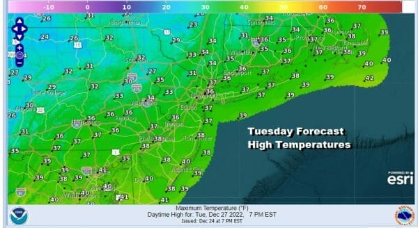
The slow moderating trend continues all week. A major storm of this magnitude has basically sucked all the energy out of the atmosphere and that leads to a period of calm weather with not much to worry about for the rest of this week. Tuesday highs will be a little higher as the slow uptrend continues. Highs will be in the lmid to upper 30s.
The warming trend continues Wednesday with some sunshine and highs reaching the lower 40s. Thursday and Friday we will higher still with middle to upper 40s Thursday and Upper 40s and lower 50s Friday. Both days will be dry with some sun. It will feel like summer compared to the last few days.
There really isn’t much in the way of cold air around. It seems that the arctic dump came down in one big push and now the atmosphere is in relax and rebuiding mode. For now any cold air is in the Western US. Here in the east the low heads to the Great Lakes with a cold front coming next week in time for New Years. It looks like we could see some showers Satuday night into Sunday New Years Day. Highs Saturday will be in the 50s to near 60 while Sunday highs will be in the 50s.
BE SURE TO DOWNLOAD THE FREE METEOROLOGIST JOE CIOFFI WEATHER APP &
ANGRY BEN’S FREE WEATHER APP “THE ANGRY WEATHERMAN!
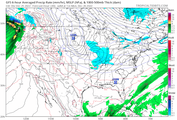
MANY THANKS TO TROPICAL TIDBITS & F5 WEATHER FOR THE USE OF MAPS
Please note that with regards to any severe weather, tropical storms, or hurricanes, should a storm be threatening, please consult your local National Weather Service office or your local government officials about what action you should be taking to protect life and property.


