Major Storm Strong Winds Heavy Rain Late Sunday to Early Monday

Major Storm Strong Winds Heavy Rain Late Sunday to Early Monday
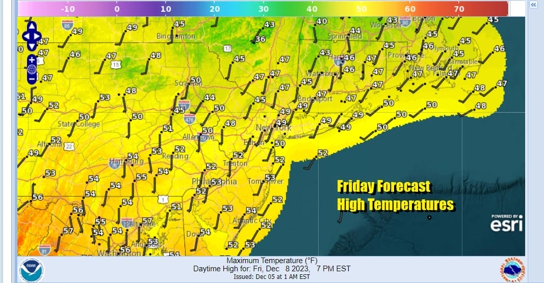
We are setting the table for a major storm to develop as a powerful cold front heads east and a wave of low pressure develops on the front and intensifies as it heads northward into New England. First off though the core of the recent shot of cold air is now gone out to the southeast as high pressure moves offshore and that leaves us with a nice Friday of sunshine and warmer temperatures. Winds are turning southwest and high temperatures this afternoon will be in the upper 40s and lower 50s. Other than some passing clouds there are no issues and the radars are nice and quiet.
SATELLITE WITH LIGHTNING STRIKES

WEATHER RADAR

The warm up continues into the weekend with lows tonight from the 20s in cold spots to low 40s in warmer urban settings. Saturday will be a nice warm day with sunshine and nothing more than some occasional high clouds ahead of the Sunday system Saturday highs will be in the mid to upper 50s just about everywhere.

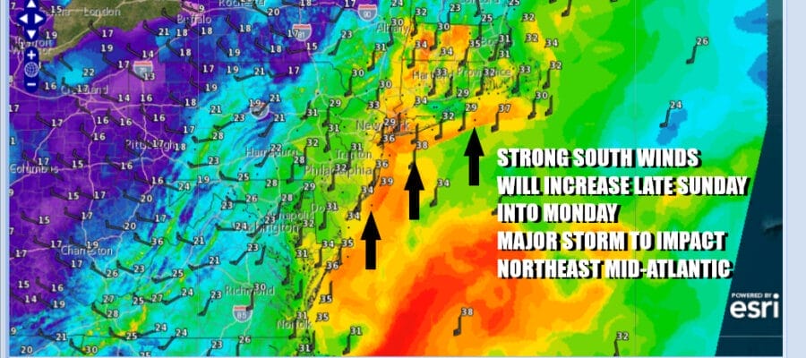
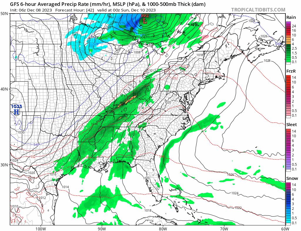
Now let’s move to Sunday where weather conditions will deteriorate. Low pressure in the Southern Plains Saturdayis heading for the Great Lakes. That wave isn’t going to do very much other than push the front further east. Strong inflow from the Gulf of Mexico and the Atlantic will create a moisture surge ahead of the cold front. Another wave will develop on that front Sunday in the Central Appalachians and move northeast.
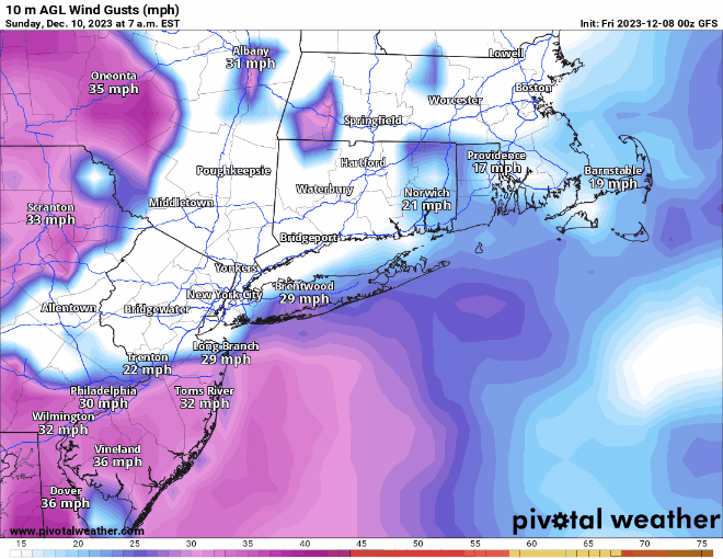
Winds will begin increasing Sunday and by late Sunday afternoon we will see gusts in the 30 to 40 mph range. Then they will increase further. The worst of this wind wise will be between 10pm Sunday and 5am Monday (roughly) where we could see wind gusts of 50 to 60 mph especially along the coast. Gusts inland will generally be in the 30 to 40 mph with some odd gusts higher.
Also we will be dealing with heavy rains of 2 inches or more that will also fall in a very short period of time. The heaviest rains will be overnight Sunday into Monday morning. Also for some in the eastern half of Pennsylvania (except the southeast) northeast through the Poconos and Catskills and points northward there will be a change ot snow and a brief burst of heavy snow could certainly lead to a few inches of accumulation if not more the further north you go.

As far as coastal flooding is concerned for Sunday, tides may run high, and there could be some coastal flooding at high tide in some vulnerable areas however since this system is moving through quickly we suspect that at this time minor to perhaps some isolated areas of moderate coastal flooding is indicated. Temperatures Sunday will rise into the 60s. Rain will end Monday morning as winds shift to the northwest and become strong and gusty in the 30 to 40 mph but off the highs reached overnight. Look for clouds giving way to some sun from west to east in the afternoon with temperatures settling in the low to mid 40s. After this system is done the rest of next week looks to be dry and quiet.
BE SURE TO DOWNLOAD THE FREE METEOROLOGIST JOE CIOFFI WEATHER APP &
ANGRY BEN’S FREE WEATHER APP “THE ANGRY WEATHERMAN!
MANY THANKS TO TROPICAL TIDBITS FOR THE USE OF MAPS
Please note that with regards to any severe weather, tropical storms, or hurricanes, should a storm be threatening, please consult your local National Weather Service office or your local government officials about what action you should be taking to protect life and property.
(Amazon is an affilate of Meteorologist Joe Cioffi & earns commissions on sales.)


