MAJOR EAST COAST STORM
High Wind Warning Coastal Areas, Flood Watch Inland
Delaware, New Jersey, NYC, Hudson Valley

MAJOR EAST COAST STORM
High Wind Warning Coastal Areas, Flood Watch Inland
Delaware, New Jersey, NYC, Hudson Valley
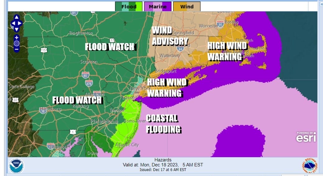
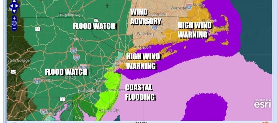
We have a slew of warnings, watches and advisories ahead of this major storm that is moving up the East Coast. High wind warnings are up for parts of New York City & all of Long Island, Southern Westchester, Coastal Connecticut to Rhode Island and Southeastern New England. Coastal flood watches and warnings for minor to moderate coastal flooding at high tide for the New Jersey coast as well as Long Island. Flood Watches are up for New Jersey, Pennsylvania, the Catskills and the Hudson Valley for heavy rain that could cause localized flooding.

No doubt we have a busy weather day ahead as weather conditions deteriorate. Low pressure is moving up the East Coast straddling the Carolinas and it will continue to move northward from there, straddling the Delaware and New Jersey coasts tonight before making its way across Long Island and into New England. Rain develops from south to north late this afternoon and as shown by the HRRR model above, it becomes heavy overnight into Monday morning.
SATELLITE WITH LIGHTNING STRIKES

WEATHER RADAR

You will be able to follow the progress of the low and the developing ran on the satellites and radars above. During the late afternoon and evening winds along the coast will increase and east of the low center track, winds will be stronger. The strongest winds will occur between 10pm tonight and 8am Sunday with peak winds probably in the 3am to 6am range. Coastal areas under High Wind Warnings can expect gusts to 50 mph or higher.
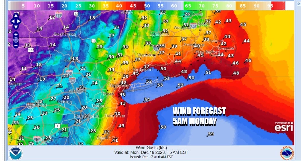
During Monday as the storm center moves northward up the Hudson Valley we will see winds decrease. Also do note that wind gusts in Western New Jersey and Eastern Pennsylvania are much lower than what you see on the coast so the further inland you are, the less impact fromt wind. However in the Lower Hudson Valley eastward through much of Southern and Souteastern New England, gusts will be up close to 40 mph.
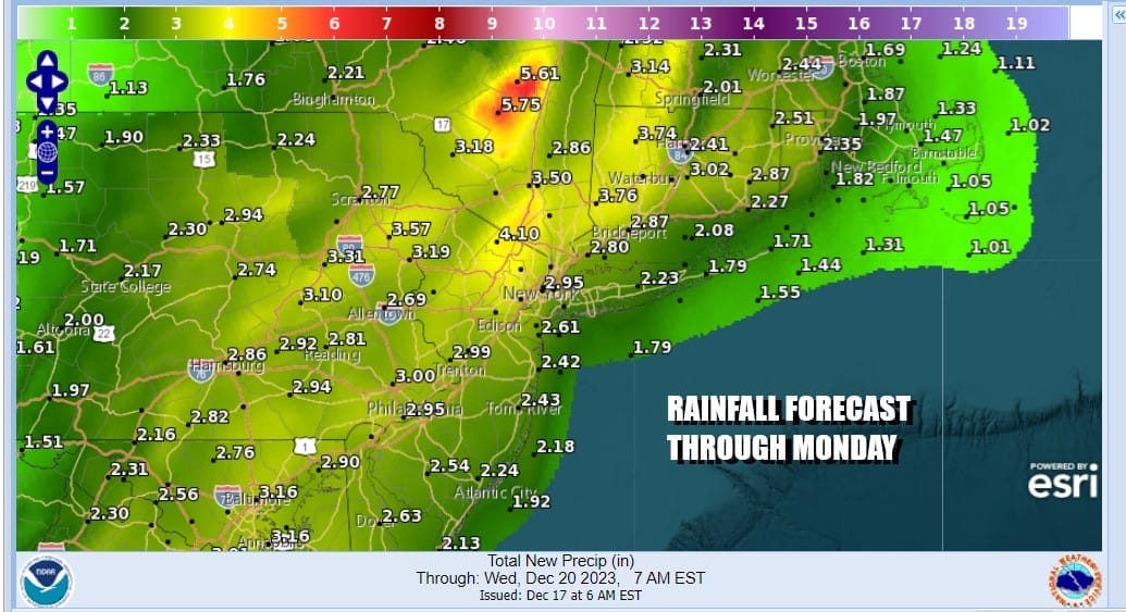
Rainfall amounts of 2 to 3 inches will be quite common with some isolated higher amounts.Rain will taper off from south to north during the afternoon and we will see it turn colder an drier Monday night and Tuesday. Obviously snow is not an issue anywhere in the Northeast with this storm because there is no cold air around. Tuesday might bring some scattered snow showers with clouds and some sunshine. As for temperatures today and Monday we will be in the 50s and then colder lower to middle 40s Tuesday.
BE SURE TO DOWNLOAD THE FREE METEOROLOGIST JOE CIOFFI WEATHER APP &
ANGRY BEN’S FREE WEATHER APP “THE ANGRY WEATHERMAN!
MANY THANKS TO TROPICAL TIDBITS FOR THE USE OF MAPS
Please note that with regards to any severe weather, tropical storms, or hurricanes, should a storm be threatening, please consult your local National Weather Service office or your local government officials about what action you should be taking to protect life and property.
(Amazon is an affilate of Meteorologist Joe Cioffi & earns commissions on sales.)


