Light Snow Tonight As Storm Exits Better Weather Next 2 Days

Weather in 5/Joe & Joe Weather Show Latest Podcast
Light Snow Tonight As Storm Exits Better Weather Next 2 Days
Usually we see weather conditions improve relatively quickly behind a storm system but this one is moving at a snails pace. The surface low was in virtually the same spot it was in at this time yesterday. The upper air storm system and trough is sitting right over the East Coast and we are simply waiting for this storm to make its exit.
SATELLITE

There have been bands of light snow over New Jersey and points southward and it looks like on the radar that some echoes are forming over NYC and points east this evening. This should finally slide out later tonight and the precipitation could produce a coating to some odd spots maybe getting upwards of an inch. Otherwise this is nothing but a nuisance and a non event for us. Lows by morning will be in the mid 20s to near 30.


Wednesday the storm will be sitting over Nova Scotia and strengthening and that will leave us in clouds and some sunshine. There will be a gusty wind and temperatures Wednesday will be in the 30s. Thursday we should see sunshine and less wind as high pressure moves overhead. Highs will be in the 30s to near 40 degrees.
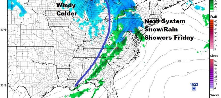
The next system is a cold front on Friday which is rushing rapidly eastward. A strong storm is forming over the Great Lakes. Usually this would be a straight forward rain shower forecast however the deep snow cover Thursday night could cool the boundary layer by a few degrees. I wouldn’t be surprised to see a burst of snow as the precipitation arrives Friday morning. It might even leave a quick coating to an inch or so in some places. Otherwise this plays through and it turns colder over the weekend.

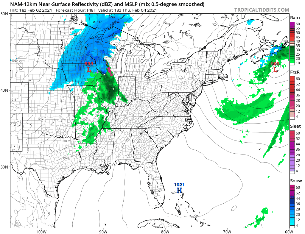
Saturday will be a breezy cold day as cold high pressure starts to build in from Central and Western Canada. The southern part of Friday’s front stalls out in the Gulf of Mexico and we see a wave developing on this front and heading northeast. The late day GFS is more robust with this low and even though it takes it south and east of us, it could be overwhelming the East with cold dry air too quickly. The European leaves more room for this and in fact it brings it up the coast for the 4th run in a row. We continue to monitor. This is by no means a slam dunk here but the signs are there from the changes in the overall pattern that this low could be closer to the coast than advertised.
BE SURE TO DOWNLOAD THE FREE METEOROLOGIST JOE CIOFFI WEATHER APP &
ANGRY BEN’S FREE WEATHER APP “THE ANGRY WEATHERMAN!
MANY THANKS TO TROPICAL TIDBITS & F5WEATHER FOR THE USE OF MAPS
Please note that with regards to any severe weather, tropical storms, or hurricanes, should a storm be threatening, please consult your local National Weather Service office or your local government officials about what action you should be taking to protect life and property.


