DOWNLOAD MY NEW FREE JOESTRADAMUS WEATHER APP FOR ALL DEVICES
Light Rain Drizzle Showers Today Slow Improvement Next Several Days
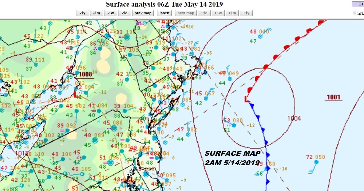
At least it isn’t pouring rain this morning but we are still under the influence of low pressure to the southeast which is keeping us in a northeast flow of moist air. There isn’t much showing up on the radar this morning but it is cloudy and it will likely remain overcast all day long. With the low in this position it is going to be very hard to bring any amount of dry air in to allow some sun to break through. At least with the lack of rainfall this morning into this afternoon (other than some drizzle) we should see temperatures rise from the 40s and at least nudge up into the 50s.
SATELLITE

REGIONAL RADAR

All the steady rain (and in the colder air snow) has moved up into Northern New England and Upstate NY however we still have to deal with the upper air trough that has yet to move through. There is one disturbance that will be dropping southeastward later today and this could trigger off some showers later this afternoon into this evening. Keep an eye on the local radars for this.
LOCAL RADAR NEW YORK CITY

LOCAL RADAR PHILADELPHIA


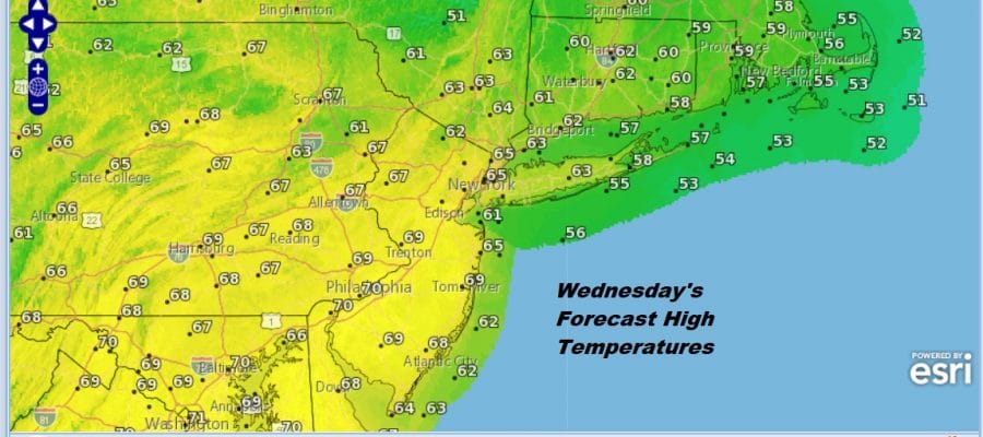
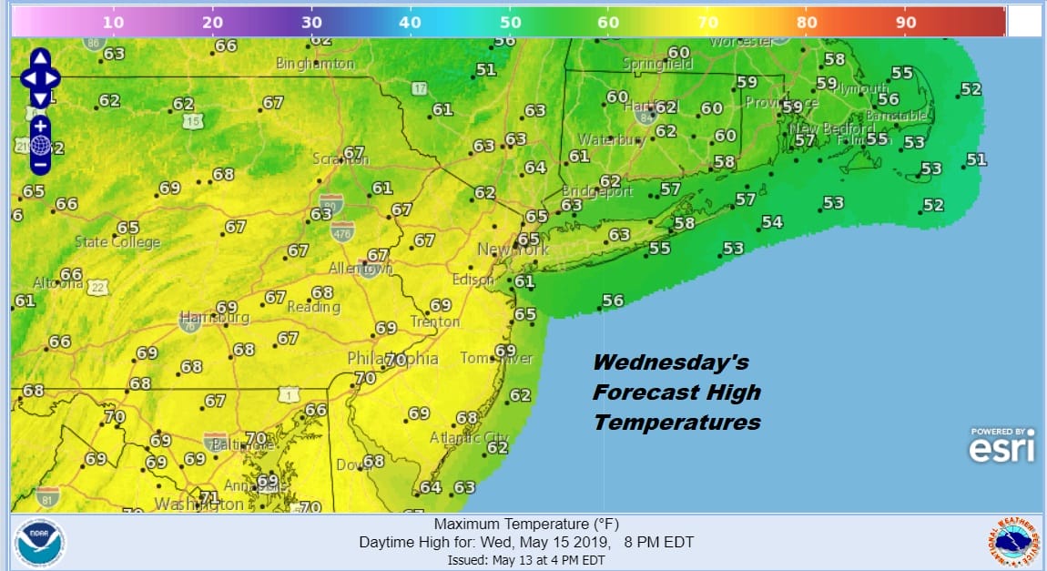
Once that arm plays through this evening we should see some general improvement tonight as skies clear. It will still be rather cold for this time of year with lows in the upper 30s to mid 40s. However we should see some sunshine on Wednesday and that should send temperatures up into the 60s.
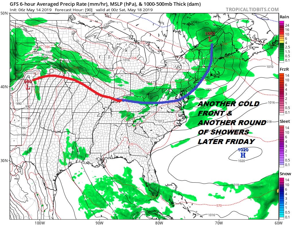
Wednesday night into Thursday morning another upper air disturbance means another round of showers possible overnight though this system does appear weak. Clouds will give way to some sun Thursday with highs in the 60s. Then we have another front approaching on Friday with clouds and the chance for showers.
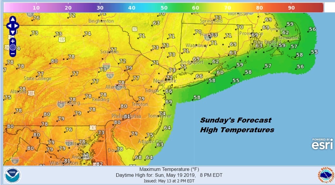
As far as the weekend goes, I wanted to be cautious about the advertised warmup on the models and it seems that they may have been a bit over zealous. The front passes through and at least this one doesn’t stall out anywhere close. It should mean for a nice Saturday of sunshine with highs reaching into the 70s. That low to the west should hold off bringing any showers close until Monday so that Sunday will be nice with some sunshine and highs reaching the 70s to perhaps near 80 in Southern Pennsylvania and Southern New Jersey.
Hopefully this will all work out without any last minute short range complications. Yesterday’s high in NYC Central Park was 48 degrees which was the lowest “high” temperature on record. It was also 22 degrees below the average high of 70 degrees which for this time of year is a rather huge departure from normal. So far for the month May is running 2 degrees below average. Let us at least try to see if we can get it up to the normal high sometime later this week.
MANY THANKS TO TROPICAL TIDBITS FOR THE USE OF MAPS
Please note that with regards to any tropical storms or hurricanes, should a storm be threatening, please consult your local National Weather Service office or your local government officials about what action you should be taking to protect life and property.


