Improving Weather Today But Sunshine Self Destructs Monday & Tuesday,
Rain Late Week into Weekend

Improving Weather Today But Sunshine Self Destructs Monday & Tuesday,
Rain Late Week into Weekend
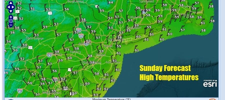
Our storm system from Saturday and overnight has moved to the east and it is beginning to pull away offshore. As winds have turned northerly they will will increase some today. Dry air is heading southward behind the storm system and this should lead to decreasing clouds and increasing amounts of sunshine for this afternoon. As for temperatures today they will be mostly in the 50s for highs’
Satellite loops show a large upper trough from Atlantic Canada extends southwestward to the Lower Mississippi Valley and this will create issues for the next couple of days. Much like last week when we had to deal with a stubborn upper low in Eastern Canada, this trough will be hanging around for a couple of days this week.
SATELLITE WITH LIGHTNING STRIKES

WEATHER RADAR

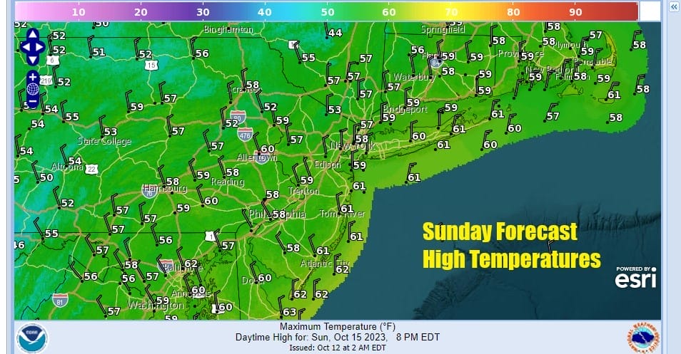
This situation puts us in a place where days start off with sunshine and then rather quickly go to mostly cloudy skies. There is always the odd chance for a few scattered instability showers to develop and we will cover for that possibility Monday and Tuesday. Both days highs will likely not get much out of the 50s.
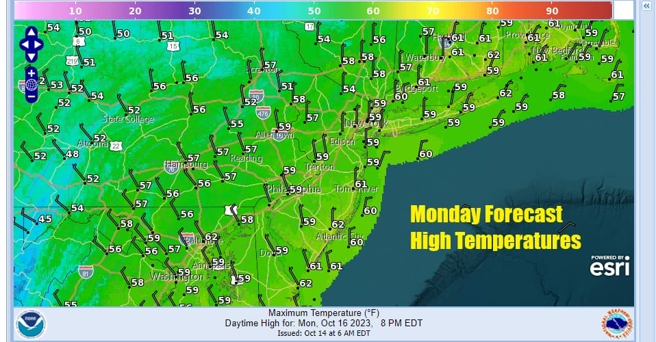

The upper trough by Wednesday will start to pull out and that means that we should see a more stable atmosphere and more in the way of sunshine for both Wednesday and Thursday. This should allow temperatures to nudge higher and we see highs reaching the low to even a few middle 60s for both Wednesday and Thursday.

Friday brings sunshine and arriving clouds as a cold front approaches from the Great Lakes and Ohio Valley and a wave develops on that front in the Southeast US and races northward. All this energy piling on in the Eastern US will likely bring rain and maybe even a thunderstorm or two Friday night into at least part of Saturday. Naturally it has to rain on a weekend day as this would be the 7th straight weekend of rain if this verifies. It seems likely that rain will fall at least for part of next weekend and then Sunday looks to be the better day at this point with leftover clouds, gusty winds and chilly temperatures. We will discuss more on the week ahead ahead and next weekend tonight on the Joe & Joe Weather Show Podcast at 7:35pm on youtube.
BE SURE TO DOWNLOAD THE FREE METEOROLOGIST JOE CIOFFI WEATHER APP &
ANGRY BEN’S FREE WEATHER APP “THE ANGRY WEATHERMAN!
MANY THANKS TO TROPICAL TIDBITS FOR THE USE OF MAPS
Please note that with regards to any severe weather, tropical storms, or hurricanes, should a storm be threatening, please consult your local National Weather Service office or your local government officials about what action you should be taking to protect life and property.
(Amazon is an affilate of Meteorologist Joe Cioffi & earns commissions on sales.)


