Another Day of Sun Clouds & Patchy Showers,
Next Storm System Late Weekend into the Weekend

Another Day of Sun Clouds & Patchy Showers,
Next Storm System Late Weekend into the Weekend
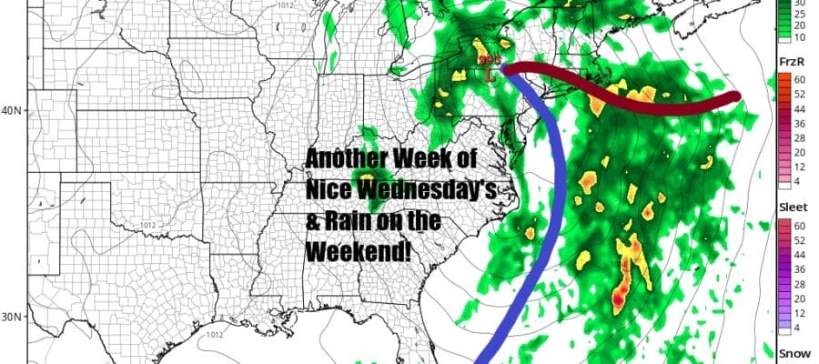
We seem to be stuck in these repeating patterns of starting off the week with some unsettled weather followed by nice weather for the middle and late week, and then of course we see rain for one if not both weekend days. That is the situation for this week and much like last week, we have a system in Eastern Canada and a lagging trough in the Eastern US creating self destructive morning sunshine followed by clouds and the risk for patchy showers. That is the outlookf for today and high temperatures will reach the upper 50s to lower 60s this afternoon.
SATELLITE WITH LIGHTNING STRIKES

WEATHER RADAR

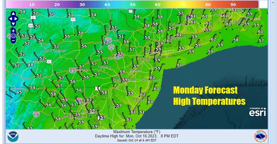
We can see some of those patchy showers over inland areas on the regional radar. Once we get past sunset the atmosphere stabilizes some and skies partially clear. Lows Tuesday morning will be mostly in the 40s with some upper 30s in the coldest spots inland. Tuesday is a repeat of today with clouds, some sun, and the odd passing shower with highs reaching into the 60s in some areas.

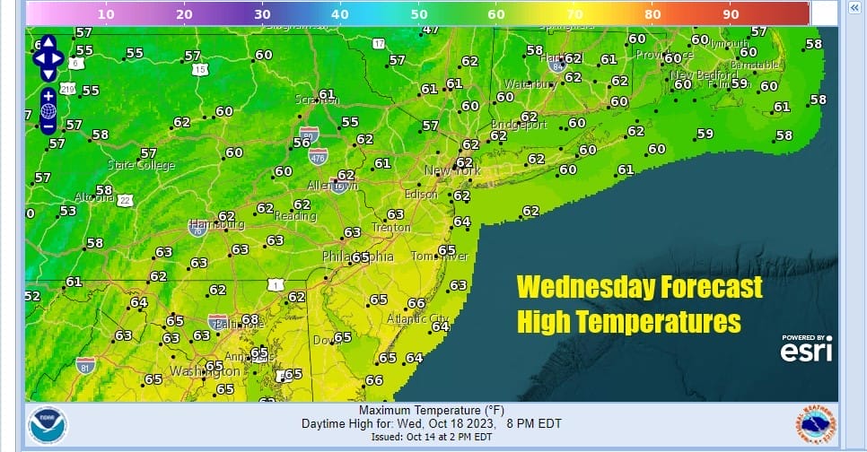
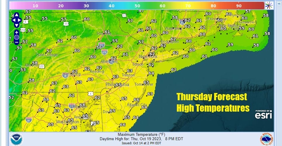
We have been talking about this streak of rainy weekends probably reaching 7 this coming weekend but we are also seeing a streak of beautiful Wednesday’s for some reason. That streak reaches back through September. Wednesday will be nice and sunny. the upper trough moves east and we see highs in the low to mid 60s. The same holds for Thursday which will also be a nice day of sunshine with highs in the 60s.
Now comes the downhill slide as a cold front swings east across the Midwest and Ohio Valley Friday. Lower pressures in the Southeast US will create a developing low that will move northward as the front moves eastward. Gradually that low strengthens and pulls moisture up the East Coast from off the Atlantic and we wind up dealing with increasing clouds Friday with highs in the 60s and rain developing from west to east as well as south to north Friday night.

We will likely see showery rains Saturday morning into midday if the timing is correct here and then it will be windy Saturday afternoon as winds shift to the northwest and the rain ends. The storm strengthens in Northern New England so we will see gusty winds Saturday night and Sunday. Temperatures Saturday will be into the 60s before dropping once the front passes. Sunday will be a windy chilly day with clouds and some self destructive sunshine, another chance for some passing scattered showers, and highs just in the low and middle 50s at best. This leads to a chilly start to next week, and the possibility some areas could see their firsts frosts of the fall season.
BE SURE TO DOWNLOAD THE FREE METEOROLOGIST JOE CIOFFI WEATHER APP &
ANGRY BEN’S FREE WEATHER APP “THE ANGRY WEATHERMAN!
MANY THANKS TO TROPICAL TIDBITS FOR THE USE OF MAPS
Please note that with regards to any severe weather, tropical storms, or hurricanes, should a storm be threatening, please consult your local National Weather Service office or your local government officials about what action you should be taking to protect life and property.
(Amazon is an affilate of Meteorologist Joe Cioffi & earns commissions on sales.)


