Hurricane Ian Makes South Carolina Landfall
Weekend Raw Wet Virginia to Southern New England
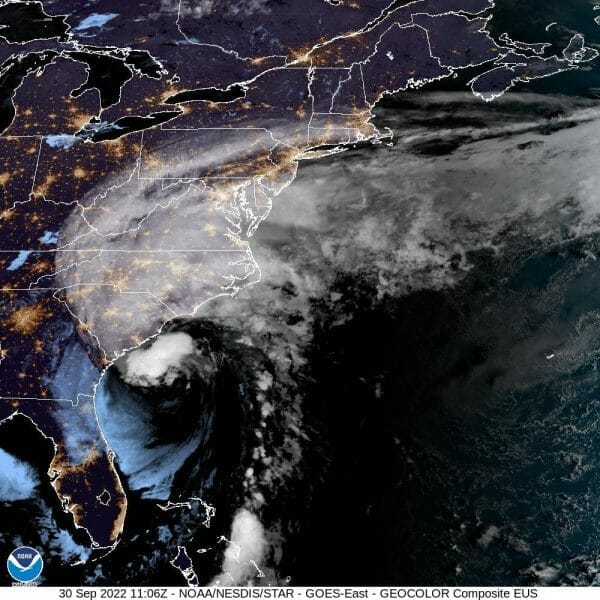
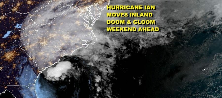
Hurricane Ian is making its final approach to the South Carolina coast where it will make its final landfall (we hope). Hurricane Warnings are in effect for the coast of South Carolina and a small portion of Southeast North Carolina with Tropical Storm Warnings for a small portion of the Georgia coast, as well as most of the coast of North Carolina. Look for a landfall early this afternoon.

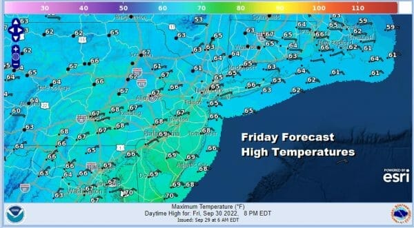
The storm has more of a hybrid structure to it where it looks more like a non tropical cyclone than a tropical cyclone but it remains a warm core system. Maximum winds are 85 mph with the strongest winds and the heaviest rains north and west of the center. Once Ian is inland the core should continue moving northwestward into Western North Carolina. Heavy rain will be spreading west and north today. We here in the Northern Mid Atlantic to Southern New England we will squeeze in one more dry day with sunshine giving way to arriving clouds. Highs will be in the 60s.
Tonight clouds will thicken up. Temperatures will settle into the 50s. Rain moves up the coast from south to north and we will see rain overspread the entire area during the early morning hours. Saturday will be a raw and dreary day with rain. This will also be a case where the further north you go the less rain you will get and just the opposite as you go south.

Amounts could be substantial with some areas getting 2 to 3 inches of rain along the immediate coast. Amounts of 1 to 2 inches likely from the Washington DC, Philadelphia, NYC, to Hartford/Providence. Less than an inch over the two weekend days will be north and west of there. One positive here is that this is spread out over 2 days which means that there will be some breaks in there where the rain lightens up or stops. The other is that it will have plenty of time to soak in. So we will just simply say on and off rain Saturday and Sunday. Some of the rain will be heavy at times especiially along the coast. A 15 to 20 mph northeast wind will make it raw, and temperatures both days won’t get much out of the 50s.

The first part of next week is going to be a bit difficult as the doom and gloom scenario continues. Another low is forecast to develop along the Mid Atlantic coast and that could bring more rain here. We could get a break for awhile Monday but it will be cloudy with patchy rain around. Then a steadier rain and wind event is possible Tuesday into Wednesday but that will depend on the position of the low relative to the coast. Genuine improvement won’t come until later next week.
BE SURE TO DOWNLOAD THE FREE METEOROLOGIST JOE CIOFFI WEATHER APP &
ANGRY BEN’S FREE WEATHER APP “THE ANGRY WEATHERMAN!
MANY THANKS TO TROPICAL TIDBITS & F5 WEATHER FOR THE USE OF MAPS
Please note that with regards to any severe weather, tropical storms, or hurricanes, should a storm be threatening, please consult your local National Weather Service office or your local government officials about what action you should be taking to protect life and property.


