Hurricane Ian Heads to Gulf of Mexico While
Weather In The East Looks Mostly Dry For This Week
The new week begins with not much fanfare in the Northeast and Mid Atlantic states. A cold front moved through last night with downpours and some thunderstorms. Now we being a slow improving trend that will lead to a mostly dry week. We do have a series of upper troughs and weak cold front that will be moving through over the next couple of days. Each one is going to take us down a step in terms of temperatures. Today we will see a mix of sun and clouds. There could be some widely scattered scattered showers around this aftenroon but most will not see anything. Highs today will be in the low to mid 70s.

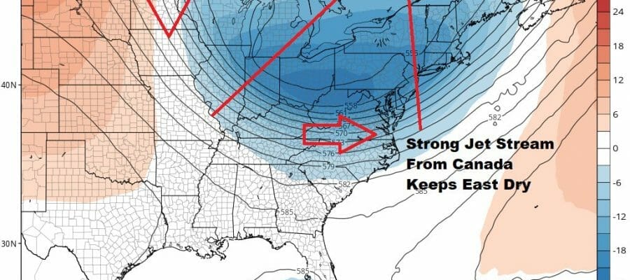
This strong jet stream pattern will keep things cool and dry and it also keeps Hurricane Ian at bay as that storm moves into the Northeast Gulf of Mexico and the Florida west coast. Hurricane Watches are now posted for parts of the Florida west coast and we will likely see warnings go up at some point. Ian an its moisture cannot move up the East Coast as long as this upper trough holds.
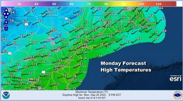
This leaves us with mostly nice weather here and we might be able to hold on to it into the weekend. Skies will be clear tonight with lows in the 40s inland and low to mid 50s coast and warmer urban settings. Tuesday will be a partly sunny day. I’m going to leave any mention of a shower out of the forecast as this next upper trough looks rather weak. Highs will be in the upper 60s inland and 70 to 75 coast.
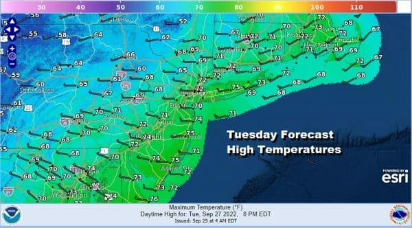
Higher pressures continue to move in Wednesday as the upper trough begins a slow pivot east. Look for a sunny cool day with highs in the upper 60s and lower 70s. Wednesday night will be nice and clear with lows in the 40s inland and lower 50s along the coast.

Thursday will be sunny and the coolest of the cool air will be in for Thursday and Friday. A northeast wind will prevail and there will be a bit of a chill in the air. However again no rain is forecast. Highs will be in the low and middle 60s and the same will hold for Friday.
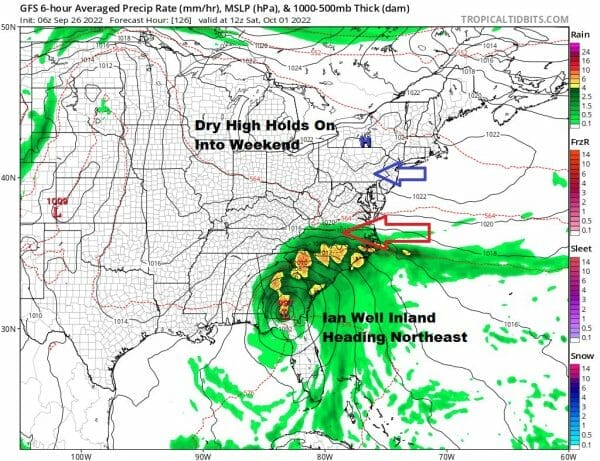
With a little luck it seems that the high to the north will hold in for the weekend and that will help to suppress the rains from Ian from moving northeast with any great rush. In fact a case can be made that Ian’s remnants will only get so far north before getting pushed to the east. At least this leaves with a nice Saturday of sunshine and some clouds with highs in the 60s thanks to a continued northeast wind. Sunday also could wind up being dry if this idea of a suppressed system plays out. There is still a long way to go on this idea but we will play along until we can figure it out.
HURRCANE IAN BECOMES A HURRICANE AND RAPIDLY STRENGTHENING
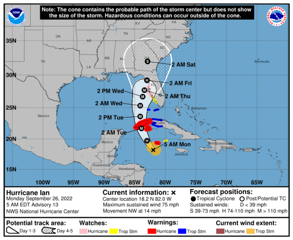
Ovenrght Ian begain a rapid strengthening trend and that looks to continue today. Watches are up for parts of the Florida West Coast as Ian is forecast to become a major hurricane. The area of landfall looks to be somewhere from Tampa north to the Florida big bend but the track is rather tenuous here as it is only straddling the coastline. Also the further north Ian gets, the more it gets to interact with very dry air in the Southeast US and that could cause Ian to weaken before landfall (hopefully). More on Ian will be available on my weather platform on Patreon
BE SURE TO DOWNLOAD THE FREE METEOROLOGIST JOE CIOFFI WEATHER APP &
ANGRY BEN’S FREE WEATHER APP “THE ANGRY WEATHERMAN!
MANY THANKS TO TROPICAL TIDBITS & F5 WEATHER FOR THE USE OF MAPS
Please note that with regards to any severe weather, tropical storms, or hurricanes, should a storm be threatening, please consult your local National Weather Service office or your local government officials about what action you should be taking to protect life and property.


