Tropical Storm Ian Strengthening Later Today Severe Weather Risks Late Today
Week Ahead Outlook
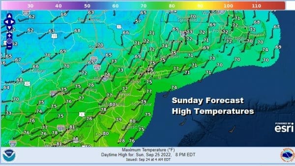
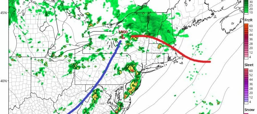
Some clouds have rolled in overnight and the dew points are rising today as are temperatures. We have a rather strong weather front that will be approaching and moving through late today and tonight. Ahead of it look for cloudy to partly sunny conditions with a southwest wind and that should take highs to the upper 70s and even a few lower 80s.
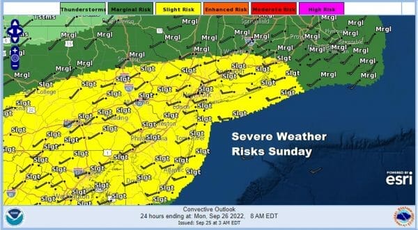
The Storm Prediction Center has gotten more bullish with the idea of severe weather and has raised the risk to “slight” which means to me that instead of thunderstorms where one or two isolated cells develop, we will probably see more numerous potential severe thunderstorms in the mix later this afternoon and evening.
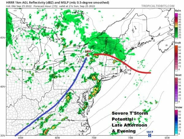
Models are suggesting that there could be two distinct lines of storms with one in the late afternoon between 3pm and 6pm from west to east and a second line between 10pm and midnight so we will be paying close attention to the radars going into tonight. Otherwise we will have leftover clouds afterwards. Most lows will be in the 50s to near 60.
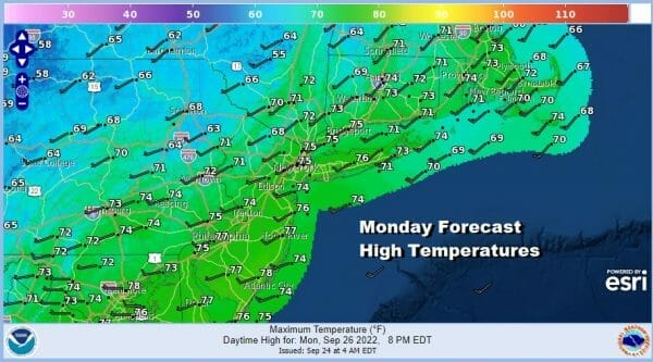
This week we will see what I would describe as a stair step decline in temperatures as a series of fronts and upper troughs move through Monday and Tuesday and that sets us up for a large Canadian high to build into the Great Lakes and Northeast. Monday look for some sun mixing with clouds especially inland west and north of the coast as the first upper trough moves through. I’m going to throw in the chance for a few scattered showers especially in upstate NY adn into Central New England where they will be more numerous. Highs will be in a range of 70 to 75.
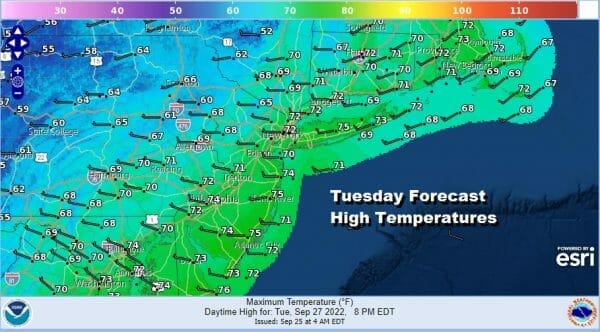
Tuesday we take another step down with partly sunny skies. Another upper trough and front will move through but this looks weaker so I’m not going to throw in any mention of showers. Highs Tuesday in the upper 60s and lower 70s. Wednesday we are looking at some sunshine and now the cold high is building in. NWS forecast has highs in the upper 60s to lower 70s but I think that is at least 5 degrees to high and that highs will be more like upper 50s to at best mid 60s.

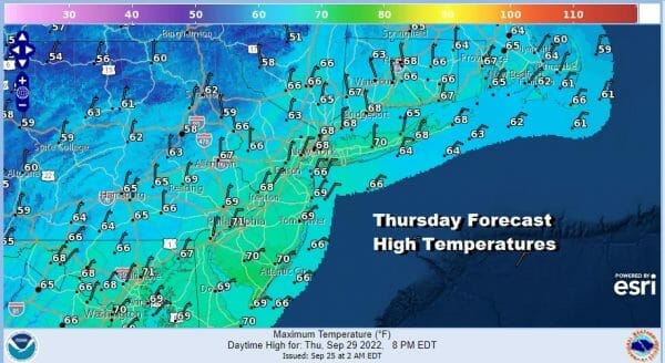
Wednesday night into Thrusday morning lows could be in the low to mid 40s and even a rather large area of 30s is possible inland. Thursday will be sunny and quite cool with highs just in the upper 50s to lower 60s and again NWS is probably about 5 degrees or so too high. Skies should be mostly sunny.
We will hold on to the dry air on Friday when by that point the high is in New England and what will likely be Hurricane Ian, having made landfall lateThursday or early Friday pushing moisture up through the Southeast US. Ian is forecast to strengthen rapidly later today as conditions are highly favorable for strengthening.

Regarding the weather here next week, much depends on where landfall occurs and whether the remnant low and moisture take a path northeast up the east side of the Appalachains or the west side, or perhaps it will start going up the west side and translate east. Some moisture is likely to come up the coast either way so it really depends on timing of landfall. Models are still all over the place but they have come a little further east again. The focus for landfall at the moment is the Florida Big Bend as per NHC though the European is insisting the Tampa area while the GFS is in the Western Florida Panhandle. There is still much to be worked out. Also Ian will strengthen likely to at least a category 3 and possibly a 4 however IF it heads toward the Panhandle, there is going to be a lot of dry air in the Gulf States late this week and that could weaken it some before landfall. On the other hand a track toward Tampa would keep the dry air out and a much stronger storm would be in the cards. We will continue to monitor the situation though I suspect we won’t have a final picture of this for another day or two at least.
BE SURE TO DOWNLOAD THE FREE METEOROLOGIST JOE CIOFFI WEATHER APP &
ANGRY BEN’S FREE WEATHER APP “THE ANGRY WEATHERMAN!
MANY THANKS TO TROPICAL TIDBITS & F5 WEATHER FOR THE USE OF MAPS
Please note that with regards to any severe weather, tropical storms, or hurricanes, should a storm be threatening, please consult your local National Weather Service office or your local government officials about what action you should be taking to protect life and property.


