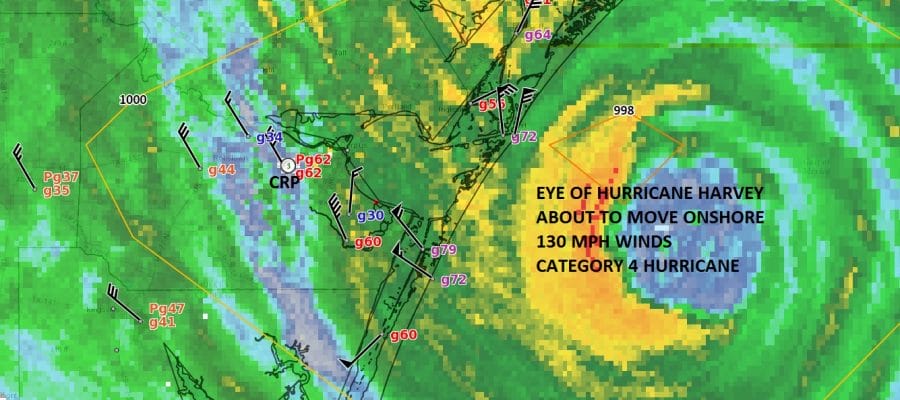
HURRICANE HARVEY CATEGORY 4 130 MPH
7PM RADAR & SURFACE OBSERVATIONS
CORPUS CHRISTI TEXAS
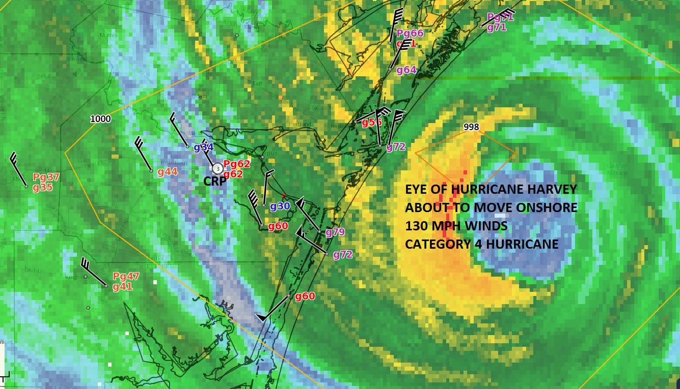
HURRICANE HARVEY CATEGORY 4 130 MPH
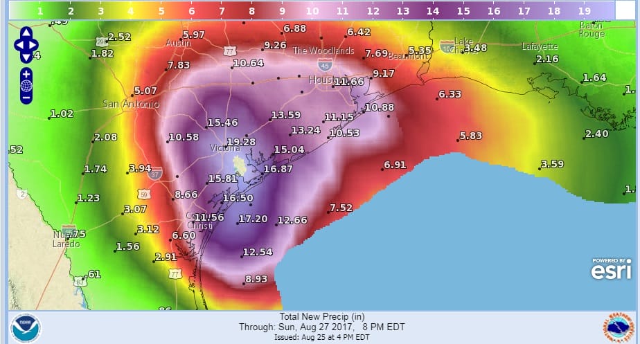
Hurricane Harvey Tropical Cyclone Update
NWS National Hurricane Center Miami FL AL092017
600 PM CDT Fri Aug 25 2017
…6 PM CDT POSITION AND INTENSITY UPDATE…
…HARVEY BECOMES A CATEGORY FOUR HURRICANE…
…SUSTAINED HURRICANE-FORCE WINDS SPREADING ONTO THE MIDDLE TEXAS
COAST…
Air Force Reserve Reconnaissance aircraft data indicate that Harvey
has become a category 4 hurricane with maximum sustained winds of
130 mph (215 km/h).
A station at Aransas Pass run by the Texas Coastal Observing
Network recently reported a sustained wind of 74 mph (119 km/h) with
a gust to 96 mph (154 km/h).
SUMMARY OF 600 PM CDT…2300 UTC…INFORMATION
———————————————-
LOCATION…27.7N 96.7W
ABOUT 45 MI…70 KM E OF CORPUS CHRISTI TEXAS
ABOUT 50 MI…85 KM SSW OF PORT OCONNOR TEXAS
MAXIMUM SUSTAINED WINDS…130 MPH…215 KM/H
PRESENT MOVEMENT…NW OR 325 DEGREES AT 8 MPH…13 KM/H
MINIMUM CENTRAL PRESSURE…941 MB…27.79 INCHES
CORPUS CHRISTI RADAR REAL TIME

.
REGIONAL RADAR

LOCAL RADAR NEW YORK CITY

LOCAL RADAR PHILADELPHIA


Our weather by contrast could not be more opposite or nicer for tonight and right through the weekend. Other than occasional passing clouds it will be partly to mostly sunny Saturday and Sunday with highs both days in the mid to upper 70s with very low humidity.
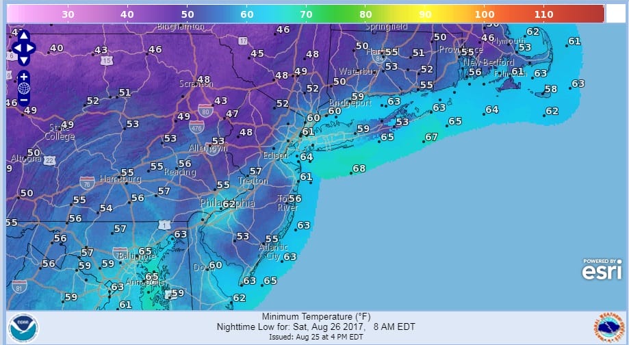
Tonight & Saturday night will be nice and cool. In some places it will be very cool with lows in the upper 40s across some of the valley areas in Northwest New Jersey, Eastern Pennsylvania, the Hudson Valley and interior Connecticut. Monday should be another nice day before onshore winds and clouds start to come into the picture on Tuesday. There are no storms on the horizon for us, tropical or otherwise.
 GET JOE A CIGAR IF YOU LIKE

FiOS1 News Weather Forecast For Long Island
FiOS1 News Weather Forecast For New Jersey
FiOS1 News Weather Forecast For Hudson Valley