Hottest Day Of The Week Thunderstorm Chance Tonight

Weather in 5/Joe & Joe Weather Show Latest Podcast
Hottest Day Of The Week Thunderstorm Chance Tonight
Here we are at another Tuesday and for the third week in a row this will be the hottest day of the week. We have sunshine forecast all day long. Humidity levels will be on the moderate side. I don’t see dew points pushing into the 70s during this afternoon. They will probably hold in the 60s making it somewhat uncomfortable but not overly so. It will be hot though with highs reaching the upper 80s to lower 90s. To the northwest on the satellite loop you can see lots of clouds and this is due to a weather front approaching us tonight.
SATELLITE

WEATHER RADAR


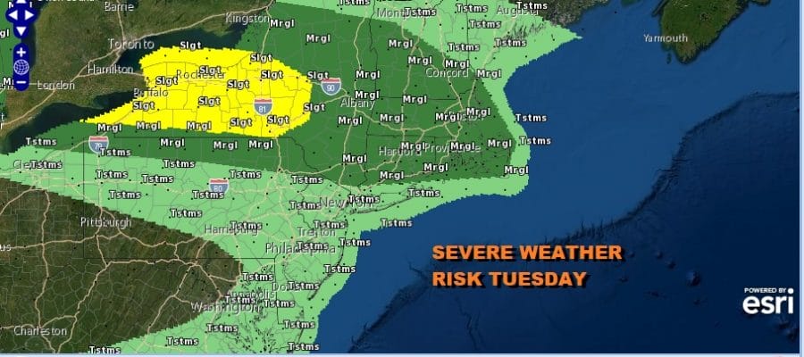
In the meantime the radars are quiet for now and other than an odd pop up we don’t expect any widespread activity during the day. This evening and overnight looks to be when we will be at risk for thunderstorms. The Storm Prediction Center has severe weather risk mostly to the north across Upstate NY and New England with the southern end of the marginal risk line across Northern Pennsylvania and straddling the Northern NJ, NY state line.

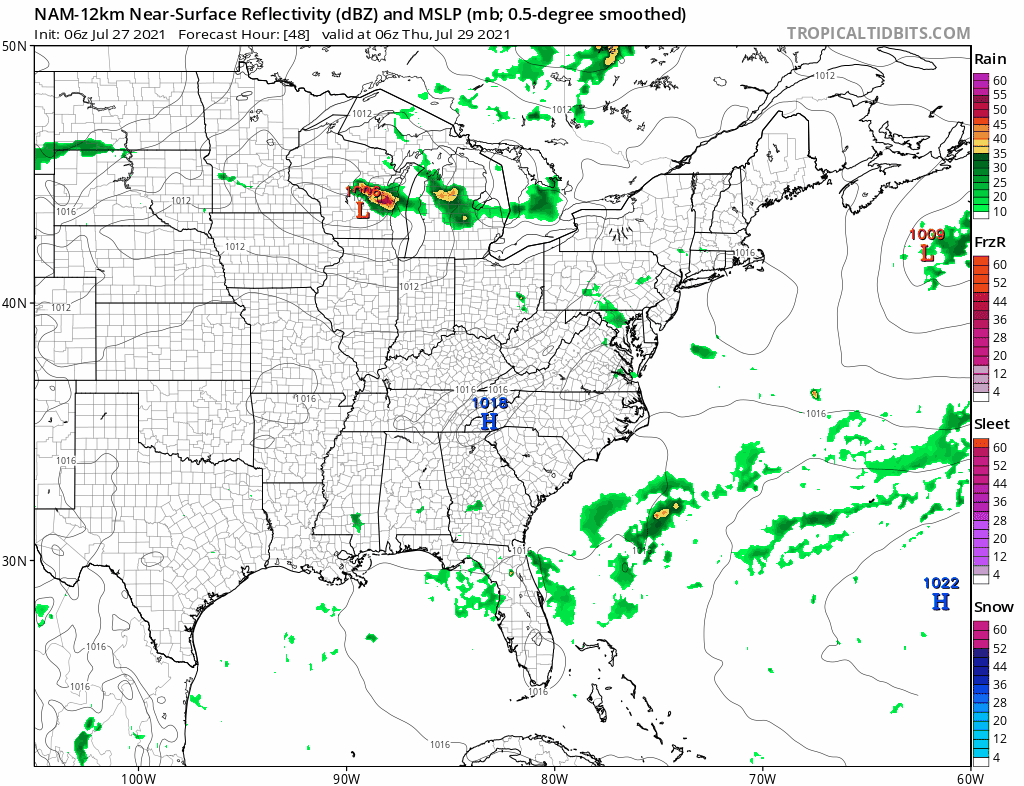
There looks to be one line of storms that will move east southeast inside that marginal risk area so if you are south of that, it is conceivable that you may not see any thunderstorms at all tonight (other than the odd pop up in the afternoon ). The NAM model shows that rather narrow line of storms coming in after sunset.

The strongest storms look to move across New England and offshore and the timing of the loop is from 5pm today until 5am Wednesday. Once this system passes we again will find ourselves in an air mass that is only slightly cooler and slightly less humid than today. In fact the humidity change for Wednesday is almost ero. So look for a very warm and humid Wednesday with sunshine or at least partly sunny skies with highs in the 80s to near 90.
Thursday to me looks interesting from the standpoint of potential thunderstorms because we have a rather strong upper air trough dropping from Southeastern Canada coupled with a stronger cold front moving southeast from the Great Lakes. I think this opens the door up for the possibility of more widespread activity Thursday afternoon into Thursday night with the potential for strong thunderstorms. Highs Thursday will be in the low to mid 80s and it looks like there could be thunderstorms developing in the early afternoon.
Friday we have a secondary cold front coming through and I don’t expect much with it when it goes by in the afternoon but behind it will come a nice shot of dry air taking us into the weekend. In face longer term. a strong northwest flow brings another front through Sunday with a shower or thunderstorm and another more impressive shot of dry air for the first part of next week.
BE SURE TO DOWNLOAD THE FREE METEOROLOGIST JOE CIOFFI WEATHER APP &
ANGRY BEN’S FREE WEATHER APP “THE ANGRY WEATHERMAN!

MANY THANKS TO TROPICAL TIDBITS & F5 WEATHER FOR THE USE OF MAPS
Please note that with regards to any severe weather, tropical storms, or hurricanes, should a storm be threatening, please consult your local National Weather Service office or your local government officials about what action you should be taking to protect life and property.


