Hot Humid Weather Ahead Little Thunderstorm Activity Until Friday

Weather in 5/Joe & Joe Weather Show Latest Podcast
Hot Humid Weather Ahead Little Thunderstorm Activity Until Friday
As often happens after a stormy wet period we get a few days of calm. This continues today as we have mainly clear skies in the Northeast and Mid Atlantic states and that is going to lead us to heat and humidity today. However the atmosphere is relatively stable so we don’t see much in the way of thunderstorms unless the odd storm pops up.

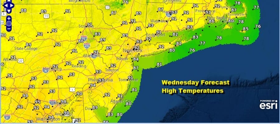
This leaves temperatures no where to go but up as highs will reach the low and middle 90s today. Even the beaches will see temperatures well into the 80s before any sea breezes. We have no tropical storms around to worry about at least for now.
SATELLITE

Hot humid days lead to very warm and humid nights with lows in the upper 60s to lower 70s except middle 70s in warmer more urban settings. Thursday will be another hot and humid day with a minimal chance for a shower or thunderstorm. Highs again will be in the upper 80s to low 90s with temperatures only a little cooler at the shore.

Friday brings a backdoor cold front into the Northeast and that front will sink southward as the day wears on. This leaves us very warm to hot and humid ahead of it with highs in the upper 80s and lower 90s with sunshine and some clouds. Friday evening and night we could see a few thunderstorms as the front passes.
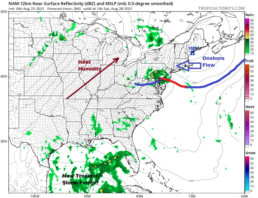
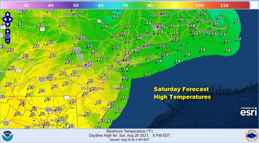
The weekend brings some questions thanks to the backdoor cold front stalling nearby. This could lead to clouds being around Saturday and Sunday with the risk for scattered downpours or a thunderstorm. To the south of the frontal boundary highs will be in the upper 80s and lower 90s while to the north temperatures will be in the 70s to near 80. Right now that boundary zone cold migrate into Southern New Jersey and Southern Pennsylvania.
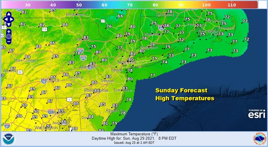
That boundary zone will be still evident on Sunday and temperatures will be about the same as Saturday with upper 70s to lower 80s to the northeast and upper 80a and lower 90s to the southwest.
Meanwhile the tropics will be waking up and attention shifts to the Western Caribbean. Late this week a large gyre will produce the first of what could be several tropical storms in the coming weeks. This first storm will head into the Western Gulf of Mexico and will become a threat to the Texas or Louisiana coasts. Conditions will be very favorable for strengthening with this system so we will watch this storm with interest though obviously it is no threat here.
BE SURE TO DOWNLOAD THE FREE METEOROLOGIST JOE CIOFFI WEATHER APP &
ANGRY BEN’S FREE WEATHER APP “THE ANGRY WEATHERMAN!

MANY THANKS TO TROPICAL TIDBITS & F5 WEATHER FOR THE USE OF MAPS
Please note that with regards to any severe weather, tropical storms, or hurricanes, should a storm be threatening, please consult your local National Weather Service office or your local government officials about what action you should be taking to protect life and property.


