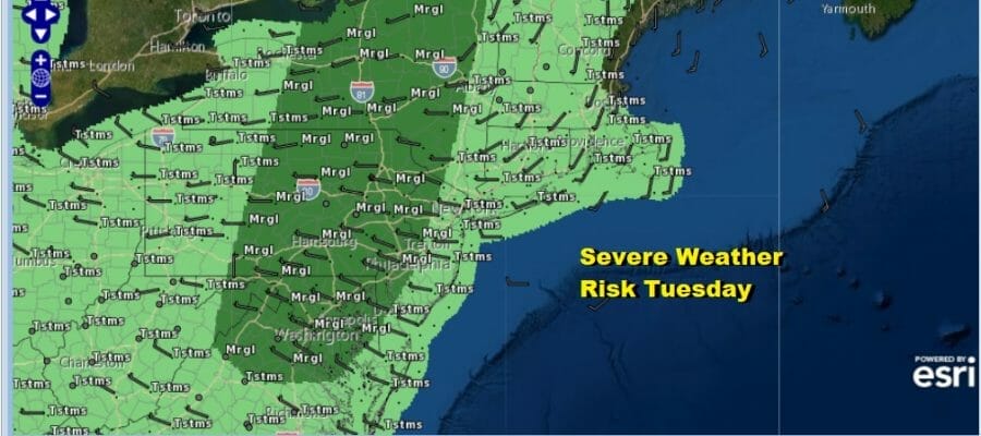
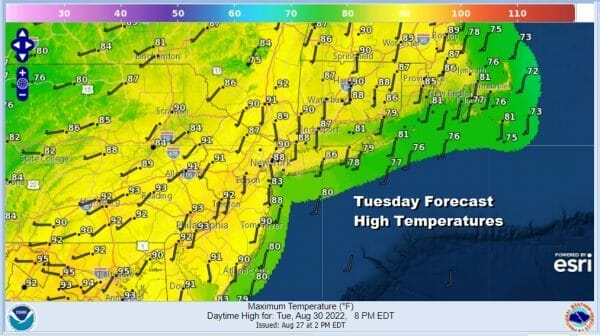
Hot Humid Severe Weather Risks Inland Late Today Into Tonight
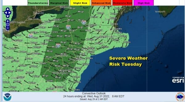
We have a hot humid afternoon with some sunshine that is going to take highs to the upper 80s and lower 90s. Late today into tonight thunderstorms will develop ahead of a cold front. The Storm Prediction Center has a marginal risk for severe weather for inland areas from Virginia to Western and Northern New England. Most of the thunderstorms will likely weaken as they approach the coast so the line cuts off in Western New Jersey and from the Hudson Valley west of Route 87.
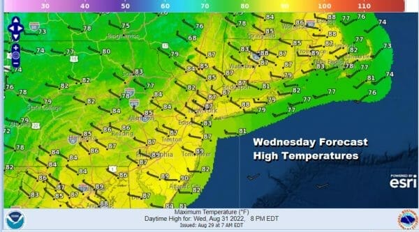
Once the front passes offshore we will begin a stair step decline in temperatures and humidity for the rest of the week. Skies should partially clear out later tonight with most lows in the 60s to around 70. Wednesday should be a nice sunny day as humidity levels ease. Highs will reach the mid to upper 80s.
Thursday and Friday will be two nice sunny days with low humidity. Thursday highs will be in a range of 80 to 85. Friday highs will be in the upper 70s and lower 80s. It will be a nice finish to the week as temperatures head down closer to average for this time of year.
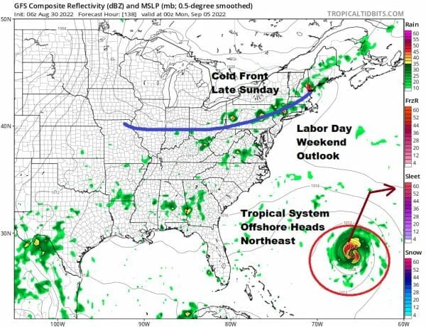
The weekend will be warmer and more humid with sunshine taking highs in to the middle and upper 80s. There is an outside chance for an isolated shower or thunderstorm. Sunday will be dry for most of the day but a cold front will arrive late in the day with the chance for showers and thunderstorms. Highs again will be in the mid to upper 80s. Monday, Labor Day will hinge on this cold front and whether it temporarily stalls. A tropical system is likely to be offshore and that is going to cause the front to get hung up for a short time. Monday looks like we could see clouds and some scattered showers and thunderstorms. The tropical system is going to turn to the northeast and once that happens, it will allow the front to move bringing improving weather conditions back next Tuesday along with lower humidity and lower temperatures.
BE SURE TO DOWNLOAD THE FREE METEOROLOGIST JOE CIOFFI WEATHER APP &
ANGRY BEN’S FREE WEATHER APP “THE ANGRY WEATHERMAN!
MANY THANKS TO TROPICAL TIDBITS & F5 WEATHER FOR THE USE OF MAPS
Please note that with regards to any severe weather, tropical storms, or hurricanes, should a storm be threatening, please consult your local National Weather Service office or your local government officials about what action you should be taking to protect life and property.


