
Hot Humid Late T’Storms Tuesday Less Humid Cooler Second Half of Week
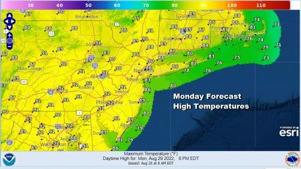
The last days of August are here and with them comes heat and humidity to start off the week. The lengthening nights means we see low clouds develop only to burn off to sunshine and temperatures are heading for the upper 80s and lower 90s this afternoon. The atmosphere is stable so we do not see any chance for a shower or thunderstorm developing. Tonight will be a warm humid night with some developing clouds and a little coastal fog. Lows will be in the mid 60s to lower 70s.
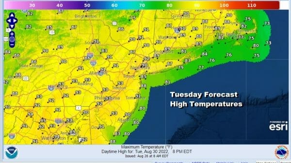
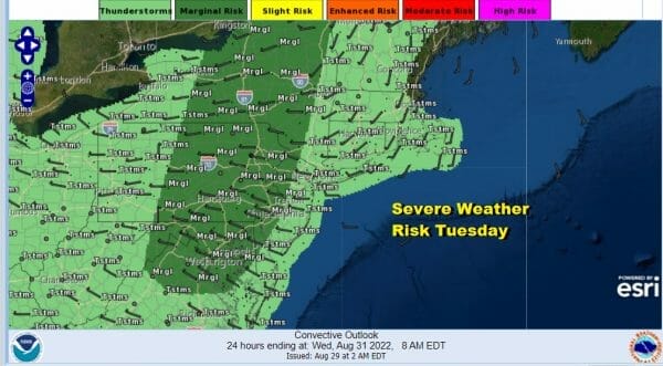
Tuesday will be another day of heat and humidity but with a cold front approaching we see the chance that there could be some showers and thunderstorms late in the day inland. Highs will reach the upper 80s and lower 90s just about everywhere though it will be cooler along the shore. The Storm Prediction Center has a marginal risk of severe weather from Northeastern NY south to Northeastern Virginia.
As far as rainfall is concerned I expect these thunderstorms to mostly fall apart as they reach the coast tomorrow night and that means once again little or no rainfall is forecast. Inland in Pennsylvania and points west we could see quarter to half inch amounts from these thunderstorms but amounts cut down drastically to the east.

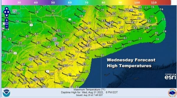
The front moves offshore and that brings us to the second half of the week which will be still on the warm side but in the low to mid 80s for highs rather than 90s. Also humidity levels will be dropping off for Wednesday through Friday making it more bearable. Highs Wednesday with partly to mostly sunny skies will be in the mid to upper 80s.
Thursday and Friday will be sunny both days with highs mostly between 80 and 85 degrees. Temperatuers will be a little cooler along the shore each afternoon and no rain is forecast Wednesday through Friday. Right now the Labor Day Holiday weekend looks to be very warm and more humid over time but nothing more than an isolated shower or thunderstorm Saturday through Monday.
BE SURE TO DOWNLOAD THE FREE METEOROLOGIST JOE CIOFFI WEATHER APP &
ANGRY BEN’S FREE WEATHER APP “THE ANGRY WEATHERMAN!
MANY THANKS TO TROPICAL TIDBITS & F5 WEATHER FOR THE USE OF MAPS
Please note that with regards to any severe weather, tropical storms, or hurricanes, should a storm be threatening, please consult your local National Weather Service office or your local government officials about what action you should be taking to protect life and property.


