
HERMINE GFS MODEL OVERNIGHT RUN
HERMINE GFS MODEL OVERNIGHT RUN MODEL LOOPS &
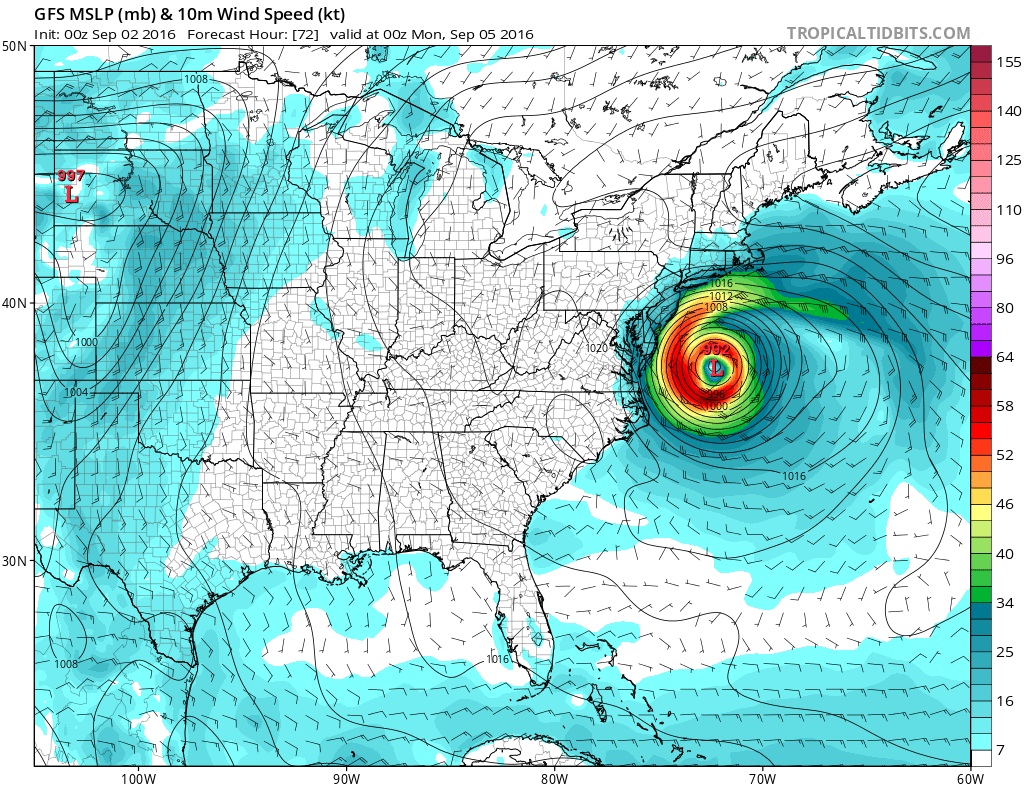
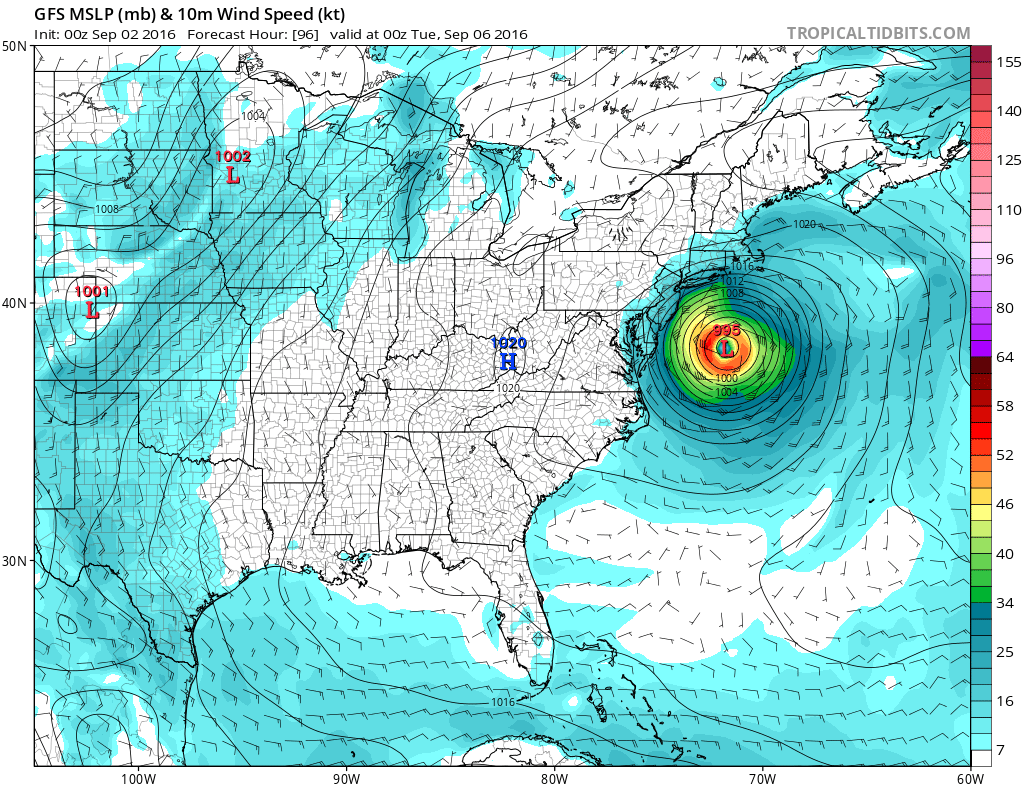
STALLS STORM OFF NEW JERSEY FOR MANY DAYS
SUGGESTS SERIOUS COASTAL FLOODING EVENT
CAUTION: UNCERTAINTY EXTREMELY HIGH

The GFS model run tonight offers a jaw dropping solution regarding Hermine. It is almost impossible to take it seriously. The implications are huge in that it loops and stalls Hermine for nearly a week east of New Jersey and south of Long Island. If this were even close to being true, the coastal flooding would be severe. However please bear this in mind Im in no way forecasting this. I am trying to digest the logic behind it all and of course we need to see what the other global models do with this.
First of with regards to Hermine at the moment the hurricane made landfall tonight over the Florida panhandle with 80 to 85 mph winds. Now it begins its move up the coast. The satellite loop shows the offshore frontal zone with the hurricane on the southern end moving north northeast and headed for the Southeast US coastline.

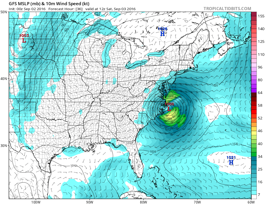
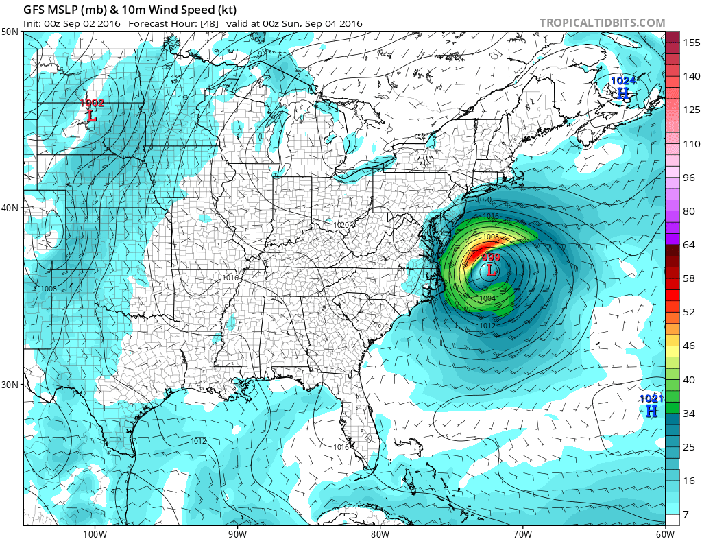
Now going forward the east part of this forecast is that Hermine will straddle the coast as a tropical storm until it emerges off North Carolina Saturday morning. Initially the storm moves northeast but then by later Sunday it comes to a grinding halt.
HERMINE GFS MODEL SATURDAY MORNING
HERMINE GFS MODEL SATURDAY NIGHT
HERMINE GFS MODEL GFS MODEL SUNDAY MORNING

HERMINE GFS MODEL SUNDAY NIGHT
HERMINE GFS MODEL MONDAY NIGHT
HERMINE GFS MODEL TUESDAY NIGHT

HERMINE GFS MODEL WEDNESDAY NIGHT
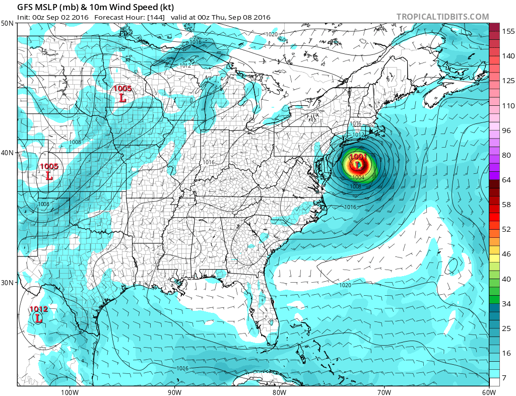
HERMINE GFS MODEL THURSDAY NIGHT

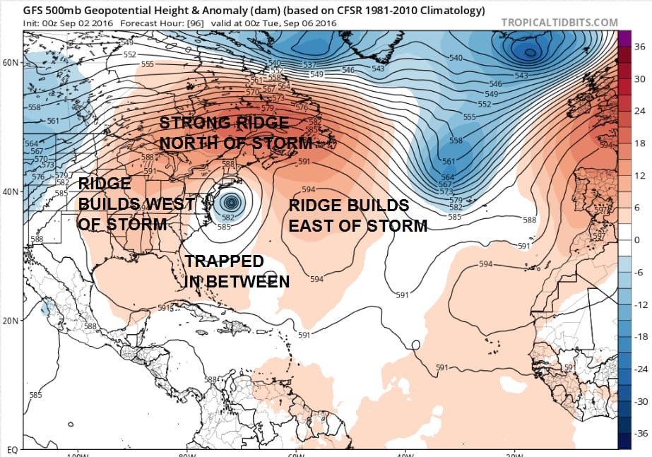
I normally don’t put up this many maps but I wanted to show the sequence beginning Saturday morning and taking us through next Thursday evening. The video above shows a looping view with an explanation. Something like this probably defies an analog to look at since this is something that certainly I have never seen before. What the model is doing aloft is that it is building a ridge on three sides of this and essentially trapping the storm in between. It would take days for the ridges on either side to break down enough and allow this to move east.
HERMINE GFS MODEL UPPER AIR MONDAY NIGHT
I spoke to a few colleagues and we are all scratching our heads trying to grasp this model run. A quick look at the usually squirrely Canadian model has a similar idea further east and actually keeps this more of a tropical system structure as it loops and backs it westward. However it does it along 70 west which would be a much shorter and a much less severe event. At this point I would just say that lets wait for the European which on the day run did have a similar looping concept further south and west than the GFS model did. From a forecast standpoint I’m not any more or less convinced on what will transpire this weekend. Uncertainty remains incredibly high.
FiOS1 News Weather Forecast For Long Island
FiOS1 News Weather Forecast For New Jersey
FiOS1 News Weather Forecast For Hudson Valley
NATIONAL WEATHER SERVICE SNOW FORECASTS
LATEST JOESTRADAMUS ON THE LONG RANGE
Weather App

Don’t be without Meteorologist Joe Cioffi’s weather app. It is really a meteorologist app because you get my forecasts and my analysis and not some automated computer generated forecast based on the GFS model. This is why your app forecast changes every 6 hours. It is model driven with no human input at all. It gives you an icon, a temperature and no insight whatsoever.
It is a complete weather app to suit your forecast needs. All the weather information you need is right on your phone. Android or I-phone, use it to keep track of all the latest weather information and forecasts. This weather app is also free of advertising so you don’t have to worry about security issues with your device. An accurate forecast and no worries that your device is being compromised.
Use it in conjunction with my website and my facebook and twitter and you have complete weather coverage of all the latest weather and the long range outlook. The website has been redone and upgraded. Its easy to use and everything is archived so you can see how well Joe does or doesn’t do when it comes to forecasts and outlooks.
Just click on the google play button or the apple store button on the sidebar for my app which is on My Weather Concierge. Download the app for free. Subscribe to my forecasts on an ad free environment for just 99 cents a month.
Get my forecasts in the palm of your hand for less than the cost of a cup of Joe!
![]()
![]()