
Heatwave Coming How Hot Is Hot?

Heatwave Coming How Hot Is Hot?
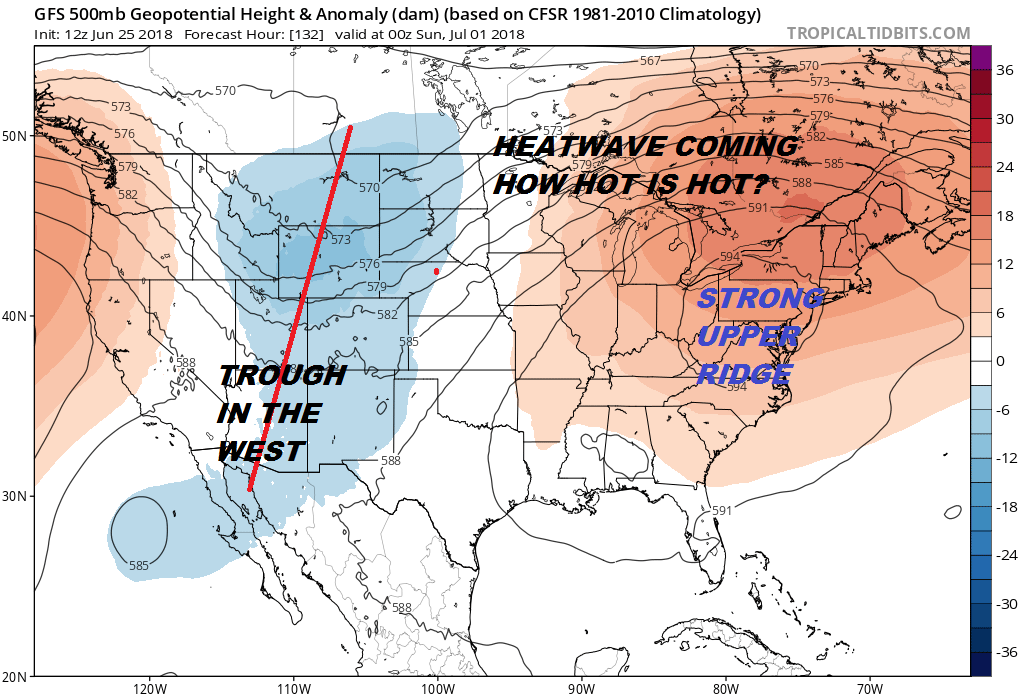
Everything we see in the upper air pattern is pointing to a heatwave. The upper air is setting up for a long duration stretch of 90+ weather that could last at least 6 or 7 days and peppered in there will be a few 100 degree days once of which could be next Sunday. The upper high is going to be centered pretty much right over head which will magnify the heat. Humidity will be up there too so this is going to be a rather brutally hot stretch of weather.
SUNDAY JULY 1 2018 2PM TEMPERATURE FORECAST
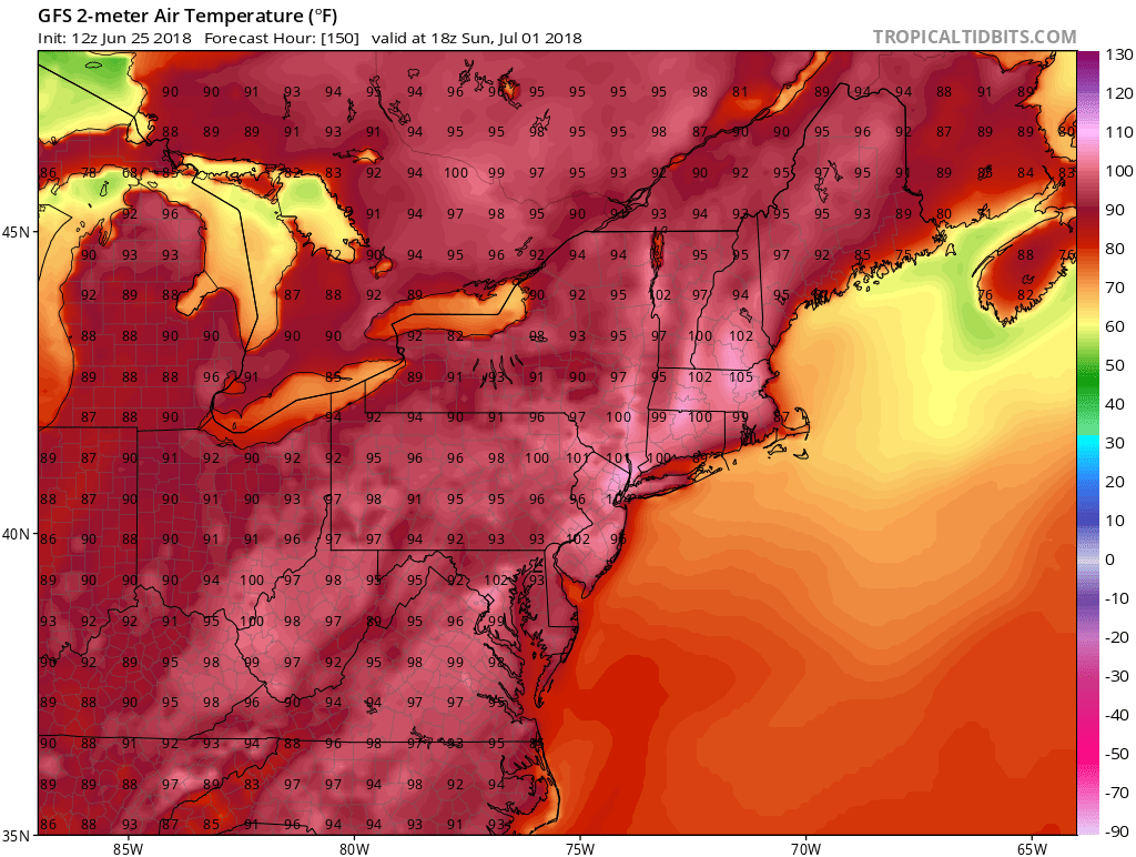
It isn’t often that you see the GFS spew out 100 degree plus prints on a forecast map but i has done this the last several runs. These are 2pm temperatures so you might nudge these up another degree or so especially inland. It is hard to say whether these are a bit overdone. That will depend on how much sunshine we get. The upper high overhead would suggest not much in the way of cloud cover to get in the way. Pop up isolated thunderstorms are probably likely late in the afternoon.
MONDAY JULY 2, 2018 FORECAST 2PM TEMPERATURES
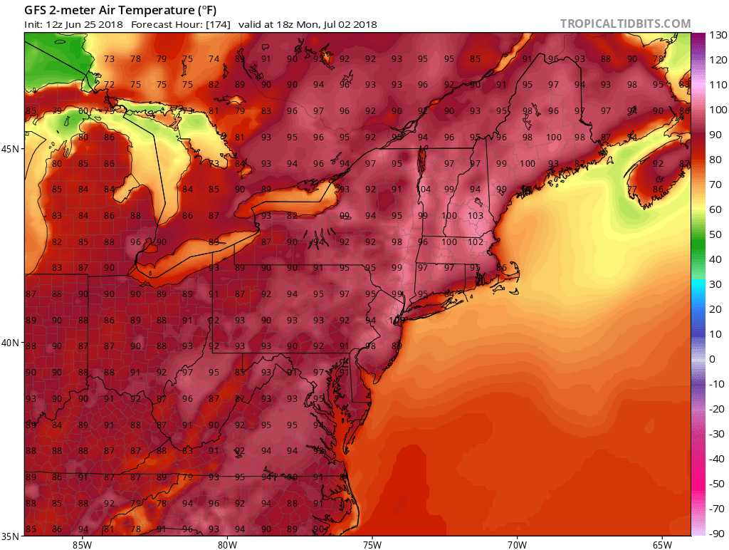
Monday could be a repeat performance of near or just over the 100 degree mark. After Monday the upper high does begin to slowly flatten out and weaken and a cold front will get close to us Tuesday night or on Wednesday but whether it has the power to get through or not remains to be seen. Temperatures could ease a bit Tuesday and Wednesday especially if we can see a greater chance for thunderstorms running around as the next front nears. Needless to say it will be hot and it will be beach weather this weekend so prepare to find ways to stay cool.
SHOP THE JOESTRADAMUS STORE
MANY THANKS TO TROPICAL TIDBITS FOR THE WONDERFUL USE OF THE MAPS

GET JOE A CIGAR IF YOU LIKE!
FiOS1 News Weather Forecast For Long Island
FiOS1 News Weather Forecast For New Jersey
FiOS1 News Weather Forecast For Hudson Valley
NATIONAL WEATHER SERVICE SNOW FORECASTS
LATEST JOESTRADAMUS ON THE LONG RANGE