Heatwave Breaks Late Today Severe Weather Risk
Pleasant Weather Arrives Friday

Today will be the last day of the heatwave for most of the area if you define a heat wave as consecutive days of highs over 90 degrees. We are going to see sunshine into this afternoon. Highs will reach the low and middle 90s in most places. A few hot spots could push it up to 96 or 97. A cold front will be approaching late today and that will set off some thunderstorms.
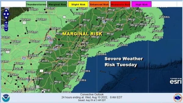
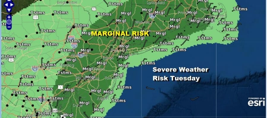
The Storm Prediction Center is indicating a marginal risk for severe weather from the Delmarva Peninsula northeast to Southeastern New England and this include Philadelphia, NYC, Hartford, Providence, and Boston. Isolated severe thunderstorms will be in the mix. It will likely be a narrow line of thundertorms moving out of Pennsylvania around 4pm and reaching the coast around 6 or 7pm. Once the front goes by it will stall out leaving the area in clouds overnight with lows in the upper 60s to mid 70s.
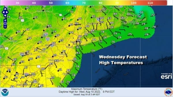
Wednesday the vast majority of the area will be in the 80s due to more cloud cover. There will be a few places that could touch 90 degrees mainly in Southern New Jersey. The cold front will be stalled nearby and a wave on it will generate some showers and thundertorms late Wednesday into Wednesday night. A developing wave on the front heads northeast and once that goes by Thursday morning weather conditions will improve and humidity levels will begin to drop.
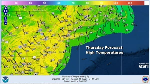
Thursday will be a day of leftover clouds giving way to some sunshine. Highs will be in the middle 80s in most places. Dropping dew points will accelerate Thursday night as an upper trough moves through and that brings in very dry air for Friday and for the weekend. Look for some sunshine Friday with a nice northwest breeze and highs in the upper 70s and lower 80s.

Saturday looks great with sunshine in the upper 70s and lower 80s. Nights will be in the 50s to lower 60s Friday night and Saturday night. Next week we will see opportunities for some rain as a trough in the Eastern US will generate some waves of low pressure passing up along the coast or just inland of the coast. The tropics continue to remain quiet and we don’t see any issues from the tropics anytime soon.
BE SURE TO DOWNLOAD THE FREE METEOROLOGIST JOE CIOFFI WEATHER APP &
ANGRY BEN’S FREE WEATHER APP “THE ANGRY WEATHERMAN!
MANY THANKS TO TROPICAL TIDBITS & F5 WEATHER FOR THE USE OF MAPS
Please note that with regards to any severe weather, tropical storms, or hurricanes, should a storm be threatening, please consult your local National Weather Service office or your local government officials about what action you should be taking to protect life and property.


