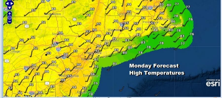
Heat Humidity Through Tuesday But Real Relief Comnig Late Week
Another couple of days of heat and high humidity are ahead of us. We have steamy conditions with ridiculously high dew points. The satellite view doesn’t show much in the way of clouds so with a good deal of sunshine, temperatures should make it up to the low and middle 90s. It will be a little bit cooler at the shore which is the best place for relief. There were pop up showers and thunderstorms yesterday. Some areas got them but most did not. We will include a mention for pop up scattered showers and thunderstorms and again some places will get them and most will not. Tonight will be another warm steamy night with lows in the 70s to around 80.
SATELLITE

WEATHER RADAR

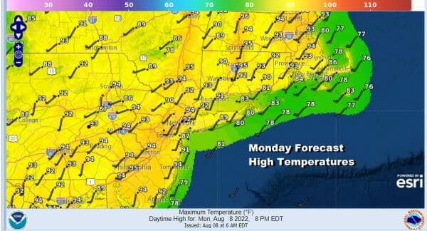
Tuesday we see another weather front approaching and that front might set off some scattered showers and thunderstorms in the late afternoon and evening. However until that happens we will have sunshine hot and humid conditions with highs again reaching the low and middle 90s. This will be the 8th day in a row of 90 plus highs for many folks in Eastern Pennsylvania to Southern New England.
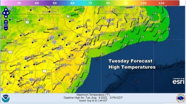
This weather front will be hanging around nearby on Wednesday and that will produce more in the way of clouds. That may be enough to keep temperatures lower and break the streak of 90 degree plus highs in most areas. We will also call for the chance for scattered downpours or thunderstorms though much of the time Wednesday it will not be raining. Highs should be mostly in the 80s.

We are unfortunately not going to see much rain as we transition to a cooler drier scheme late this week. Thursday pushes the final cold front offshore and an upper trough drops into the Eastern US. This is going to drive dry air rather far to the south along the East Coast. Dew point relief will make it all the way south into the Southeastern US!
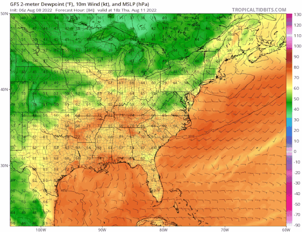
We are also going to get temperature relief as well. I think we could see Friday and Saturday high temperatures at best in the upper 70s and lower 80s with nights in the 50s to around 60. It also looks like we could be dry this weekend as the upper trough lies along the East Coast and that keeps any rain offshore.

it also means that the weekend will be quite nice and comfortable. Longer range could open up the possibility of rain chances and also we will have to see whether the tropics somehow come into play later this month though that is purely speculative at this point. Summer is half over and starting today the average temperatures begin a slow decline. The clock on the summer is starting to tick.
BE SURE TO DOWNLOAD THE FREE METEOROLOGIST JOE CIOFFI WEATHER APP &
ANGRY BEN’S FREE WEATHER APP “THE ANGRY WEATHERMAN!
MANY THANKS TO TROPICAL TIDBITS & F5 WEATHER FOR THE USE OF MAPS
Please note that with regards to any severe weather, tropical storms, or hurricanes, should a storm be threatening, please consult your local National Weather Service office or your local government officials about what action you should be taking to protect life and property.


