Heat Humidity Pop Up Storms Heat Advisories For Week Ahead

Weather in 5/Joe & Joe Weather Show Latest Podcast
Heat Humidity Pop Up Storms Heat Advisories For Week Ahead
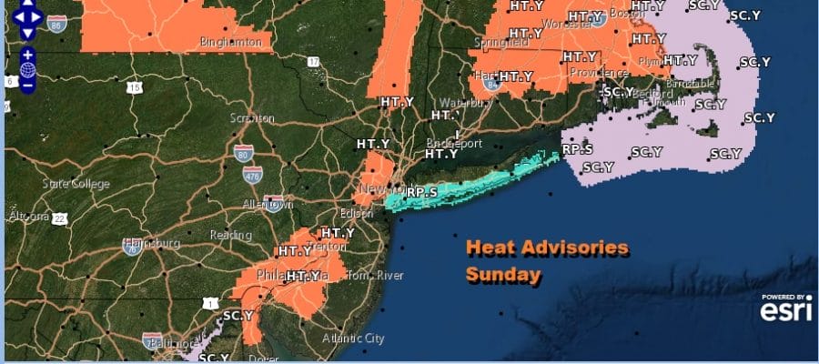
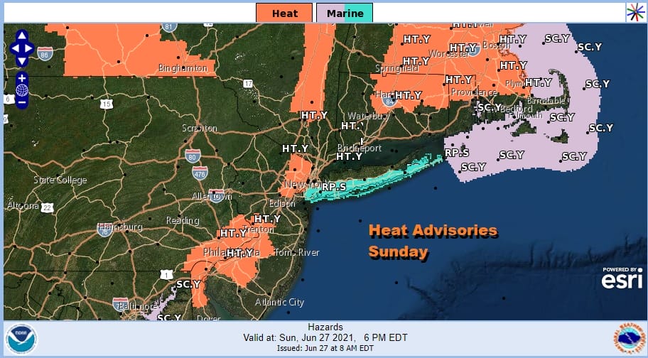
The first heat advisories are up for parts of New Jersey today as well as the Hudson Valley, Southeast Pennsylvania, and parts of the Hudson Valley and New England. The bottom line is rather simple. It is a very warm to hot day for this Sunday everywhere. Some places meet advisory criteria and others just miss it.
On the satellite we are under clouds this morning but the cloud deck is rather thin and expect the clouds to break up quickly allowing temperatures to rise. Humidity levels are very high with dew points between 65 and 70 so the air is juiced enough with tropical air. We had scattered downpours around yesterday. There should be fewer today but the chance of a pop up shower or thunderstorm can’t be completely ruled out. For most of you though it will be a rain free day.
SATELLITE

Were it not for the clouds we probably reach the low to mid 90s this afternoon but the clouds will shave off a few degrees off and we see highs reaching the upper 80s to lower 90s. Add the humidity factor and it will feel like a miserable 95 to 100.
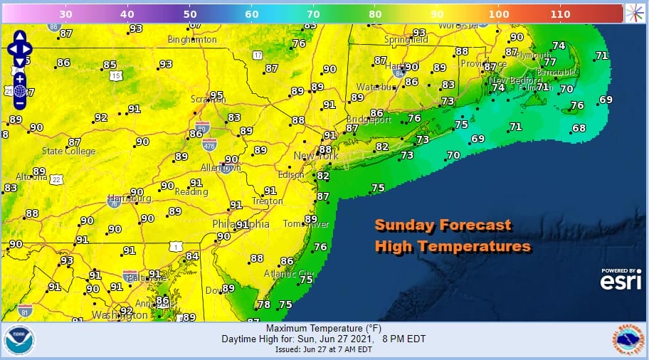
Very warm and humid nights lie ahead into Wednesday so each night will feature some patchy low clouds developing and lows in the upper 60s to mid 70s. Monday and Tuesday look like the hottest two days of the week with highs reaching the low and middle 90s. The exception will be the south facing shoreline beaches which will be about 10 degrees lower. We will leave in the chance for an isolated pop up thunderstorm Monday and Tuesday.


Wednesday brings an upper trough into the Eastern US and while it will be another brutally hot and humid day with highs in the low to mid 90s, there is probably a better chance for late day thunderstorms as the upper trough approaches.
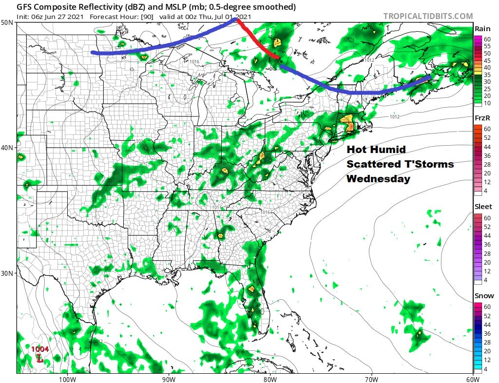
The forecast for Thursday and Friday becomes muddled as models diverge on how to handle a strong short wave dropping southeast from Canada. Models are swinging back and forth on every other run. Now it is the GFS’s turn to drop the trough to the west and cut it off making for more numerous showers and thunderstorms and putting Friday and the holiday weekend in jeopardy. The European now shows a stronger cold front not getting here until Friday with showers, thunderstorms and potential severe weather threat while leaving the weekend mostly dry and not as hot nor as humid. We will address the holiday weekend in a separate post later today.
BE SURE TO DOWNLOAD THE FREE METEOROLOGIST JOE CIOFFI WEATHER APP &
ANGRY BEN’S FREE WEATHER APP “THE ANGRY WEATHERMAN!

MANY THANKS TO TROPICAL TIDBITS & F5 WEATHER FOR THE USE OF MAPS
Please note that with regards to any severe weather, tropical storms, or hurricanes, should a storm be threatening, please consult your local National Weather Service office or your local government officials about what action you should be taking to protect life and property.


