
Flood Watch Severe Weather Risks Showery Rains Thunderstorms
Low Humidity Sunshine Cooler Temps Arrive Tuesday

Flood Watch Severe Weather Risks Showery Rains Thunderstorms
Low Humidity Sunshine Cooler Temps Arrive Tuesday
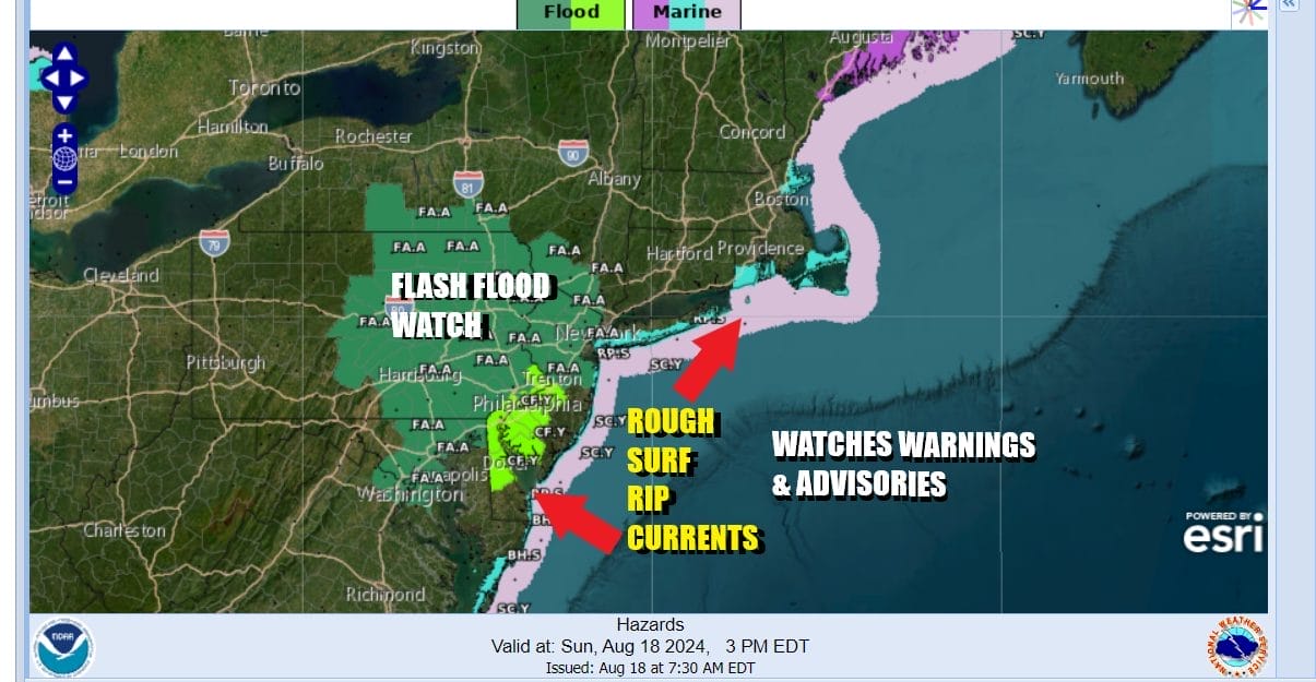
Overnight we have seen areas of heavy rain and this has set the stage for some flooding risks. Flash Flood Watches cover much of Eastern Pennsylvania and New Jersey southward into Maryland. An approaching cold front is slowing down to a crawl as it waits for the atmospheric traffic jam to break down. Tropical Storm Ernesto which is north northeast of Bermuda is the reason for the stall. It is also the reason for rough surf conditions and rip currents from Maine to Virginia.
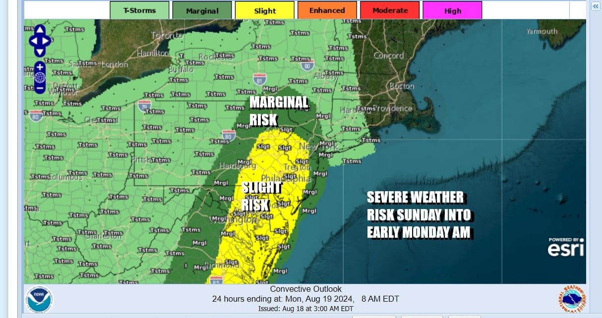
The warm humid air mass ahead of the cold front is creating conditions for severe weather and the Storm Prediction Center has indicated a marginal to slight risk for severe weather from the Hudson Valley and the Catskills southward through Eastern Pennsylvania and New Jersey to Delaware Maryland and Virginia. This area is also under a 2 percent tornado risk.
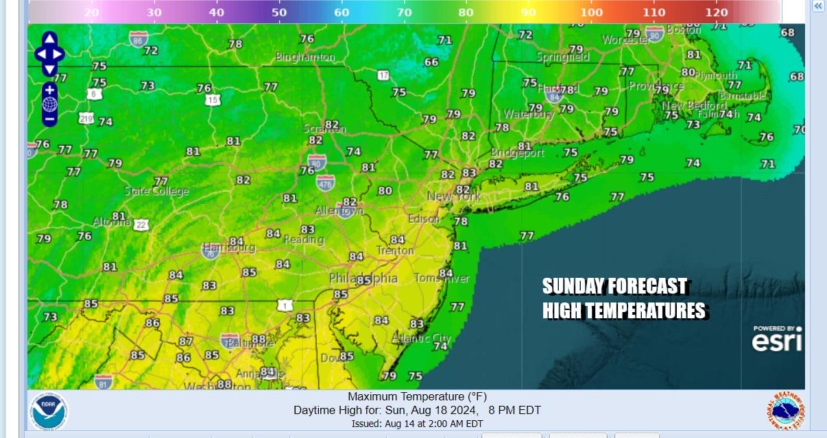
This leaves us today with lots of clouds, showery rains from time to time though not continuous, and the risk for stronger or even severe thunderstorms late today into tonight. Additional heavy rains from thunderstorms will likely set off localized flash flooding. Additional rainfall amounts of 1 to 2 inches are possible with higher numbers away from the coast. Of course in situations like this, local rainfall amounts could be double the broader forceast.
SATELLITE WITH LIGHTNING STRIKES

WEATHER RADAR

Not much is going to change tonight and Monday. The front and upper trough will edge closer to the coast and this will likely set off additional showery rains overnight and the risk for downpours and thunderstorms Monday. We do see severe weather risk possible for Monday but it should be noted that it doesn’t rain non stop. It will be warm and humid Monday with most highs in the upper 70s and lower 80s.

Finally the front clears the coast Monday night and we are going to see not only improving weather conditions later Monday night and Tuesday but a very large and somewhat strong high pressure from Central Canada and the Great Lakes builds in. Not only will we see sunshine Tuesday through at least Thursday and probably Friday, we will enjoy below average temperatures with daytime highs in the 70s and nighttime lows in the 50s and lower 60s. Dew points will will be in the 50s all week and at times even in the 40s!

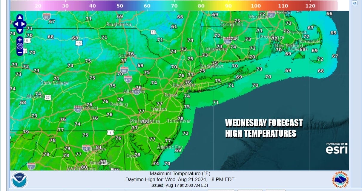
We do not see any rain for the week ahead for most of the area of Eastern Pennsylvania to Southern New England other than perhaps the odd instability shower inland Tuesday or Wednesday. We may be able to carry the rain free conditions into next weekend as the high moves offshore. This likely sets up for warmer temperatures over the weekend but humidity levels will rise only slowly. This could very well be considered the best weather week of the summer for those who like low humidity and cooler temperatures. If you like heat and humidity this is not your kind of summer weather.
BE SURE TO DOWNLOAD THE FREE METEOROLOGIST JOE CIOFFI WEATHER APP &
ANGRY BEN’S FREE WEATHER APP “THE ANGRY WEATHERMAN!
MANY THANKS TO TROPICAL TIDBITS FOR THE USE OF MAPS
Please note that with regards to any severe weather, tropical storms, or hurricanes, should a storm be threatening, please consult your local National Weather Service office or your local government officials about what action you should be taking to protect life and property.
(Amazon is an affilate of Meteorologist Joe Cioffi & earns commissions on sales.)


